MyTopo
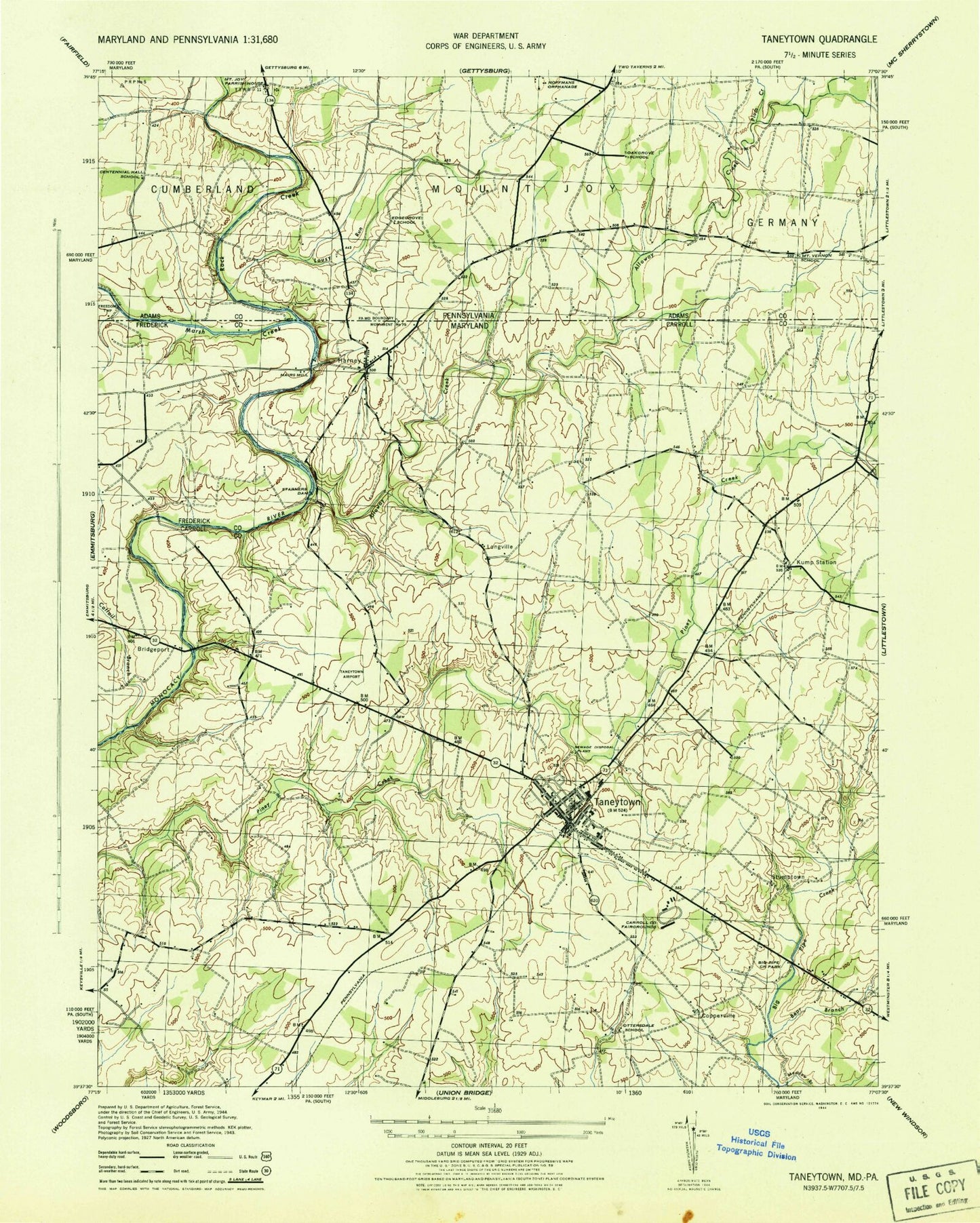
Classic USGS Taneytown Maryland 7.5'x7.5' Topo Map
Couldn't load pickup availability
Historical USGS topographic quad map of Taneytown in the states of Maryland, Pennsylvania. Map scale may vary for some years, but is generally around 1:24,000. Print size is approximately 24" x 27"
This quadrangle is in the following counties: Adams, Carroll, Frederick.
The map contains contour lines, roads, rivers, towns, and lakes. Printed on high-quality waterproof paper with UV fade-resistant inks, and shipped rolled.
Contains the following named places: Alloway Creek, Anazoy Farms, Baptist Road Cemetery, Bear Branch, Big Pipe Creek Park, Bowie Volunteer Fire Department and Rescue Squad, Bridgeport, Bridgeport Brigade Creek, Brown Heights, Brownsville, Bullfrog Road Bridge, Carroll County Fairgrounds, Carroll County Fire Department Station 11 Harney Volunteer Fire Department, Carroll County Fire Department Station 5 Taneytown Volunteer Fire Company, Carroll County Public Library - Taneytown Branch, Cattail Branch, Centennial Hall School, City of Taneytown, Clearview School, Cloverberry, Copperfield, Copperville, Crabster, Cunningham Acres, District 1 Taneytown, Edgegrove School, Eleven Meadows, Evapco Heliport, Fairground Village, Galt, Grace United Church of Christ, Grace United Church of Christ Cemetery, Green Meadows, Greenland Manor, Harney, Herring Estates, Hoffman Orphanage, Hyser Estates, Locust Row Airport, Longs Mountain View, Longville, Lousy Run, Mairs Mill, Marsh Creek, Maryland Department of State Police, Maryland State Police Headquarters, Mason and Dixon Line, Meadow Branch Big Pipe Creek, Meadow Brook, Monocacy Farms, Mount Joy Cemetery, Mount Joy Church, Mount Pleasant United Methodist Cemetery, Mount Zion United Brethren in Christ Church, Mountain View Cemetery, Northwest Middle School, Oregon School, Ottersdale, Ottersdale School, Palmer, Piney Creek Cemetery, Piney Creek Church, Piney Creek Church Cemetery, Piney Creek Presbyterian Church, Plum Creek, Rising Sun, Roberts Mill Park, Roberts Mill Run, Rock Creek, Roth Recreational Park, Ruthed Estates, Saint James Church, Saint James Reformed Cemetery, Saint Joseph Cemetery, Saint Josephs Roman Catholic Church, Saint Pauls Lutheran Church, Sewells Farm, Starners Dam, Stonemyer Manor, Stumptown, Sunrise Cemetery, Taneytown, Taneytown Academy, Taneytown Airport, Taneytown Baptist Church, Taneytown City Hall, Taneytown Elementary School, Taneytown Historic District, Taneytown Industrial Development Area, Taneytown Memorial Park, Taneytown Police Department, Taneytown Post Office, Taneytown Presbyterian Church, Taneytown Shopping Center, Tranquility Estates, Trevanion Terrace, Trinity Lutheran Cemetery, Trinity Lutheran Church, Walnut Grove, Washington School, Wheatfields, White Birch Estates, White Rose Farm, ZIP Code: 21787