MyTopo
Classic USGS Tanner Lake New Mexico 7.5'x7.5' Topo Map
Regular price
$16.95
Regular price
Sale price
$16.95
Unit price
per
Couldn't load pickup availability
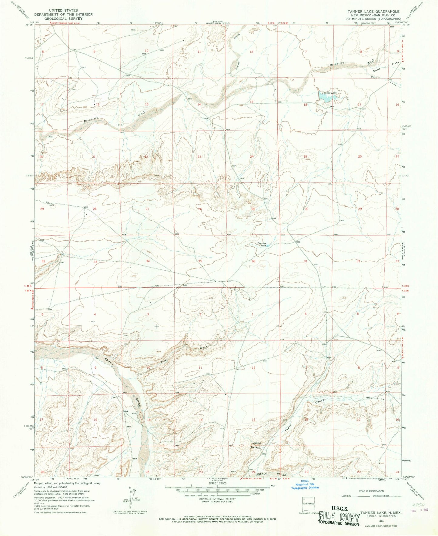
Historical USGS topographic quad map of Tanner Lake in the state of New Mexico. Map scale may vary for some years, but is generally around 1:24,000. Print size is approximately 24" x 27"
This quadrangle is in the following counties: San Juan.
The map contains contour lines, roads, rivers, towns, and lakes. Printed on high-quality waterproof paper with UV fade-resistant inks, and shipped rolled.
Contains the following named places: 15B-24 Water Well, 19R-326 Water Well, 19T-507 Water Well, Alamo Wash, Chaco Wash Pit, Coal Creek, Delnazini, DH-3 Water Well, DH-5 Water Well, DH-7 Water Well, Dog Eye Pond, Rock Wash, Tanner Lake, TL-7-2 Water Well, TL-8-1 Water Well, Tsaya, Tsaya Canyon, Tsaya Post Office