MyTopo
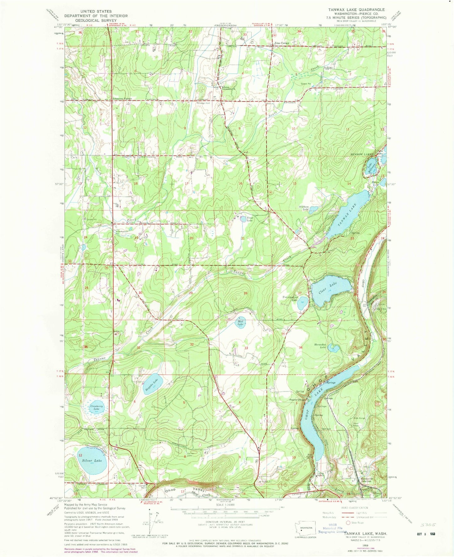
Classic USGS Tanwax Lake Washington 7.5'x7.5' Topo Map
Couldn't load pickup availability
Historical USGS topographic quad map of Tanwax Lake in the state of Washington. Map scale may vary for some years, but is generally around 1:24,000. Print size is approximately 24" x 27"
This quadrangle is in the following counties: Pierce.
The map contains contour lines, roads, rivers, towns, and lakes. Printed on high-quality waterproof paper with UV fade-resistant inks, and shipped rolled.
Contains the following named places: Benbow Lakes, Benston Community Church, Byron Lake, Clay City, Clear Lake, Clear Lake Census Designated Place, Cranberry Lake, Eatonville Junction, Horseshoe Lake, Jims Corner, Johnsons Corner, Lake Whitman, Leber, Lynch Creek, Mud Lake, Ohop, Ohop Lake, Pierce County Fire District 21 Graham Fire and Rescue Station 93, Pierce County Sheriff's Office Eatonville, Point Ohop, Rainier Cemetery, Rapjohn Lake, Silver Lake, South Pierce Fire and Rescue Station 170 Headquarters, South Pierce Fire and Rescue Station 175, South Pierce Fire and Rescue Station 176, Stidham Lake, Tanwax Greens Golf Course, Tanwax Lake, Tanwax Lake Dam, Thompson Dam, Three Hundred Fourth Street Landfill, Trout Lake, Twentyfive Mile Creek, Twentyseven Lake, Twin Lakes, Weyerhaeuser Elementary School