MyTopo
Classic USGS Taos Junction New Mexico 7.5'x7.5' Topo Map
Regular price
$16.95
Regular price
Sale price
$16.95
Unit price
per
Couldn't load pickup availability
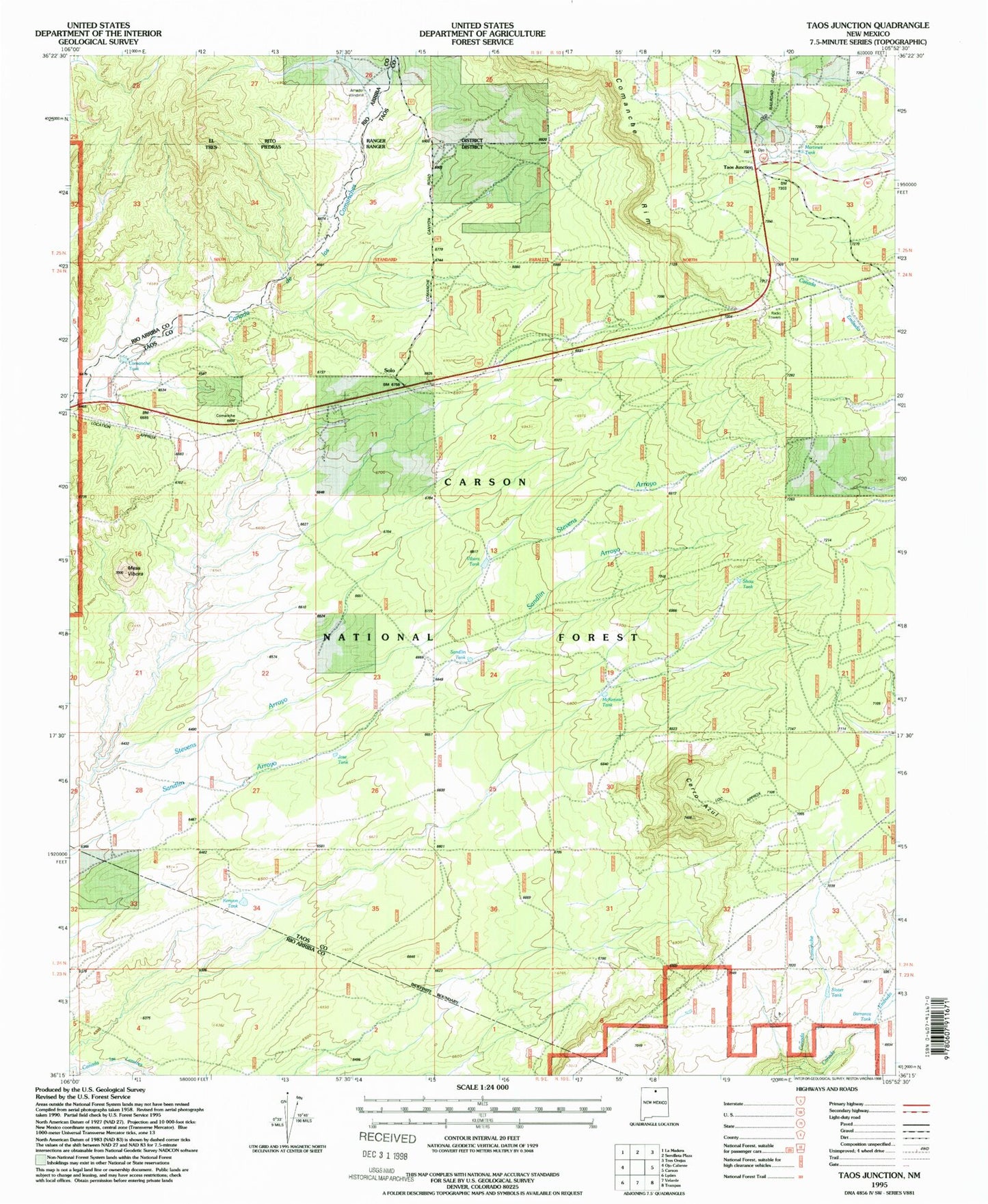
Historical USGS topographic quad map of Taos Junction in the state of New Mexico. Map scale may vary for some years, but is generally around 1:24,000. Print size is approximately 24" x 27"
This quadrangle is in the following counties: Rio Arriba, Taos.
The map contains contour lines, roads, rivers, towns, and lakes. Printed on high-quality waterproof paper with UV fade-resistant inks, and shipped rolled.
Contains the following named places: Amador Windmill, Barranca Tank, Canada Embudo, Cerro Azul, Comanche Tank, Goats Point Prospect, Jose Tank, Kenyon Tank, Martinez Tank, McKenzie Tank, Mesa Vibora, RG-27285 Water Well, Sandlin Tank, Show Tank, Slater Tank, Solo, Taos Junction, Vibora Tank