MyTopo
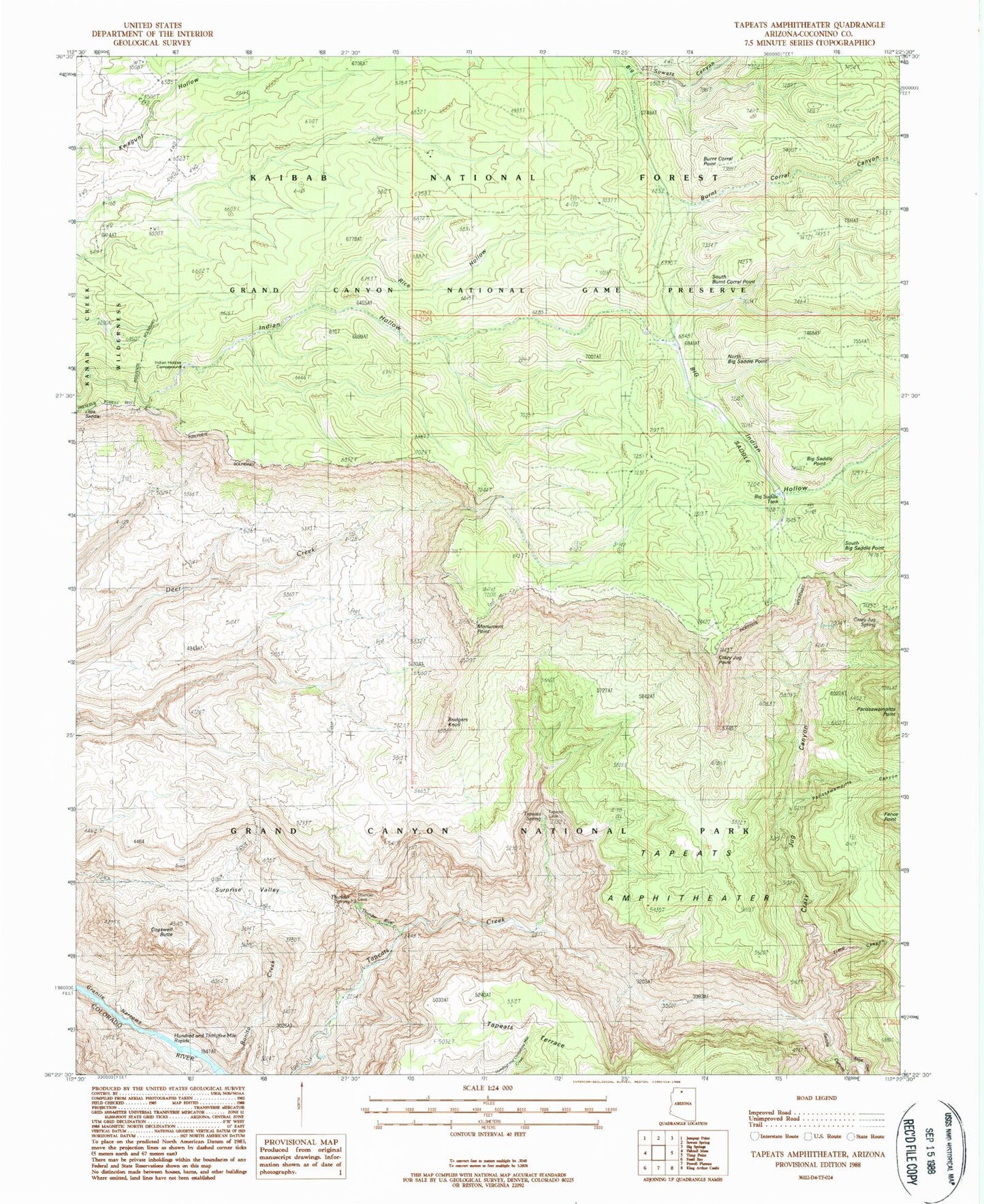
USGS Classic Tapeats Amphitheater Arizona 7.5'x7.5' Topo Map
Couldn't load pickup availability
Historical USGS topographic quad map of Tapeats Amphitheater in the state of Arizona. Scale: 1:24000. Print size: 24" x 27"
This quadrangle is in the following counties: Coconino.
The map contains contour lines, roads, rivers, towns, lakes, and grids including latitude / longitude and UTM / MGRS. Printed on high-quality waterproof paper with UV fade-resistant inks.
Contains the following named places: Big Saddle, Big Saddle Camp, Big Saddle Point, Bonita Creek, Bridgers Knoll, Burnt Corral Canyon, Burnt Corral Point, Crazy Jug Canyon, Crazy Jug Point, Crazy Jug Spring, Fence Point, Hundred and Thirtyfive Mile Rapids, Monument Point, North Big Saddle Point, Parissawampitts Canyon, Parissawampitts Point, Rice Hollow, Saddle Canyon, South Big Saddle Point, South Burnt Corral Point, Stina Canyon, Surprise Valley, Tapeats Amphitheater, Tapeats Spring, Tapeats Terrace, Thunder River, Thunder Spring, Cogswell Butte, Indian Hollow Campground, Indian Hollow Trick Tank, Indian Hollow-Thunder Springs Trail Twenty-three, Kwagunt Trick Tank, Rice Hollow Trick Tank, Sowats Trick Tank, Big Saddle Tank, Timp Canyon, Indian Hollow Wildlife Apron, Bill Hall Trail