MyTopo
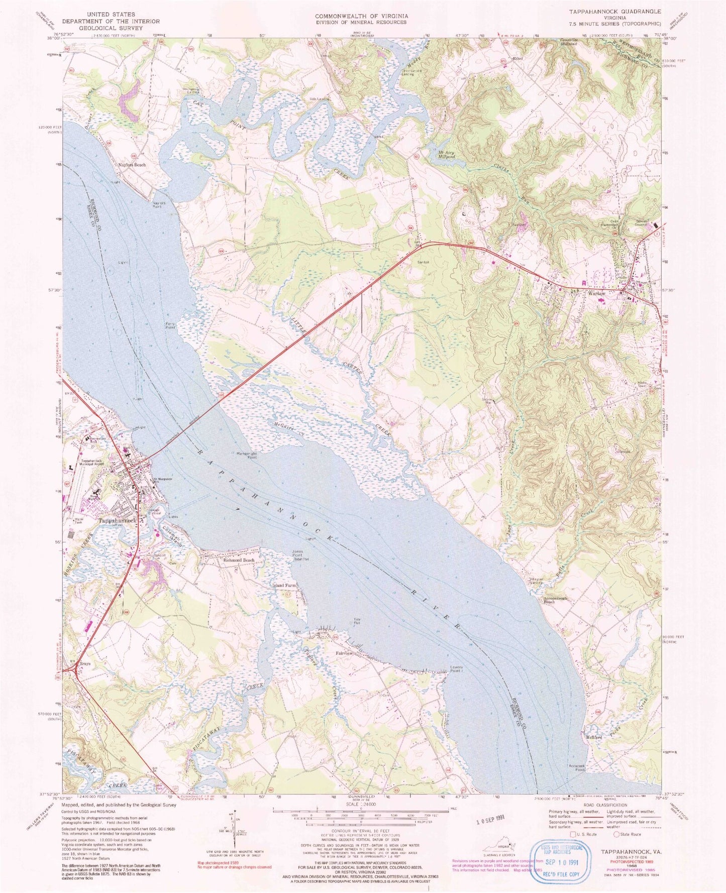
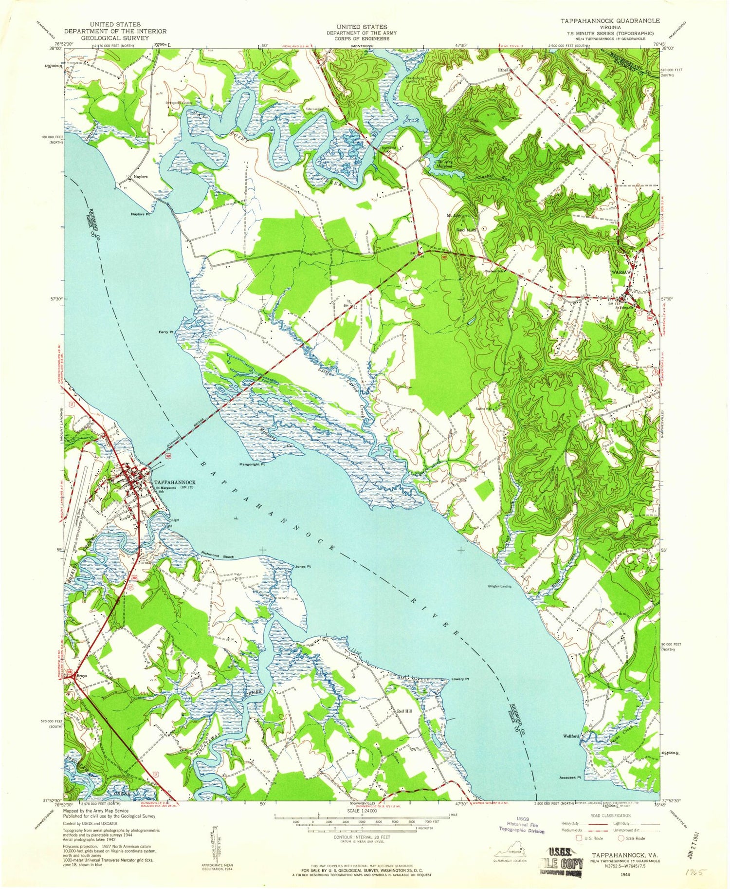
Classic USGS Tappahannock Virginia 7.5'x7.5' Topo Map
Couldn't load pickup availability
Historical USGS topographic quad map of Tappahannock in the state of Virginia. Typical map scale is 1:24,000, but may vary for certain years, if available. Print size: 24" x 27"
This quadrangle is in the following counties: Essex, Richmond, Westmoreland.
The map contains contour lines, roads, rivers, towns, and lakes. Printed on high-quality waterproof paper with UV fade-resistant inks, and shipped rolled.
Contains the following named places: Coleman Island, Accaceek Point, Accopatough Beach, Balls Creek, Cat Point Creek, Clarks Run, Clarksville Church, Doctors Creek, Downing Bridge, Essex High School, Ferry Point, Hoskins Creek, Jones Point, Jugs Creek, Little Carter Creek, Mangoright Point, McGuire Creek, Mount Airy Millpond, Muddy Run, Naylors Point, Pecks Creek, Sabine Hall, Saint Margaret's School, Piscataway Creek, Taylors Creek, Lowery Point, Magoright Bar, Naylors, Ferry Landing, Dillard Dam, Mount Airy Dam, Delano Dam, Brays Fork, Tappahannock, Tappahannock Municipal Airport (historical), Brays, Chestnut Hill Landing, Ethel, Fairview, Island Farm, Islington Landing, Naylors Beach, Richmond Beach, Side Landing, Strangeway Landing, Warsaw, Wellford, WRAR-AM (Tappahannock), WNNT-AM (Warsaw), WRAR-FM (Tappahannock), WNNT-FM (Warsaw), Black Duck Creek, Brockenbrough House, Lowerys Landing, Lowerys Point Landing, Red Hill, Tappahannock Elementary School, Tappahannock Historic District, Ticknors Creek, Wares Ferry (historical), Naylors Hole (historical), Bushwood (historical), Bushwood Creek, Cat Point Bridge, Chestnut Hill Plantation, Clarksville Baptist Church Cemetery, Mangorite Marsh, Mount Airy Mill (historical), Mount Airy Plantation, Paddys Creek, Plant Patch Ferry (historical), Saint Johns Episcopal Church Cemetery, Saint Johns Episcopal Church, Smith Hill, Turners School (historical), Upper Cat Point Bridge, District 3, Tappahannock District, Tappahannock Volunteer Rescue Squad, Tappahannock - Essex Volunteer Fire Department Station 1, Tappahannock Police Department, Essex County Sheriff's Office, Richmond County Volunteer Fire Department Station 1, Richmond County Sheriff's Office, Warsaw Police Department, Tappahannock Volunteer Rescue Squad, Richmond County Sheriff's Office, Essex County Sheriff's Office, Town of Tappahannock, Town of Warsaw, Essex Intermediate School, Chesapeake Bay Governors School, Tappahannock Junior Academy, Rappahannock Community College - Warsaw Campus, Belle Mount Vineyards, Warsaw Post Office, Rappahannock Christian Center, Victory Baptist Church, Warsaw Baptist Church, Essex Public Library, Oakwood Mobile Home Park, Riverside Estates Mobile Home Park, Carrington Place of Tappahannock, The Orchard Nursing Home, Warsaw Healthcare Center Nursing Home, Warsaw Village Retirement Center, Hobbs Hole Golf Course, Menokin Baptist Church, New Hope Church, Richmond County Public Library, Rappahannock River Valley National Wildlife Refuge, Tappahannock Post Office, Northern Neck Regional Jail