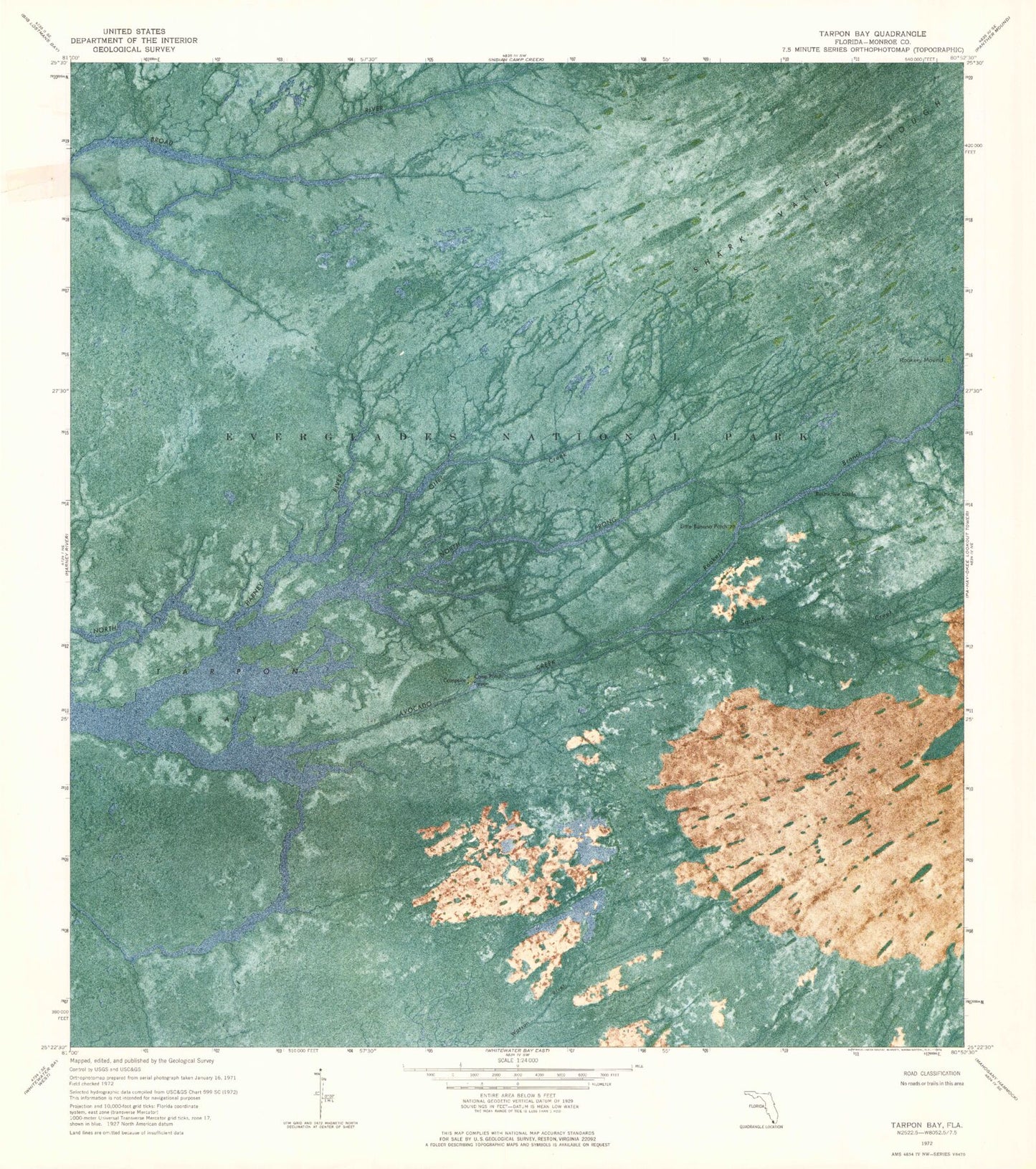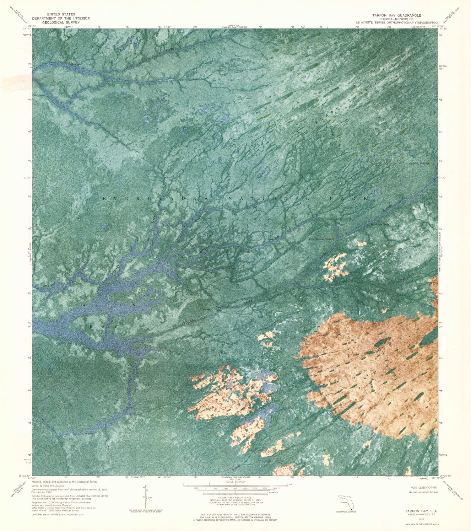
MyTopo
Classic USGS Tarpon Bay Florida 7.5'x7.5' Topo Map
Regular price
$16.95
Regular price
Sale price
$16.95
Unit price
per
Couldn't load pickup availability
Historical USGS topographic quad map of Tarpon Bay in the state of Florida. Map scale may vary for some years, but is generally around 1:24,000. Print size is approximately 24" x 27"
This quadrangle is in the following counties: Monroe.
The map contains contour lines, roads, rivers, towns, and lakes. Printed on high-quality waterproof paper with UV fade-resistant inks, and shipped rolled.
Contains the following named places: Avocado Creek, Cane Patch, Everglades National Park, Little Banana Patch, North Prong Otter Creek, Otter Creek, Rookery Branch, Rookery Mound, Squawk Creek, Tarpon Bay