MyTopo
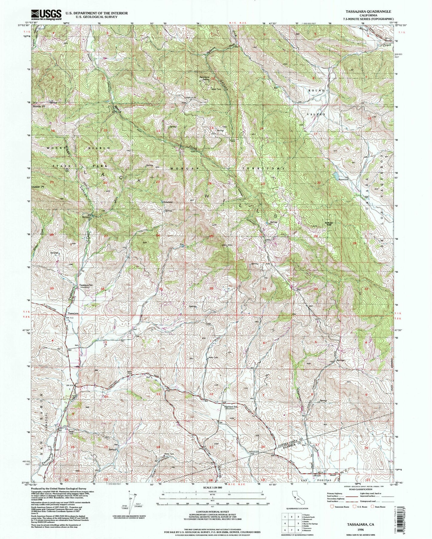
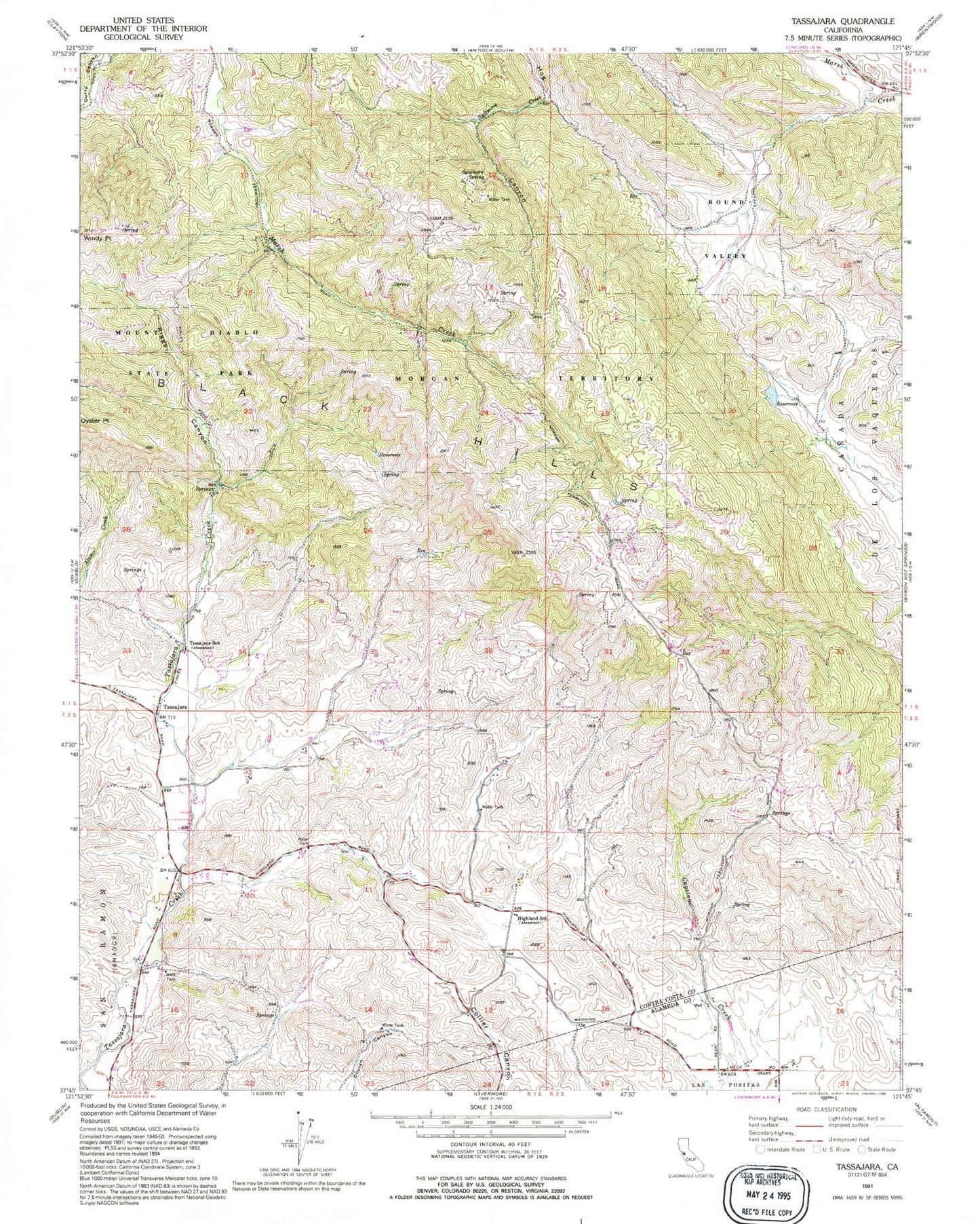
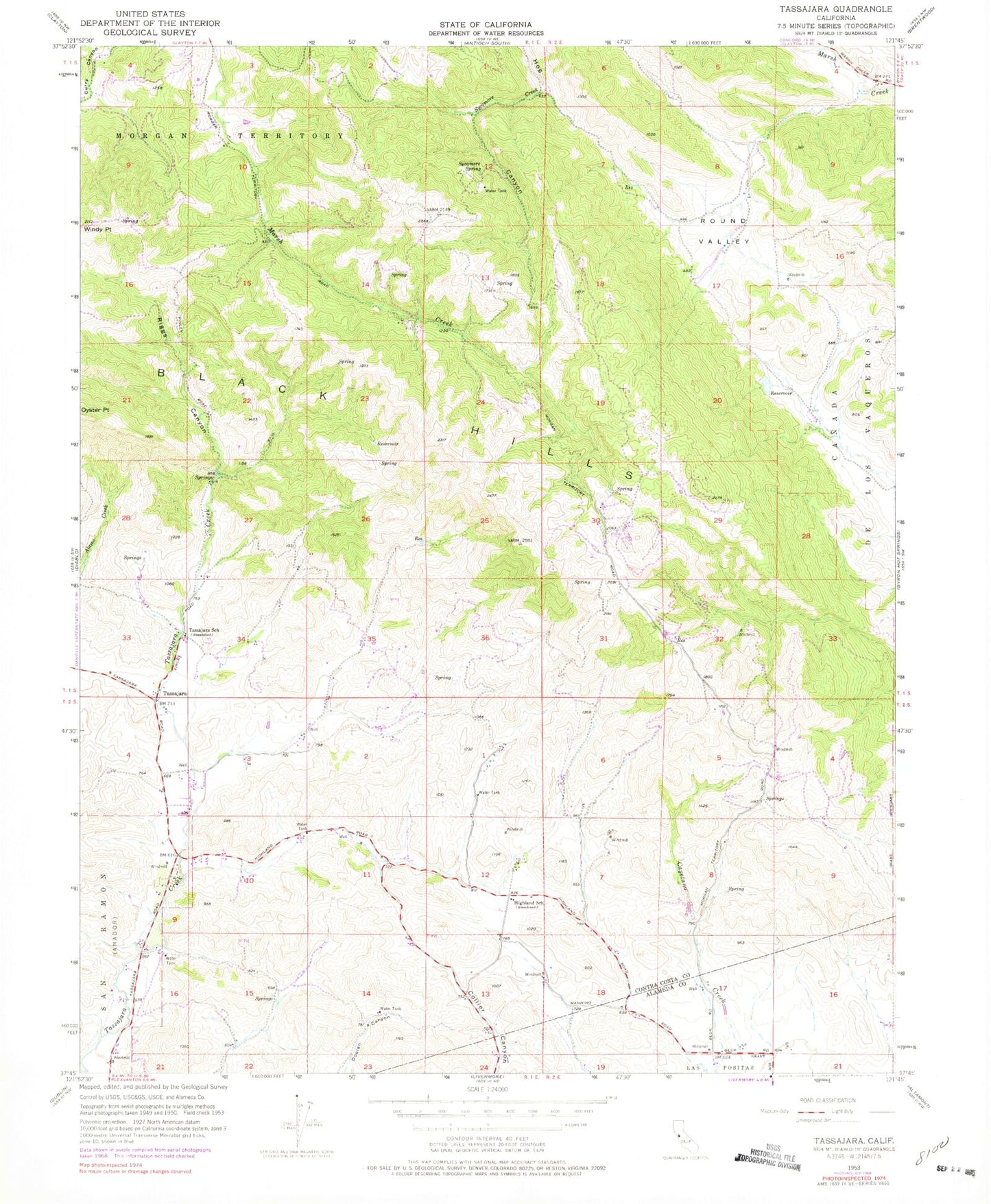
Classic USGS Tassajara California 7.5'x7.5' Topo Map
Couldn't load pickup availability
Historical USGS topographic quad map of Tassajara in the state of California. Typical map scale is 1:24,000, but may vary for certain years, if available. Print size: 24" x 27"
This quadrangle is in the following counties: Alameda, Contra Costa.
The map contains contour lines, roads, rivers, towns, and lakes. Printed on high-quality waterproof paper with UV fade-resistant inks, and shipped rolled.
Contains the following named places: Black Hills, Highland School, Morgan Territory, Round Valley, Riggs Canyon, Sycamore Spring, Tassajara School, Tassajara, KSTN-FM (Stockton), Tassajara Division, San Ramon Valley Fire Protection Fire District Training Site, San Ramon Valley Fire Protection District Station 37, Black Hills, Highland School, Morgan Territory, Round Valley, Riggs Canyon, Sycamore Spring, Tassajara School, Tassajara, KSTN-FM (Stockton), Tassajara Division, San Ramon Valley Fire Protection Fire District Training Site, San Ramon Valley Fire Protection District Station 37