MyTopo
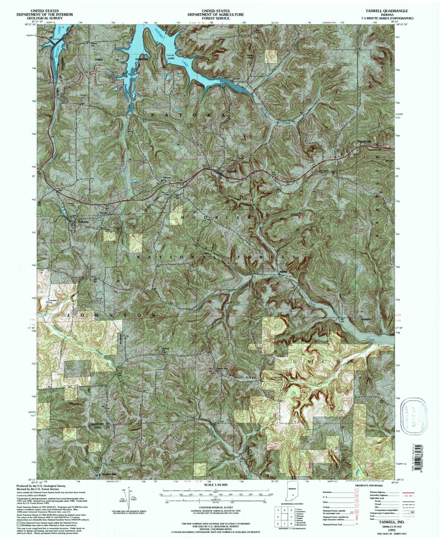
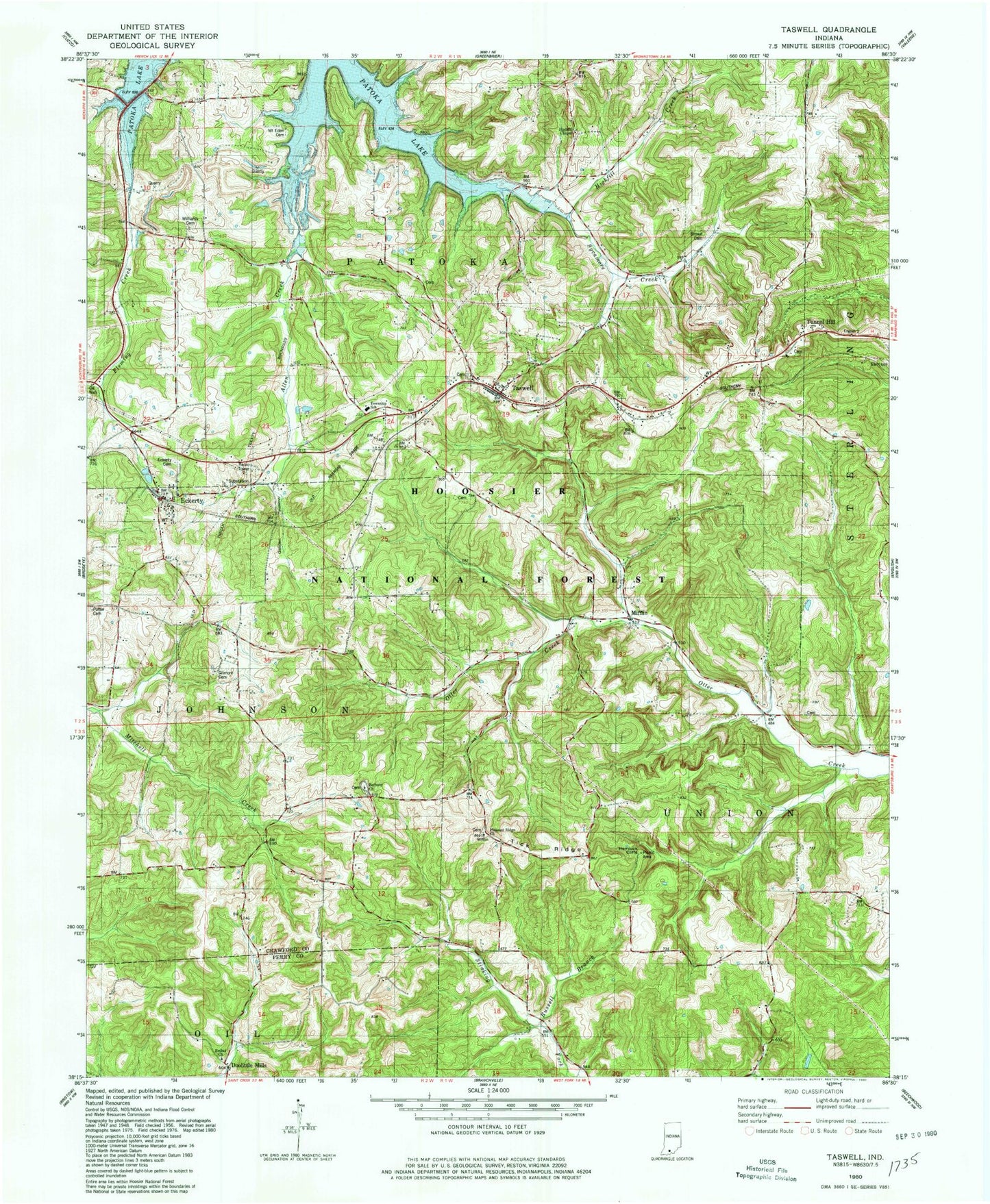
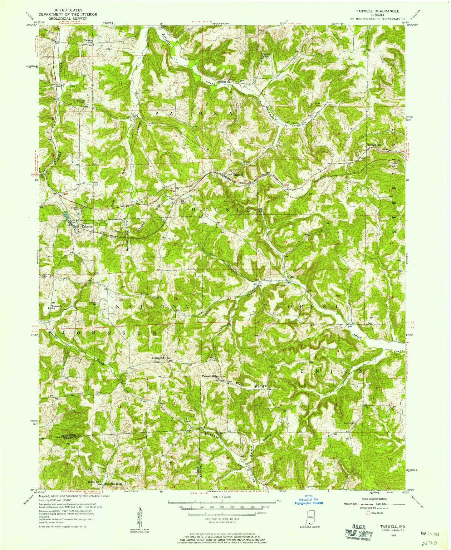
Classic USGS Taswell Indiana 7.5'x7.5' Topo Map
Couldn't load pickup availability
Historical USGS topographic quad map of Taswell in the state of Indiana. Typical map scale is 1:24,000, but may vary for certain years, if available. Print size: 24" x 27"
This quadrangle is in the following counties: Crawford, Perry.
The map contains contour lines, roads, rivers, towns, and lakes. Printed on high-quality waterproof paper with UV fade-resistant inks, and shipped rolled.
Contains the following named places: Salinda Lake Dam, Clarksville Plaza, Allen Creek, Allstott School, Bethany Church, Bethel Church, Brown Cemetery, Doolittle Mills, Eckerty, Eckerty Cemetery, Gilmore Cemetery, Golden Hollow, Highfill Chapel, Mifflin, Pedora School, Pleasant Ridge Church, Potter Cemetery, Russell Branch, Sycamore Creek, Taswell, Tick Ridge, Tunnel Hill, Williams Cemetery, Patoka School, Hemlock Cliffs, Highfill Creek, Union Tar Spring (historical), Dexter Well (historical), Township School, Hemlock Cliffs Recreation Area, Johnson Township School, Allstott School, Mount Eden Cemetery, Pedora School, Padora Post Office (historical), Township of Patoka, Township of Union, Eckerty Post Office, English Volunteer Fire Department Patoka Station, Eckerty Quarry, Ravine Arch, Arrowhead Arch, Pleasant Ridge Cemetery, Mifflin Cemetery, Tunnel Hill Cemetery, Taswell Cemetery, Bethany Union Cemetery, Highfill Chapel Cemetery, Goldman Cemetery, Salinda Lake Dam, Clarksville Plaza, Allen Creek, Allstott School, Bethany Church, Bethel Church, Brown Cemetery, Doolittle Mills, Eckerty, Eckerty Cemetery, Gilmore Cemetery, Golden Hollow, Highfill Chapel, Mifflin, Pedora School, Pleasant Ridge Church, Potter Cemetery, Russell Branch, Sycamore Creek, Taswell, Tick Ridge, Tunnel Hill, Williams Cemetery, Patoka School, Hemlock Cliffs, Highfill Creek, Union Tar Spring (historical), Dexter Well (historical), Township School, Hemlock Cliffs Recreation Area, Johnson Township School, Allstott School, Mount Eden Cemetery, Pedora School, Padora Post Office (historical), Township of Patoka, Township of Union, Eckerty Post Office, English Volunteer Fire Department Patoka Station, Eckerty Quarry, Ravine Arch, Arrowhead Arch, Pleasant Ridge Cemetery, Mifflin Cemetery, Tunnel Hill Cemetery, Taswell Cemetery, Bethany Union Cemetery, Highfill Chapel Cemetery, Goldman Cemetery