MyTopo
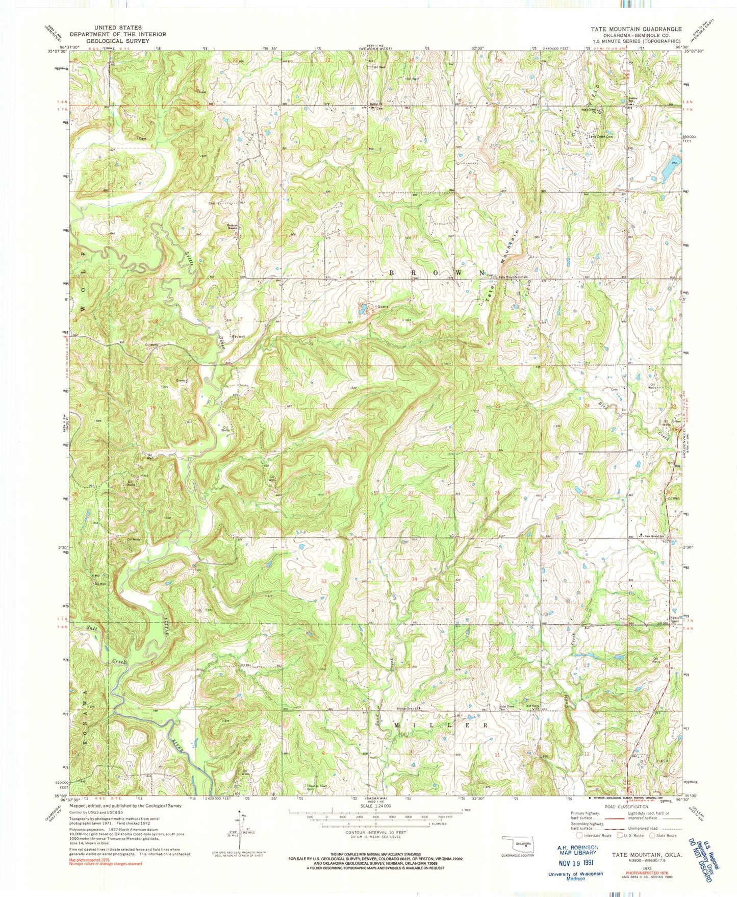
Classic USGS Tate Mountain Oklahoma 7.5'x7.5' Topo Map
Couldn't load pickup availability
Historical USGS topographic quad map of Tate Mountain in the state of Oklahoma. Map scale may vary for some years, but is generally around 1:24,000. Print size is approximately 24" x 27"
This quadrangle is in the following counties: Seminole.
The map contains contour lines, roads, rivers, towns, and lakes. Printed on high-quality waterproof paper with UV fade-resistant inks, and shipped rolled.
Contains the following named places: Bethel Church, Big Wewoka Creek Site 28 Dam, Big Wewoka Creek Site 28 Reservoir, Buckeye Mission, Justice Elementary School, Lone Dove Cemetery, Mill Creek Church, New Model School, Salt Creek, Sand Creek Cemetery, Sand Creek Church, Tate Mountain, Tate Mountain Cemetery, Thomas Town Cemetery, Thomas Town Church, Township of Brown