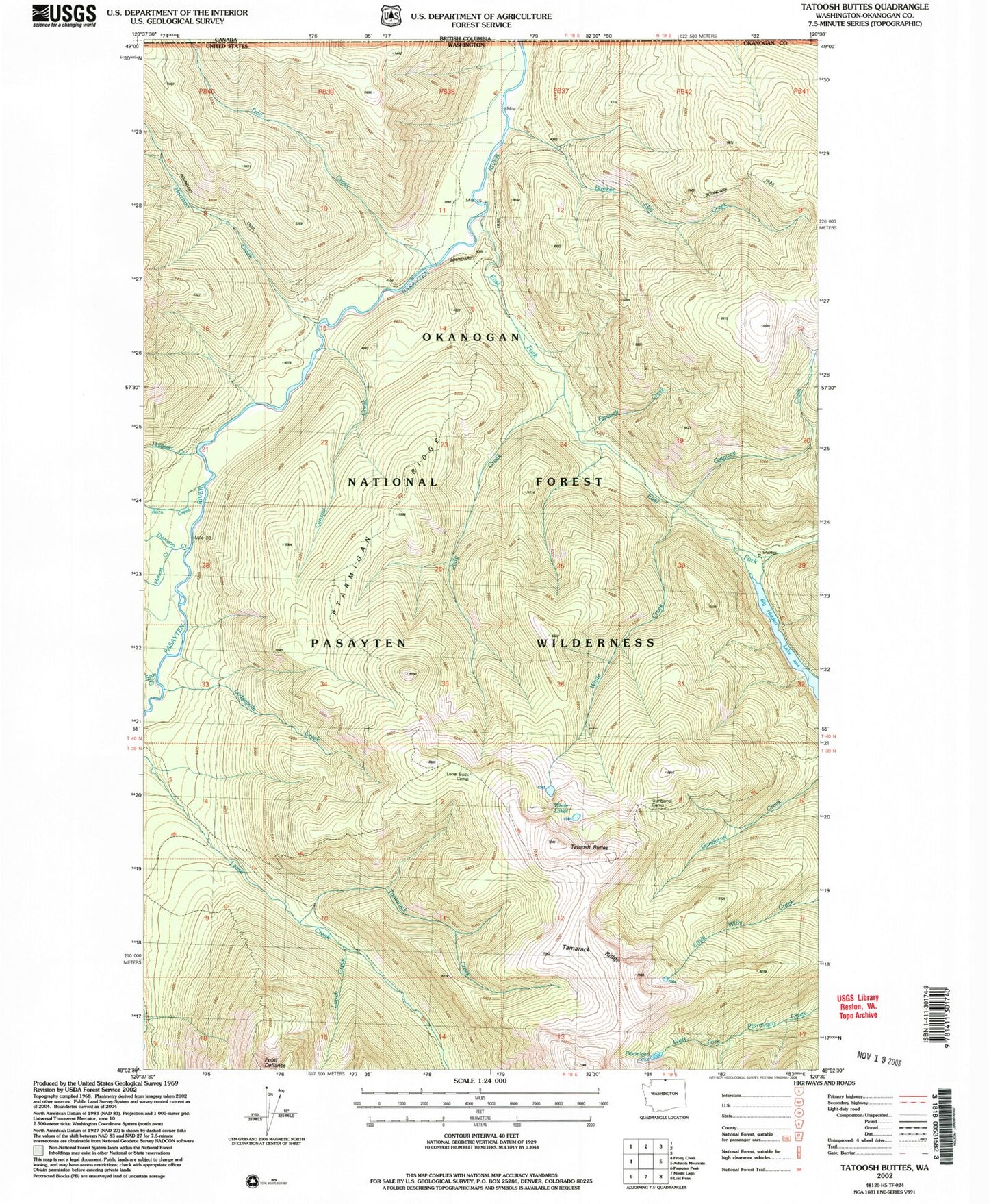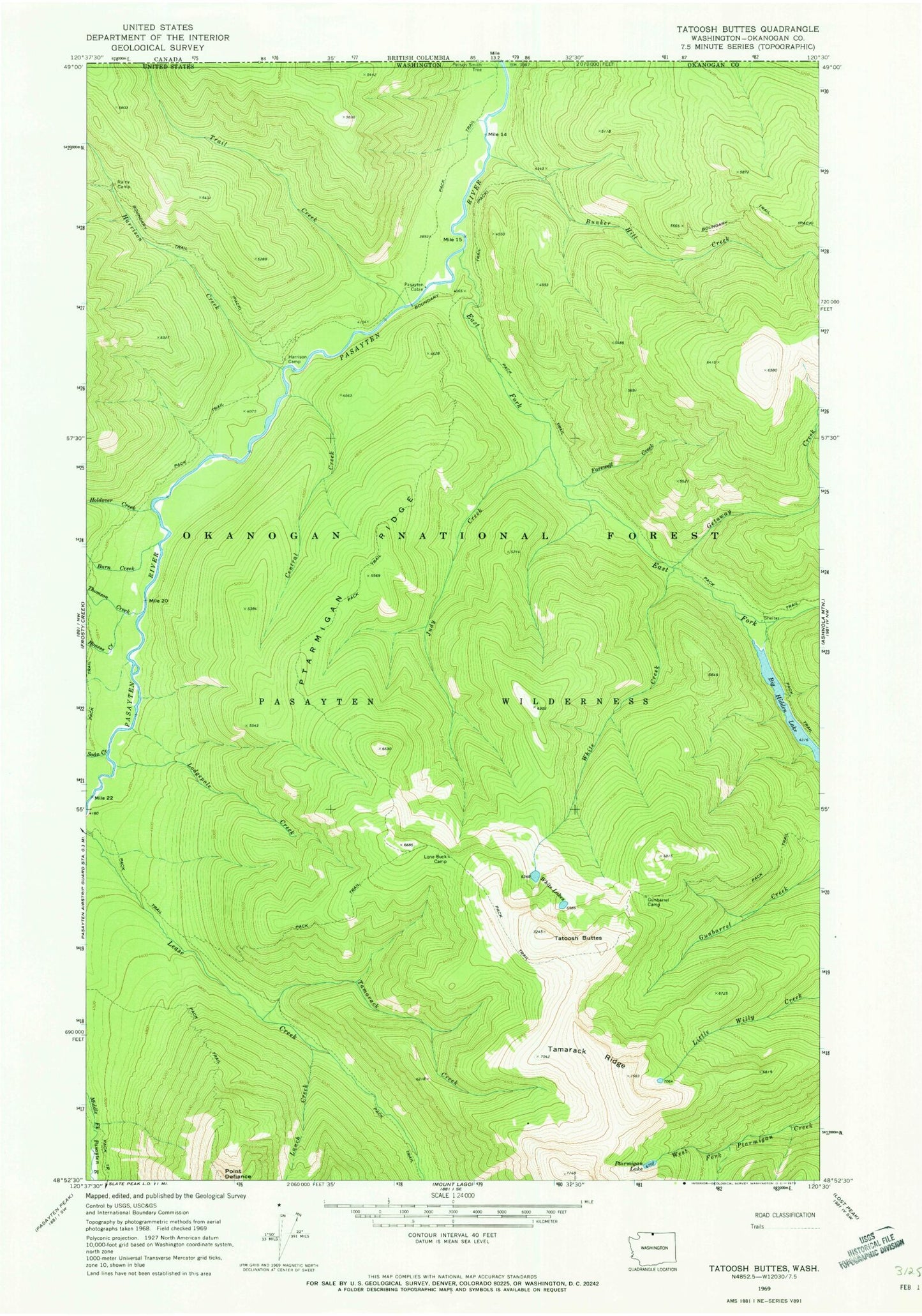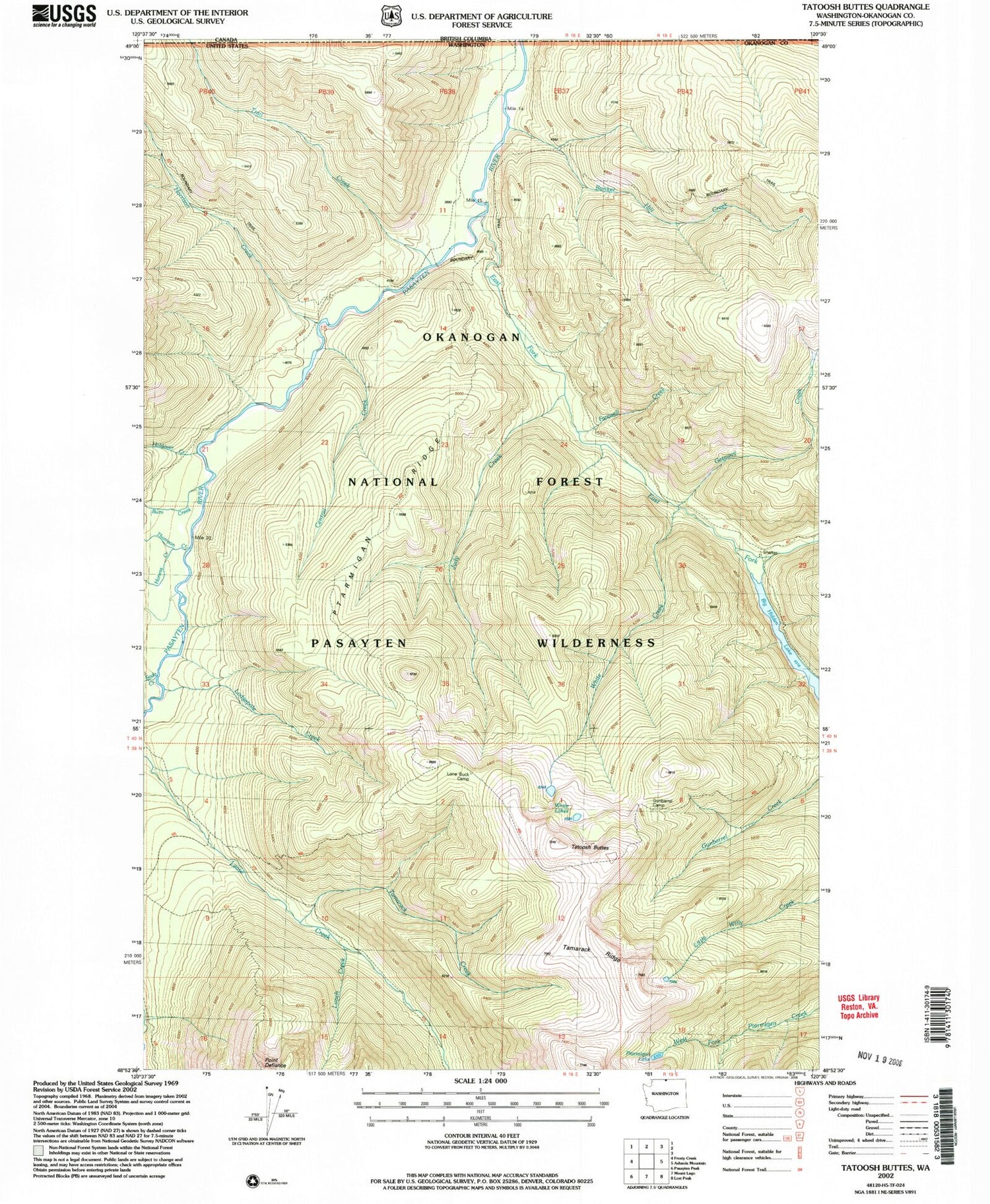
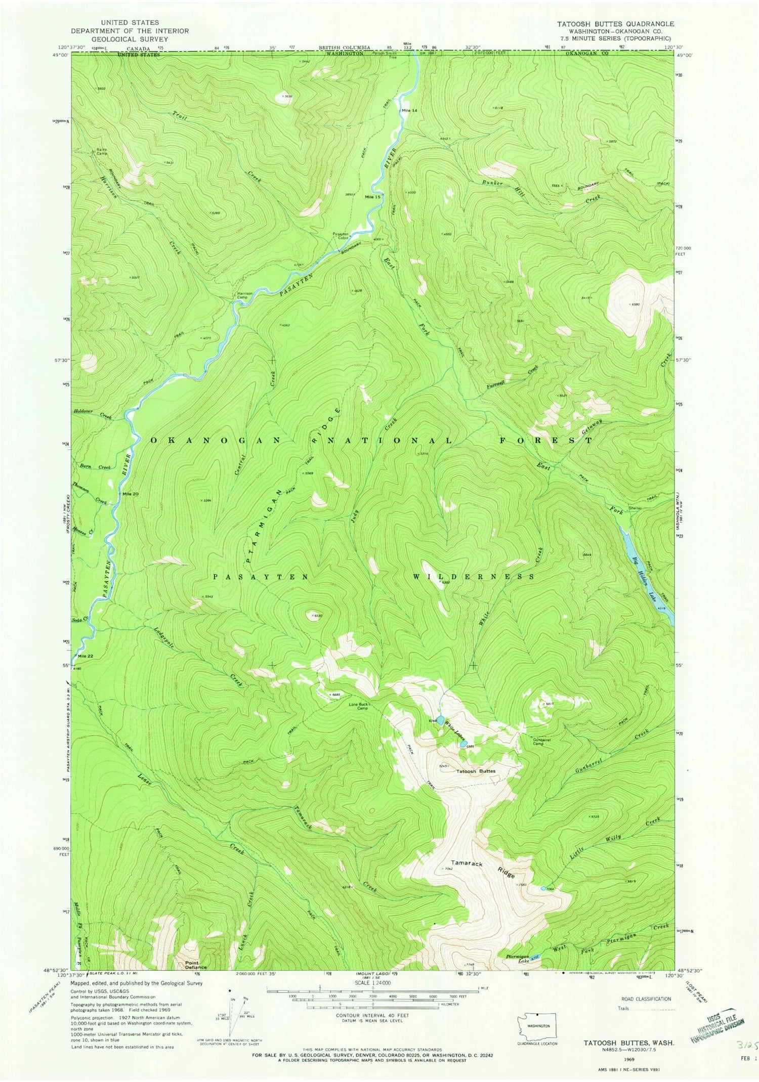
MyTopo
Classic USGS Tatoosh Buttes Washington 7.5'x7.5' Topo Map
Couldn't load pickup availability
Historical USGS topographic quad map of Tatoosh Buttes in the state of Washington. Map scale may vary for some years, but is generally around 1:24,000. Print size is approximately 24" x 27"
This quadrangle is in the following counties: Okanogan.
The map contains contour lines, roads, rivers, towns, and lakes. Printed on high-quality waterproof paper with UV fade-resistant inks, and shipped rolled.
Contains the following named places: Big Hidden Lake, Bunker Hill Creek, Burn Creek, Central Creek, East Fork Pasayten River, Farewell Creek, Getaway Creek, Gunbarrel Camp, Harrison Camp, Harrison Creek, Holdover Creek, Honess Creek, Judy Creek, Lodgepole Creek, Lone Buck Camp, Lunch Creek, Pasayten Cabin, Ptarmigan Lake, Ptarmigan Ridge, Rainy Camp, Soda Creek, Sunset Meadow, Tamarack Creek, Tamarack Ridge, Tatoosh Buttes, Thomson Creek, Trail Creek, White Creek, White Lake, White Lakes