MyTopo
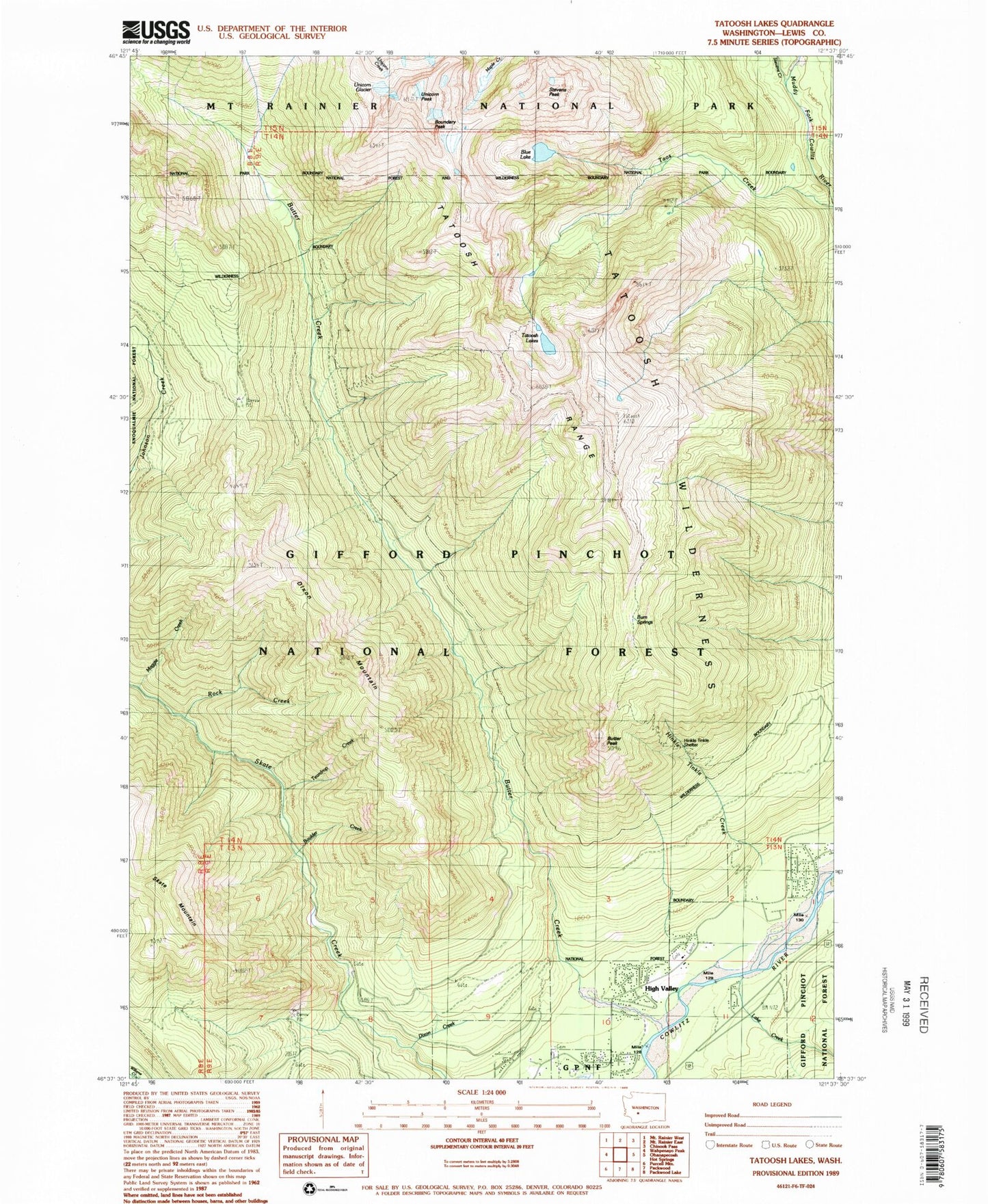
Classic USGS Tatoosh Lakes Washington 7.5'x7.5' Topo Map
Couldn't load pickup availability
Historical USGS topographic quad map of Tatoosh Lakes in the state of Washington. Typical map scale is 1:24,000, but may vary for certain years, if available. Print size: 24" x 27"
This quadrangle is in the following counties: Lewis.
The map contains contour lines, roads, rivers, towns, and lakes. Printed on high-quality waterproof paper with UV fade-resistant inks, and shipped rolled.
Contains the following named places: Blue Lake, Boulder Creek, Boundary Peak, Bum Springs, Dixon Creek, Dixon Mountain, Hinkle Tinkle Creek, Lake Creek, Maggie Creek, Rock Creek, Stevens Peak, Taos Creek, Tatoosh Lakes, Tatoosh Lookout, Tatoosh Trail, Teardrop Creek, Unicorn Glacier, Unicorn Peak, Tatoosh Wilderness, Butter Creek Research Natural Area, Evergreen Cemetery, The Burn, Hinkle Tinkle Trail, Tatoosh Trailhead, Butter Peak, Tatoosh Ridge Lookout, Stevens Creek, Tatoosh Range, Butter Creek, Tatoosh Ridge, Lewis County Fire District 10 Station 2