MyTopo
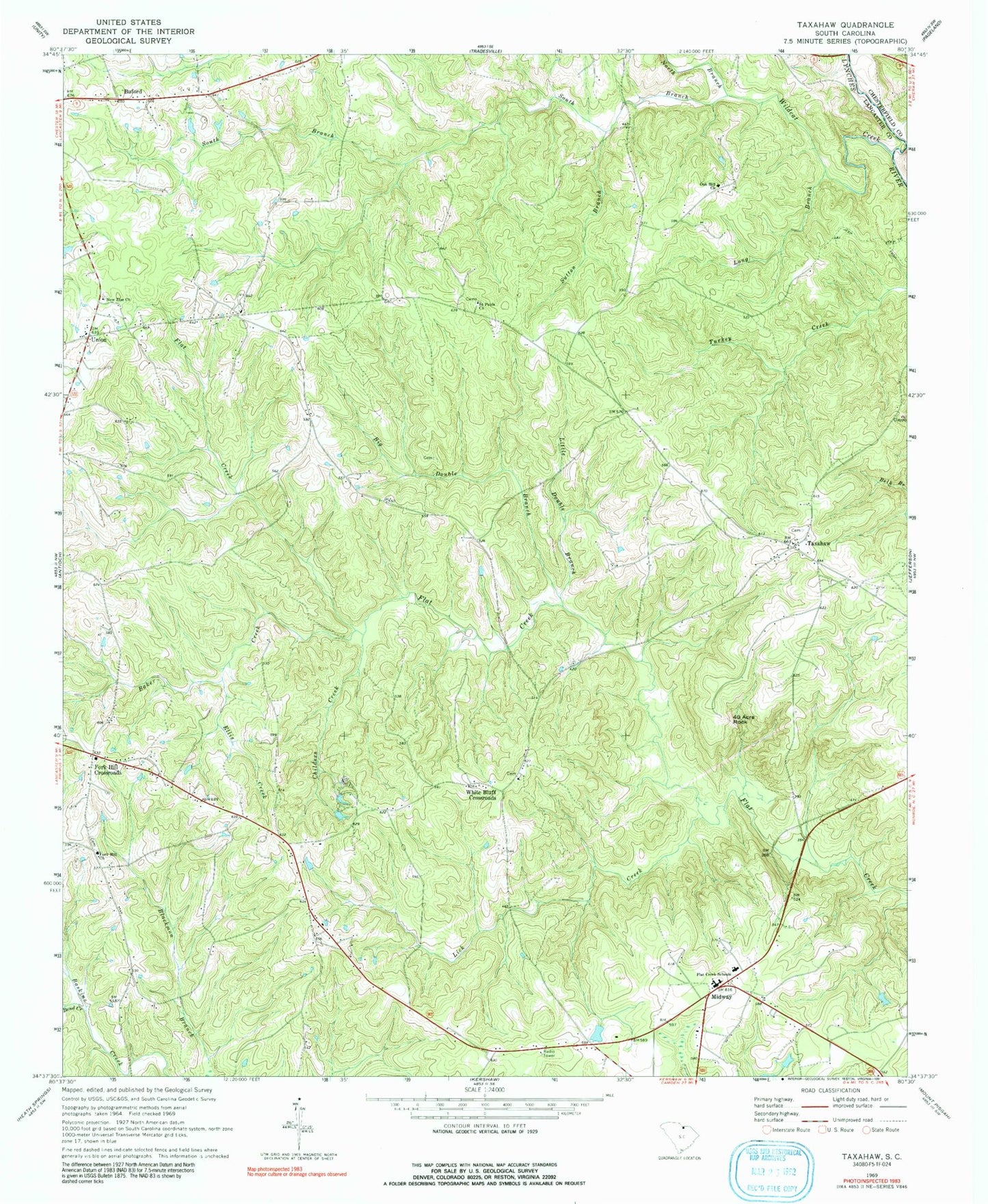
Classic USGS Taxahaw South Carolina 7.5'x7.5' Topo Map
Couldn't load pickup availability
Historical USGS topographic quad map of Taxahaw in the state of South Carolina. Typical map scale is 1:24,000, but may vary for certain years, if available. Print size: 24" x 27"
This quadrangle is in the following counties: Chesterfield, Lancaster.
The map contains contour lines, roads, rivers, towns, and lakes. Printed on high-quality waterproof paper with UV fade-resistant inks, and shipped rolled.
Contains the following named places: Baker Creek, Bend Creek, Big Double Branch, Childers Creek, Ellis Creek, Flat Creek Schools, Lick Creek, Little Double Branch, Long Branch, North Branch Wildcat Creek, Saint Pauls Church, South Branch Wildcat Creek, Sutton Branch, Taxahaw, Kennington Pond Dam D-1776, Fork Hill Cemetery, Fork Hill School (historical), Oak Hill School (historical), Saint Paul School (historical), Taxahaw Baptist Church, Taxahaw School (historical), Taxahaw School (historical), Three Fork School (historical), Union Church, Union School (historical), White Bluff Baptist Church, White Bluff School (historical), Midway, Buford, Fork Hill Church, Fork Hill Crossroads, Forty Acre Rock, New Zion Church, Oak Hill Church, Union, White Bluff Corssroads, Wildcat Creek, Tradesville Division, Flat Creek Fire Department Station 7