MyTopo
Classic USGS Taylor Well New Mexico 7.5'x7.5' Topo Map
Regular price
$16.95
Regular price
Sale price
$16.95
Unit price
per
Couldn't load pickup availability
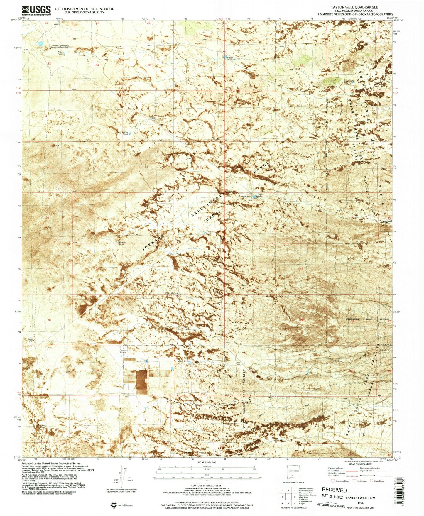
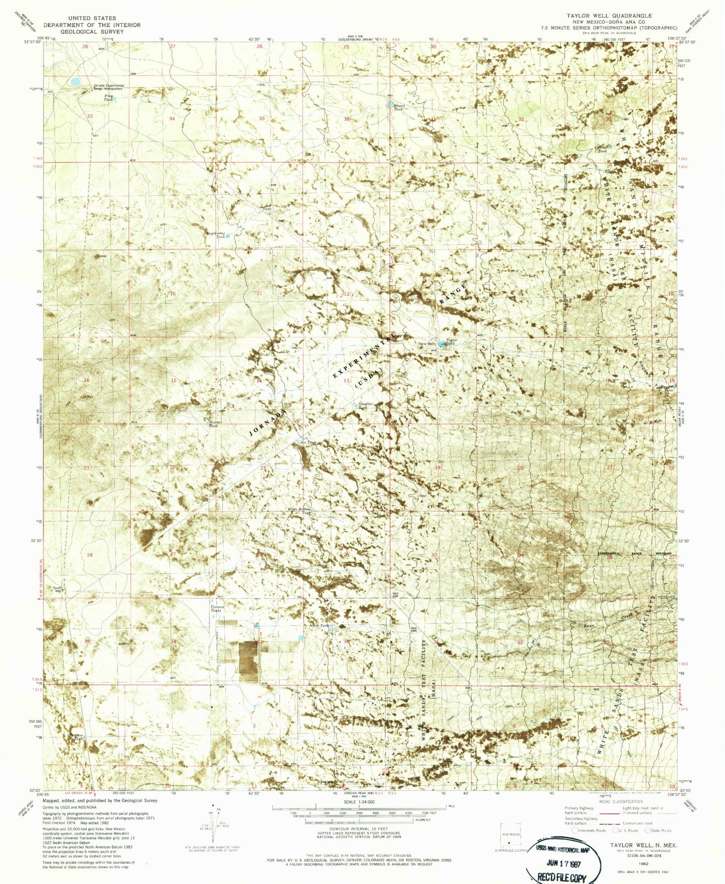
Historical USGS topographic quad map of Taylor Well in the state of New Mexico. Map scale may vary for some years, but is generally around 1:24,000. Print size is approximately 24" x 27"
This quadrangle is in the following counties: Do��a Ana.
The map contains contour lines, roads, rivers, towns, and lakes. Printed on high-quality waterproof paper with UV fade-resistant inks, and shipped rolled.
Contains the following named places: Ace Tank, Bear Creek, Brockoway Tank, Brown Tank, Corners Tanks, Cross Tank, Frog Tank, J A Tank, Jornada Experimental Range Headquarters, North Tank, Pearson Tank, Ragged Tank, Shoellar Tank, South Well, Taylor Tank, Taylor Well, Waids Airpark, Warner Tank, White Bottom Tank