MyTopo
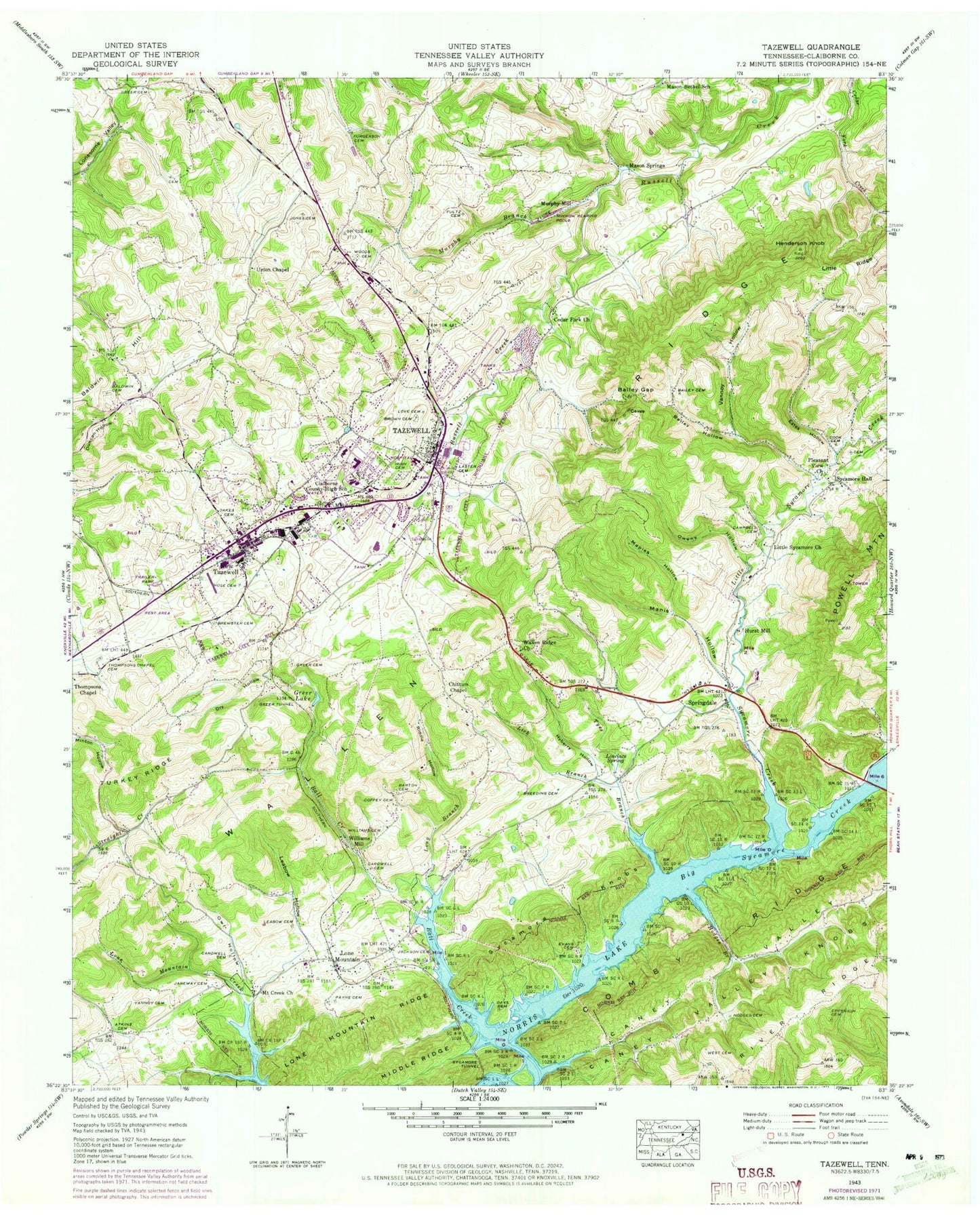
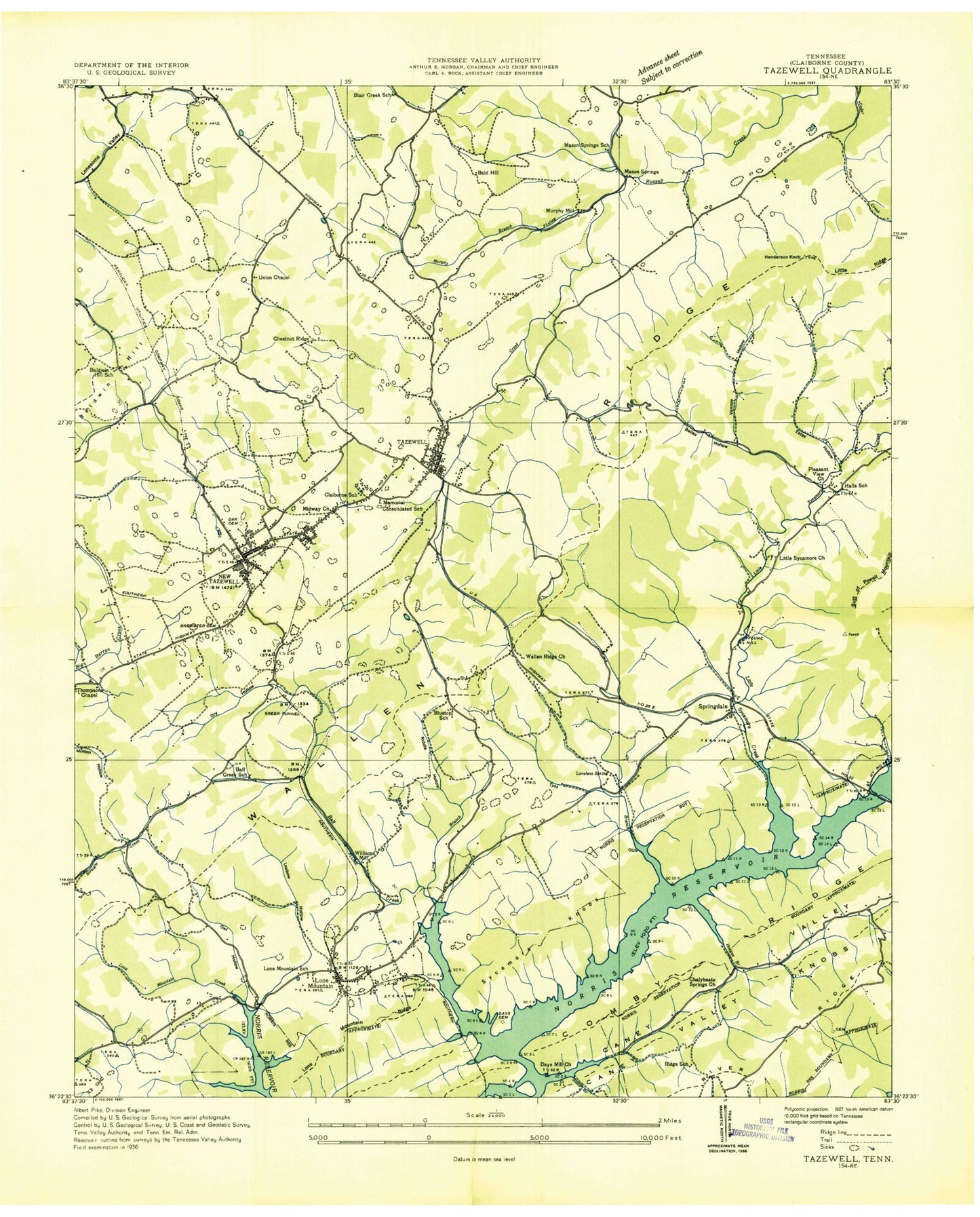
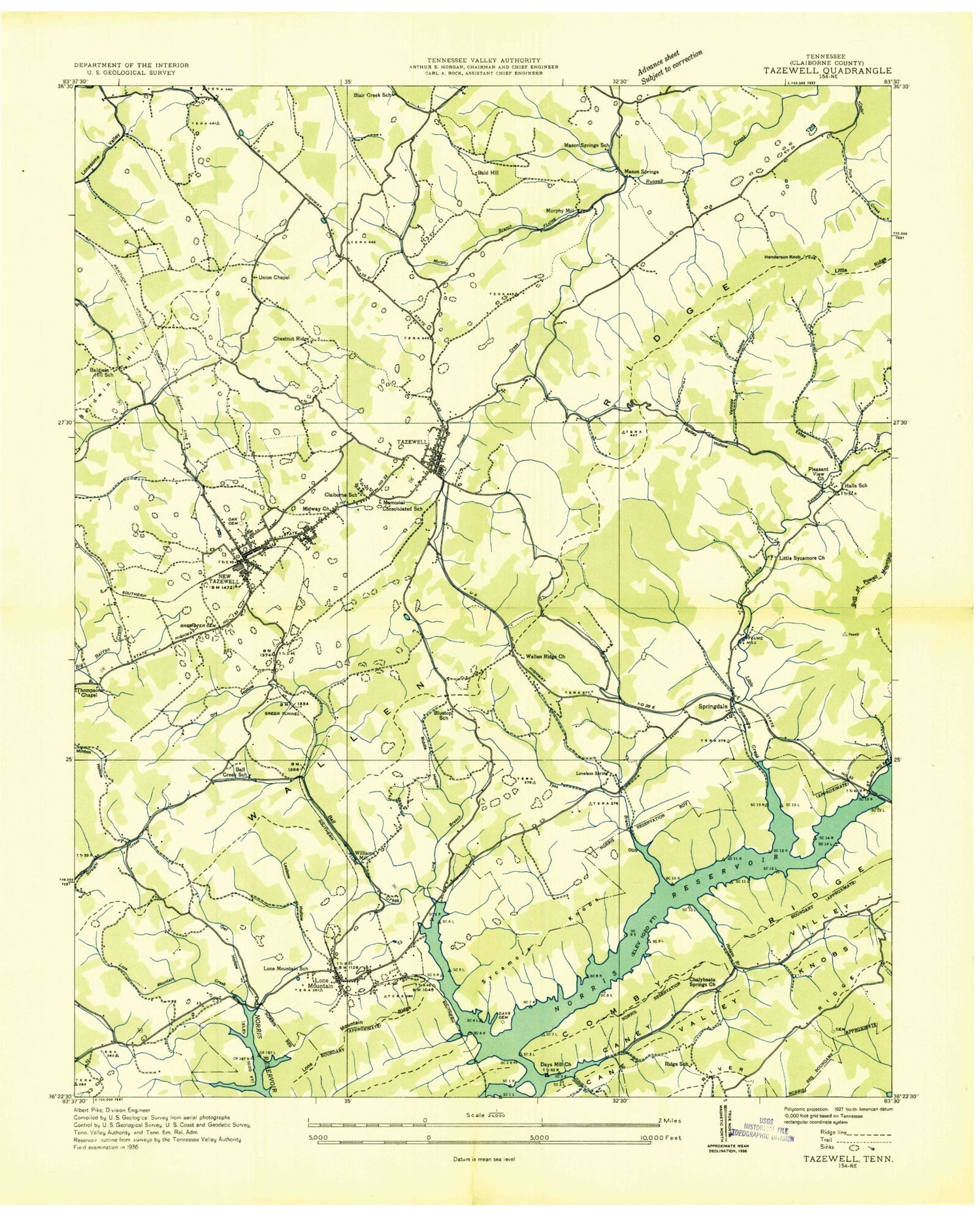
Classic USGS Tazewell Tennessee 7.5'x7.5' Topo Map
Couldn't load pickup availability
Historical USGS topographic quad map of Tazewell in the state of Tennessee. Map scale may vary for some years, but is generally around 1:24,000. Print size is approximately 24" x 27"
This quadrangle is in the following counties: Claiborne.
The map contains contour lines, roads, rivers, towns, and lakes. Printed on high-quality waterproof paper with UV fade-resistant inks, and shipped rolled.
Contains the following named places: Atkins Cemetery, Bailey Cemetery, Bailey Gap, Bailey Hollow, Bald Hill, Baldwin Cemetery, Baldwin Hill, Baldwin Hill School, Ball Creek School, Barton Cemetery, Blairs Creek School, Bluetop School, Breeding Cemetery, Brewster Cemetery, Brown Cemetery, Butt of Powell, Campbell Cemetery, Caney Valley, Caney Valley Knobs, Cardwell Cemetery, Cardwell Ridge, Cedar Fork Church, Chalybeate Springs Church, Chestnut Ridge, Chittum, Chittum Chapel, Claiborne County Emergency Medical Services, Claiborne County High School, Claiborne County Sheriff's Office, Claiborne County Vocational Center, Claiborne Medical Center, Coffey Cemetery, Commissioner District 1, Commissioner District 3, Cook Cemetery, Days Cemetery, Days Mill Church, Dry Hollow, Duncan Chapel, Epperson Cemetery, Estes Hollow, Evans Cemetery, Fultz Cemetery, Furgerson Cemetery, Greer Cemetery, Greer Lake, Greer Tunnel, Henderson Knob, Highberry Trailer Park, Hodges Branch, Hodges Cemetery, Hoge Cemetery, Hurst Mill, Hyberry Hollow, Irish Cemetery, Jackson Cemetery, Janeway Cemetery, Jones Cemetery, Laster Cemetery, Leabow Cemetery, Leabow Hollow, Lick Branch, Little Sycamore Church, Little Sycamore Creek, Lone Mountain, Lone Mountain Baptist Church, Lone Mountain Dock, Lone Mountain Methodist Church, Lone Mountain Post Office, Lone Mountain Ridge, Lone Mountain School, Long Branch, Love Cemetery, Lovelace Spring, Manis Hollow, Maples Hollow, Mason Springs, Mason Springs School, Mason-Bethel School, Middle Ridge, Midway Church, Mount Creek Church, Murphy Branch, Murphy Mill, New Tazewell, New Tazewell First Baptist Church, New Tazewell Municipal Airport, New Tazewell Police Department, New Tazewell Post Office, North Tazewell Volunteer Fire Department, Oakes Cemetery, Old Cedar Fork, Owens Hollow, Owl Hollow, Payne Cemetery, Pleasant View Church, Riddle Hollow, Ridge School, Rosenwald School, Saddle Ridge, Soldiers Memorial Middle School, Springdale, Springdale Baptist Church, Springdale Elementary School, Springdale Volunteer Fire Department Station 1, Springdale Volunteer Fire Department Station 2, Stony Branch, Sycamore, Sycamore Hall, Sycamore Hall School, Sycamore Knobs, Sycamore Tunnel, Tazewell, Tazewell / New Tazewell Fire Department, Tazewell Division, Tazewell Police Department, Tazewell Post Office, Tazewell Square Shopping Center, Tazewell-New Tazewell Elementary School, Thompsons Chapel Cemetery, Thompsons Chapel United Methodist Church, Town of New Tazewell, Town of Tazewell, Turkey Ridge, Tyes Branch, Union Chapel, Vanndy Hollow, Vannoy Cemetery, Vannoy Hollow, Wallen Ridge Church, West Cemetery, Williams Cemetery, Williams Mill, WNTT-AM (Tazewell), Woods Cemetery, ZIP Code: 37879