MyTopo
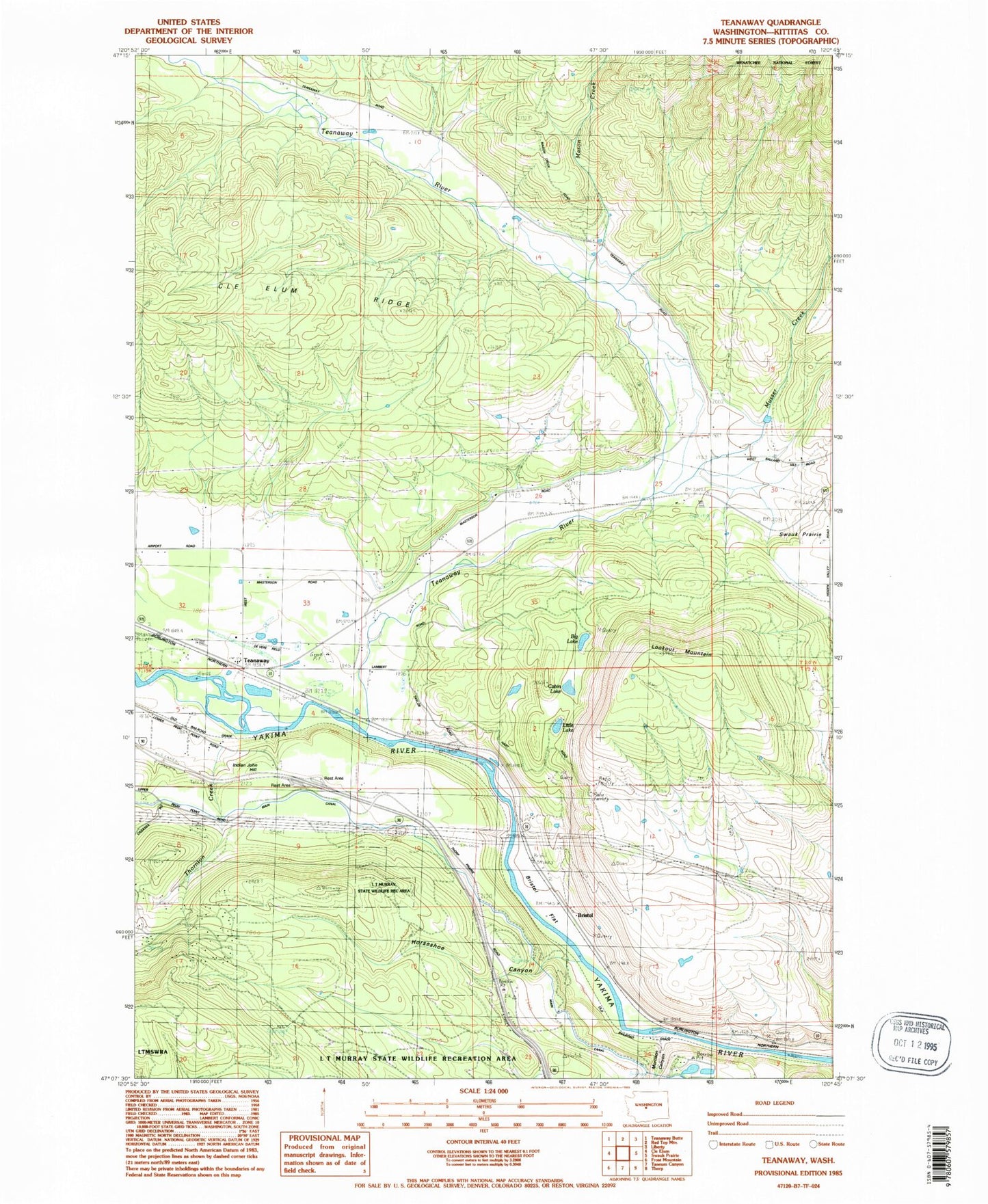
Classic USGS Teanaway Washington 7.5'x7.5' Topo Map
Couldn't load pickup availability
Historical USGS topographic quad map of Teanaway in the state of Washington. Typical map scale is 1:24,000, but may vary for certain years, if available. Print size: 24" x 27"
This quadrangle is in the following counties: Kittitas.
The map contains contour lines, roads, rivers, towns, and lakes. Printed on high-quality waterproof paper with UV fade-resistant inks, and shipped rolled.
Contains the following named places: Big Lake, Bristol, Bristol Flat, Cabin Lake, Horlick, Horseshoe Canyon, Indian John Hill, Little Lake, Lookout Mountain, Mason Creek, Morrison Canyon, Mack Creek, Teanaway, Teanaway River, Thornton Creek, Musser Creek, Casway, De Vere Field, Horlick, Kountze, Kittitas County Fire District 7 Station 2, Kittitas County Fire District 7 Station 74, Big Lake, Bristol, Bristol Flat, Cabin Lake, Horlick, Horseshoe Canyon, Indian John Hill, Little Lake, Lookout Mountain, Mason Creek, Morrison Canyon, Mack Creek, Teanaway, Teanaway River, Thornton Creek, Musser Creek, Casway, De Vere Field, Horlick, Kountze, Kittitas County Fire District 7 Station 2, Kittitas County Fire District 7 Station 74