MyTopo
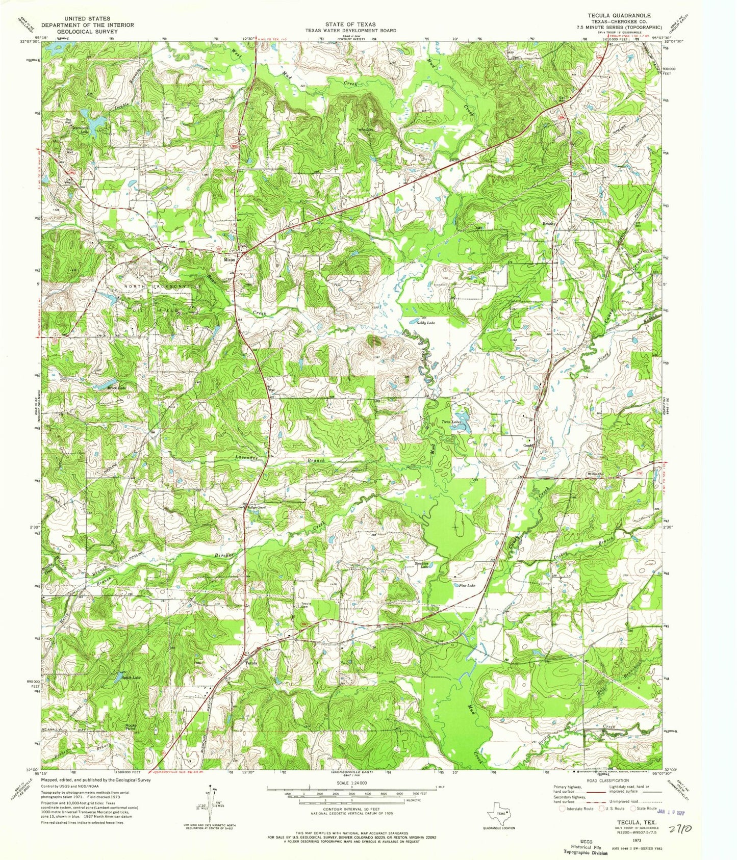
Classic USGS Tecula Texas 7.5'x7.5' Topo Map
Couldn't load pickup availability
Historical USGS topographic quad map of Tecula in the state of Texas. Map scale may vary for some years, but is generally around 1:24,000. Print size is approximately 24" x 27"
This quadrangle is in the following counties: Cherokee.
The map contains contour lines, roads, rivers, towns, and lakes. Printed on high-quality waterproof paper with UV fade-resistant inks, and shipped rolled.
Contains the following named places: Bear Creek, Bell Branch, Birches Creek, Brock Lake, Brushy, Brushy Creek, Bullard Club Lake Dam, Caney Creek, Club Lake Branch, Dickey Branch, Double Branch, Goldy Lake, Gould, Greenhead Lake, Hetty Branch, Lavender Branch, Miles Lake, Miles Lake Dam, Mixon, Mount Zion Church, North Cherokee County Volunteer Fire Department Station 1, North Cherokee County Volunteer Fire Department Station 2, North Jacksonville Oil Field, Pine Lake, Piney Branch, Rocky Point, Smith Lake, Stockton Lake, Taylors Chapel, Tecula, Tecula Cemetery, Twin Lakes, Wallace Branch, West Mud Creek