MyTopo
Classic USGS Tehipite Dome California 7.5'x7.5' Topo Map
Couldn't load pickup availability
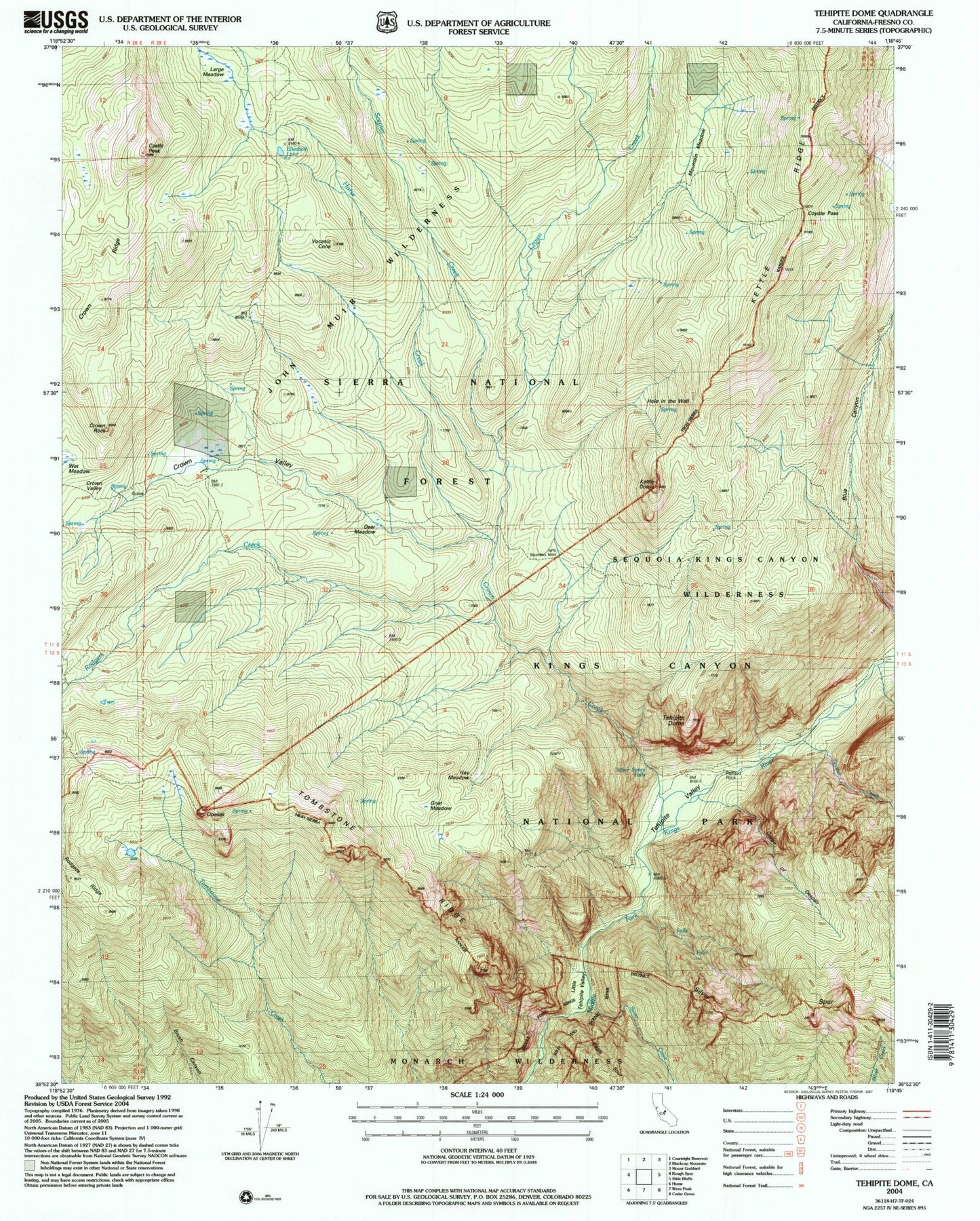
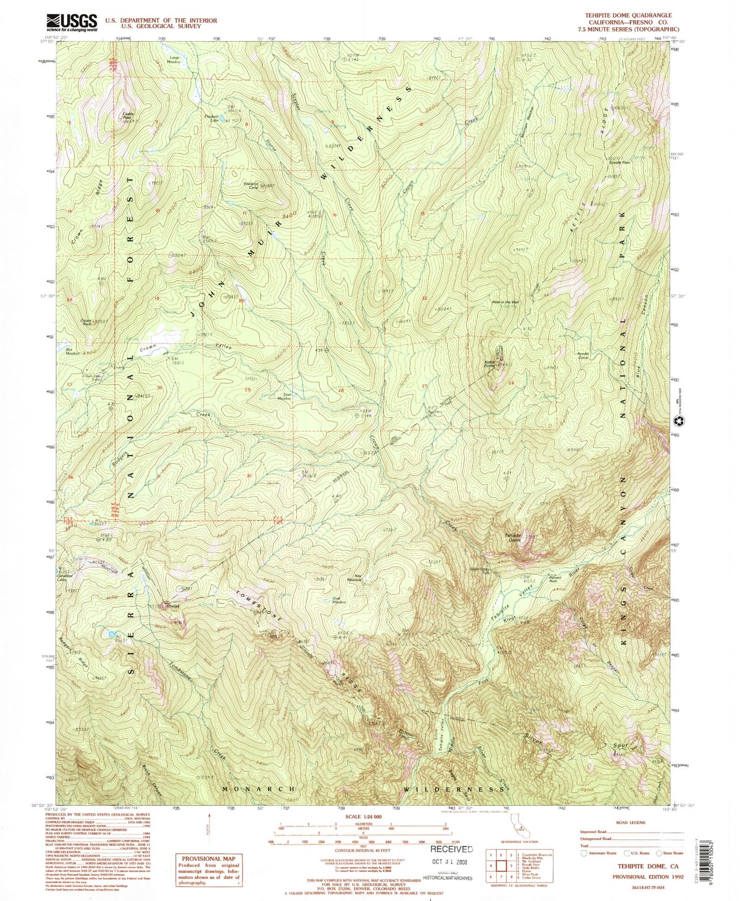
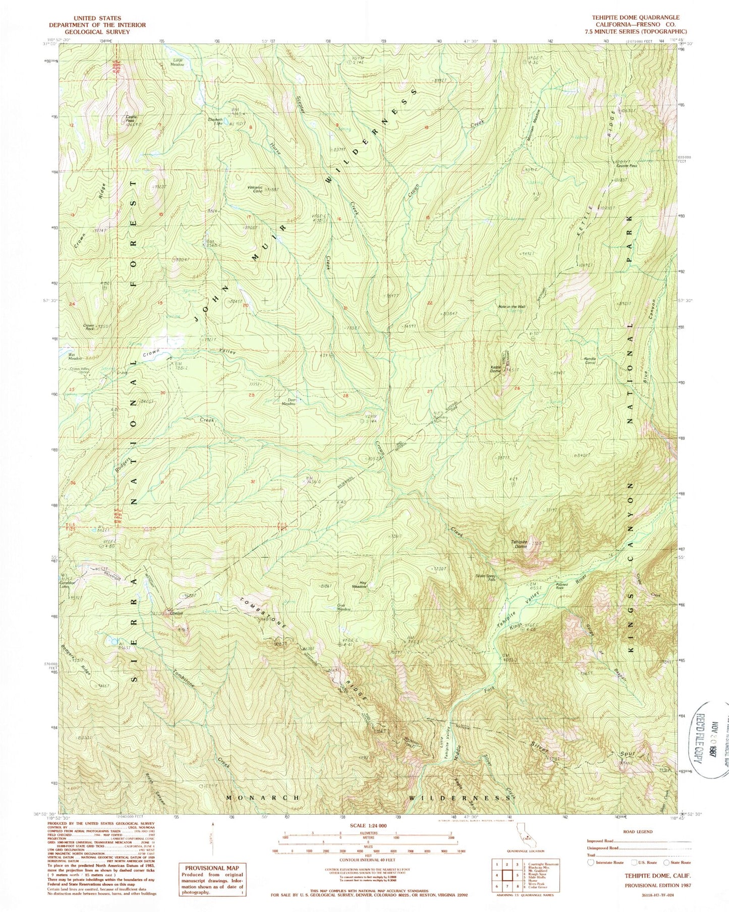
Historical USGS topographic quad map of Tehipite Dome in the state of California. Typical map scale is 1:24,000, but may vary for certain years, if available. Print size: 24" x 27"
This quadrangle is in the following counties: Fresno.
The map contains contour lines, roads, rivers, towns, and lakes. Printed on high-quality waterproof paper with UV fade-resistant inks, and shipped rolled.
Contains the following named places: Castle Peak, Coyote Pass, Crown Ridge, Crown Rock, Crown Valley, Crown Valley Guard Station, Crystal Creek, Elizabeth Lake, Gnat Meadow, Gorge of Despair, Kettle Dome, Large Meadow, Little Tehipte Valley, Mountain Meadow, Obelisk, Painted Rock, Rodgers Creek, Scepter Creek, Silver Creek, Silver Spray Falls, Crown Creek, Tehipite Dome, Tehipite Valley, Tombstone Ridge, Volcanic Cone, Hay Meadow, Crown Valley Station, Deer Meadow, Hole in the Wall, Randle Corral, Castle Peak, Coyote Pass, Crown Ridge, Crown Rock, Crown Valley, Crown Valley Guard Station, Crystal Creek, Elizabeth Lake, Gnat Meadow, Gorge of Despair, Kettle Dome, Large Meadow, Little Tehipte Valley, Mountain Meadow, Obelisk, Painted Rock, Rodgers Creek, Scepter Creek, Silver Creek, Silver Spray Falls, Crown Creek, Tehipite Dome, Tehipite Valley, Tombstone Ridge, Volcanic Cone, Hay Meadow, Crown Valley Station, Deer Meadow, Hole in the Wall, Randle Corral