MyTopo
Classic USGS Tejon Ranch California 7.5'x7.5' Topo Map
Couldn't load pickup availability
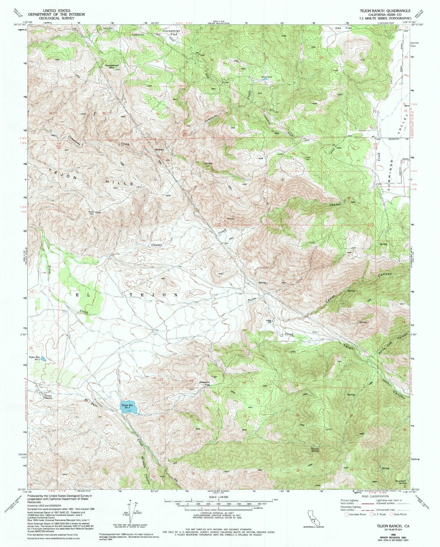
Historical USGS topographic quad map of Tejon Ranch in the state of California. Typical map scale is 1:24,000, but may vary for certain years, if available. Print size: 24" x 27"
This quadrangle is in the following counties: Kern.
The map contains contour lines, roads, rivers, towns, and lakes. Printed on high-quality waterproof paper with UV fade-resistant inks, and shipped rolled.
Contains the following named places: Cedar Canyon, Chanac Creek, Cummings Valley, Havala Spring, Horsethief Flat, Horsethief Mountain, Indian School, Jacks Camp, Joaquin Flat, Oak Flat, Rosemarr Spring, Tejon Canyon, Tejon Hills, Tejon Ranch, White Cow Canyon, Winters Canyon, Tejon Reservoir Number One, Tejon Reservoir Number Two, Tejon Storage Number 1 734 Dam, Tejon Storage Number 2 734-002 Dam, Brodines Ranch, Stallion Springs, Stallion Springs Census Designated Place, Kern County Fire Department Station 18 - Stallion Springs