MyTopo
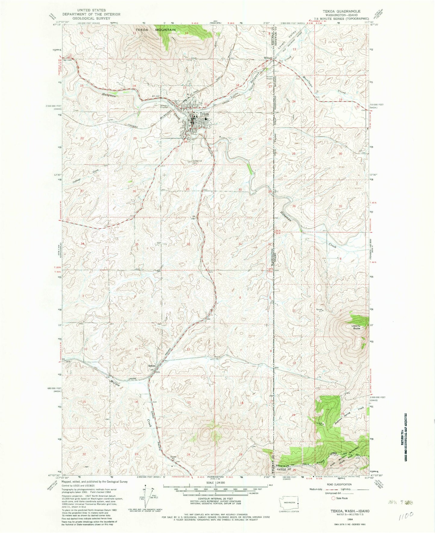
Classic USGS Tekoa Washington 7.5'x7.5' Topo Map
Couldn't load pickup availability
Historical USGS topographic quad map of Tekoa in the states of Washington, Idaho. Map scale may vary for some years, but is generally around 1:24,000. Print size is approximately 24" x 27"
This quadrangle is in the following counties: Benewah, Latah, Whitman.
The map contains contour lines, roads, rivers, towns, and lakes. Printed on high-quality waterproof paper with UV fade-resistant inks, and shipped rolled.
Contains the following named places: City of Tekoa, Goldenrod Cemetery, Hn(os(oskwe' Spring, Hnchdmine'kwe', Liberty Butte, Little Hangman Creek, Lovell Valley, Moctileme Creek, Seltice, St'umt'umm Mountain, Tekoa, Tekoa Ambulance Service, Tekoa Division, Tekoa Fire Department, Tekoa Post Office, Tilmo, Whittman County Sheriff Department Tekoa, Willard, Willard Field, ZIP Code: 99033