
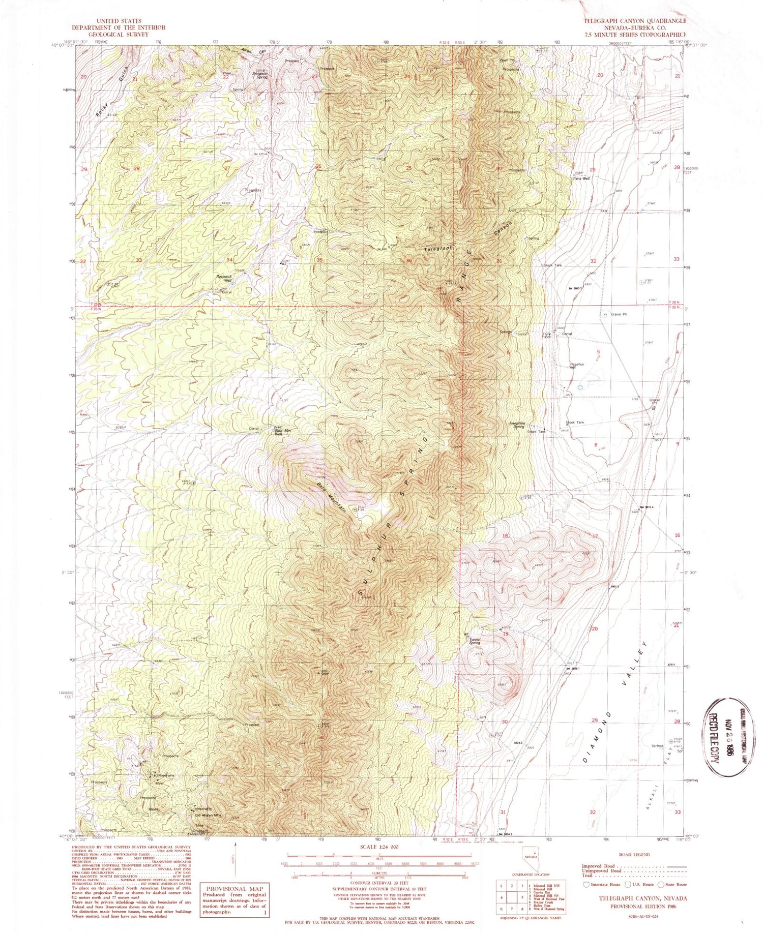
MyTopo
Classic USGS Telegraph Canyon Nevada 7.5'x7.5' Topo Map
Couldn't load pickup availability
Historical USGS topographic quad map of Telegraph Canyon in the state of Nevada. Map scale may vary for some years, but is generally around 1:24,000. Print size is approximately 24" x 27"
This quadrangle is in the following counties: Eureka.
The map contains contour lines, roads, rivers, towns, and lakes. Printed on high-quality waterproof paper with UV fade-resistant inks, and shipped rolled.
Contains the following named places: Bald Mountain, Bald Mountain Spring, Bald Mountain Well, Bear Mine, Bennett Spring, Bennett Spring Number One, Fera Well, Flynn Ranch, Flynn Ranch Springs, Josephine Spring, Lake Dou-Pah-Gade, Old Whalen Mine, Ryepatch Well, Siri Spring, Stimpson Spring, Telegraph Canyon, Tunnel Spring


