MyTopo
Classic USGS Telescope Peak California 7.5'x7.5' Topo Map
Regular price
$16.95
Regular price
Sale price
$16.95
Unit price
per
Couldn't load pickup availability
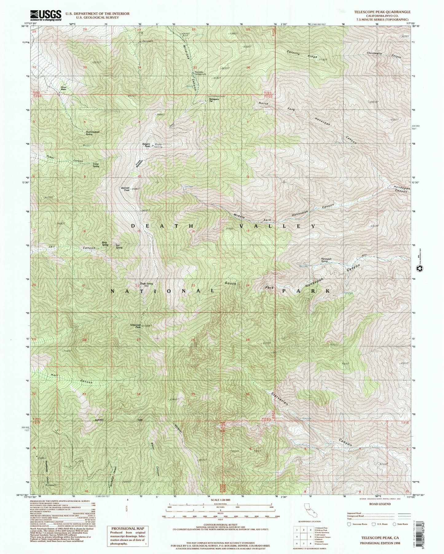
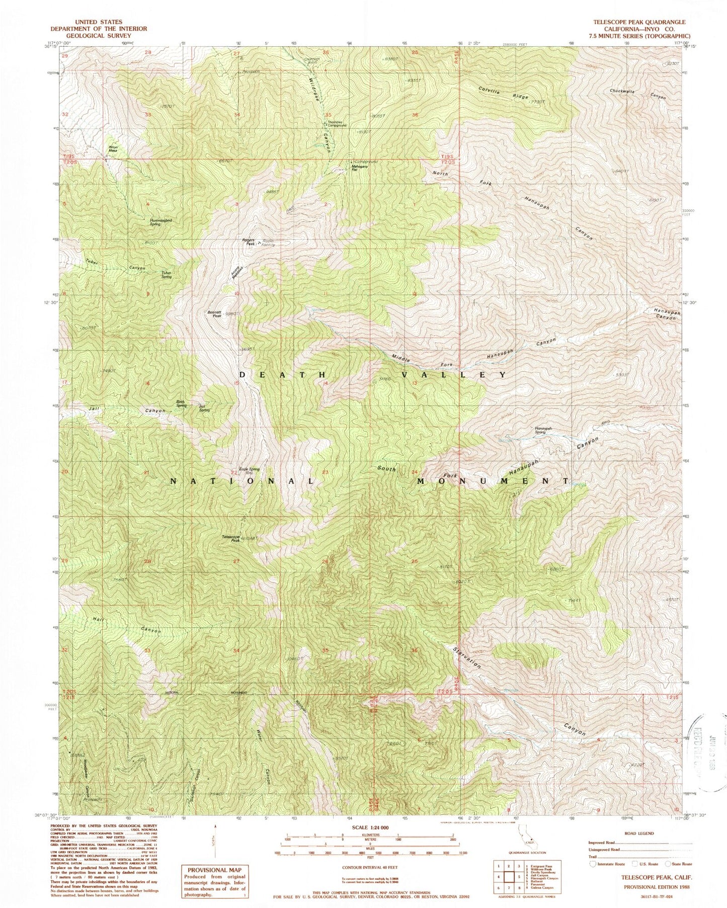
Historical USGS topographic quad map of Telescope Peak in the state of California. Typical map scale is 1:24,000, but may vary for certain years, if available. Print size: 24" x 27"
This quadrangle is in the following counties: Inyo.
The map contains contour lines, roads, rivers, towns, and lakes. Printed on high-quality waterproof paper with UV fade-resistant inks, and shipped rolled.
Contains the following named places: Arcane Meadows, Bennett Peak, Birch Spring, Eagle Spring, Hanaupah Spring, Hummingbird Spring, Jail Spring, Mahogany Flat, Middle Fork Hanaupah Canyon, North Fork Hanaupah Canyon, Rogers Peak, Telescope Peak, Thorndike Campground, Tuber Spring, Coville Ridge, Panamint Range, Pinon Mesa