MyTopo
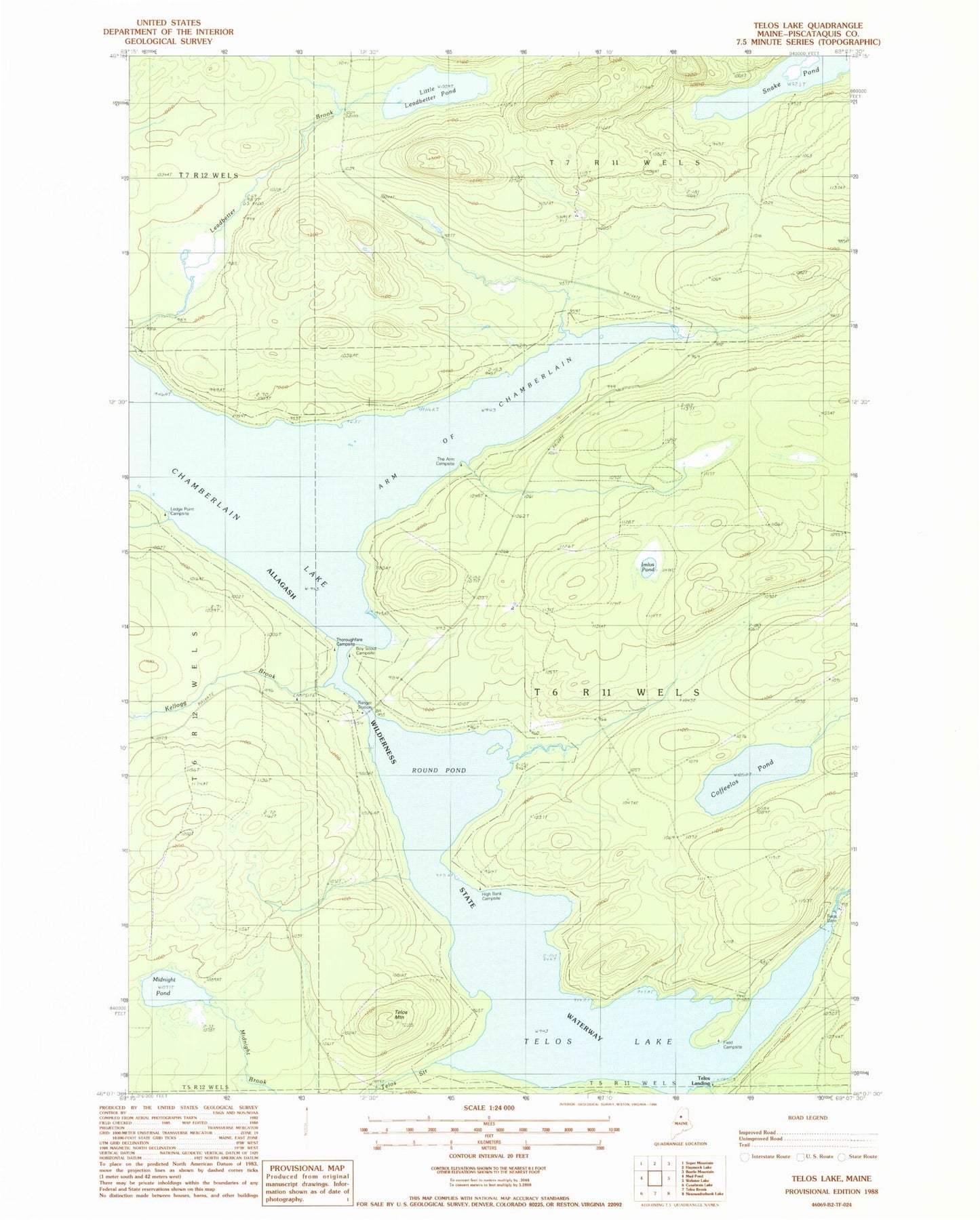
Classic USGS Telos Lake Maine 7.5'x7.5' Topo Map
Couldn't load pickup availability
Historical USGS topographic quad map of Telos Lake in the state of Maine. Map scale may vary for some years, but is generally around 1:24,000. Print size is approximately 24" x 27"
This quadrangle is in the following counties: Piscataquis.
The map contains contour lines, roads, rivers, towns, and lakes. Printed on high-quality waterproof paper with UV fade-resistant inks, and shipped rolled.
Contains the following named places: Arm of Chamberlain, Boy Scout Campsite, Chamberlain Bridge, Chamberlain-Telos Lake, Coffeelos Pond, Field Campsite, High Bank Campsite, Imlos Pond, Kellogg Brook, Ledge Point Campsite, Little Leadbetter Pond, Meadow Brook, Midnight Brook, Midnight Pond, Nugent Chamberlain Lake Seaplane Base, Round Pond, Snake Pond, T6 R11 WELS, Telos Dam, Telos Lake, Telos Landing, Telos Mountain, The Arm Campsite, Thoroughfare Campsite, Throughfare Campsite