MyTopo
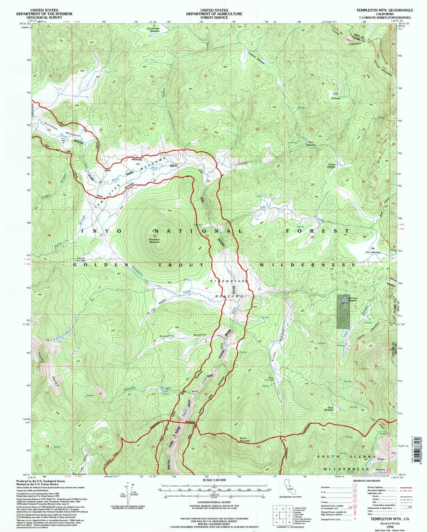
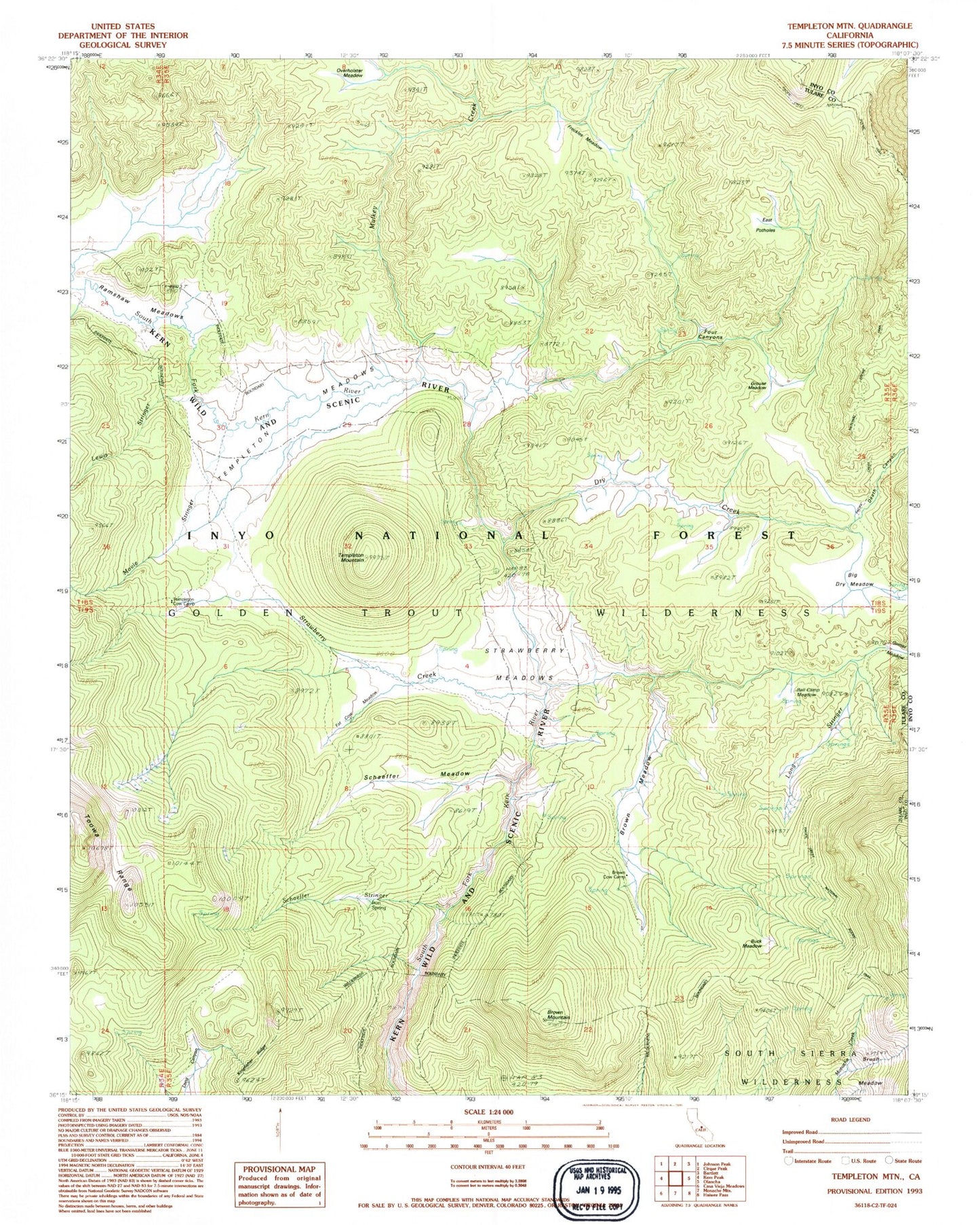
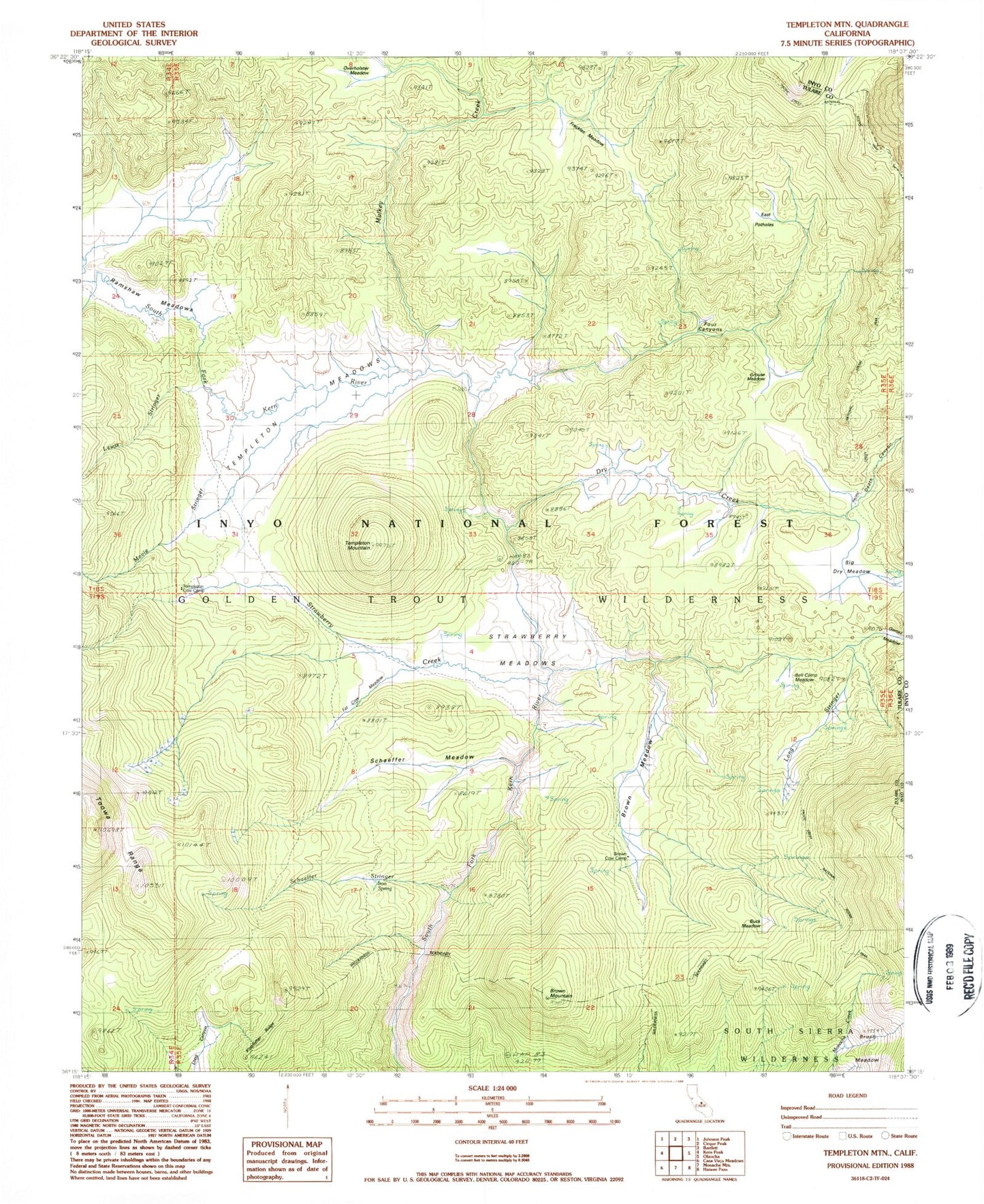
Classic USGS Templeton Mountain California 7.5'x7.5' Topo Map
Couldn't load pickup availability
Historical USGS topographic quad map of Templeton Mountain in the state of California. Typical map scale is 1:24,000, but may vary for certain years, if available. Print size: 24" x 27"
This quadrangle is in the following counties: Inyo, Tulare.
The map contains contour lines, roads, rivers, towns, and lakes. Printed on high-quality waterproof paper with UV fade-resistant inks, and shipped rolled.
Contains the following named places: Bell Camp Meadow, Big Dry Meadow, Brown Cow Camp, Brown Meadow, Brown Mountain, Brush Meadow, Buck Meadow, Death Canyon, Dry Creek, East Potholes, Fat Cow Meadow, Four Canyons, Freckles Meadow, Grouse Meadow, Iron Spring, Lewis Stringer, Long Stringer, Movie Stringer, Mulkey Creek, Overholster Meadow, Schaeffer Meadow, Schaeffer Stringer, Strawberry Creek, Strawberry Meadows, Templeton Mountain, Templeton Meadows, Kingfisher Ridge, Templeton Cow Camp, Bell Camp Meadow, Big Dry Meadow, Brown Cow Camp, Brown Meadow, Brown Mountain, Brush Meadow, Buck Meadow, Death Canyon, Dry Creek, East Potholes, Fat Cow Meadow, Four Canyons, Freckles Meadow, Grouse Meadow, Iron Spring, Lewis Stringer, Long Stringer, Movie Stringer, Mulkey Creek, Overholster Meadow, Schaeffer Meadow, Schaeffer Stringer, Strawberry Creek, Strawberry Meadows, Templeton Mountain, Templeton Meadows, Kingfisher Ridge, Templeton Cow Camp