MyTopo
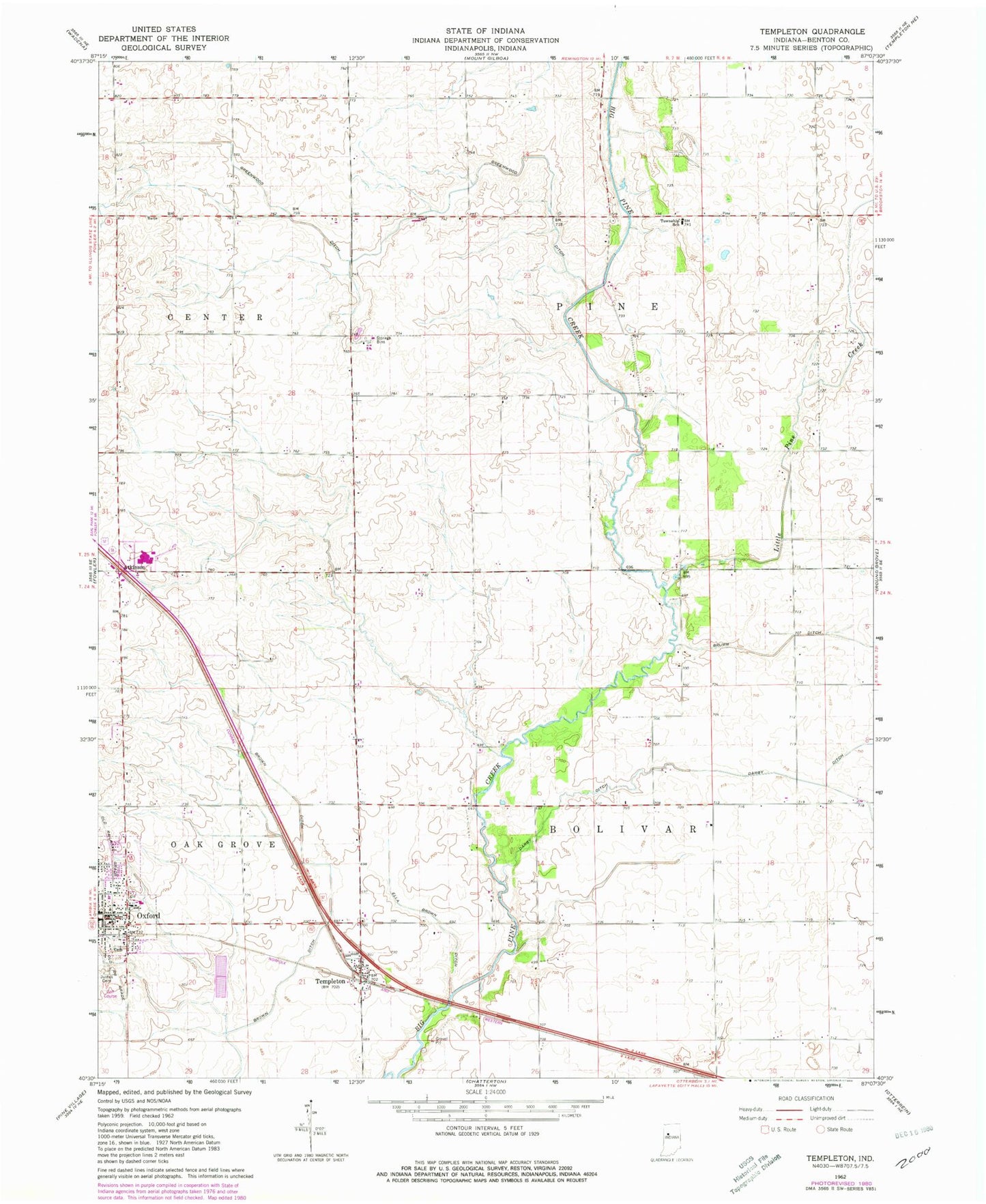
Classic USGS Templeton Indiana 7.5'x7.5' Topo Map
Couldn't load pickup availability
Historical USGS topographic quad map of Templeton in the state of Indiana. Map scale may vary for some years, but is generally around 1:24,000. Print size is approximately 24" x 27"
This quadrangle is in the following counties: Benton.
The map contains contour lines, roads, rivers, towns, and lakes. Printed on high-quality waterproof paper with UV fade-resistant inks, and shipped rolled.
Contains the following named places: Atkinson, Brown Ditch, Brumm Ditch, Darby Ditch, Ella Brown Ditch, Greenwood Ditch, Justus Cemetery, Little Pine Creek, Oxford, Oxford - Oak Grove Volunteer Fire Department, Oxford Post Office, Templeton, Templeton Census Designated Place, Town of Oxford, Township of Bolivar, Township of Pine, ZIP Code: 47971