MyTopo
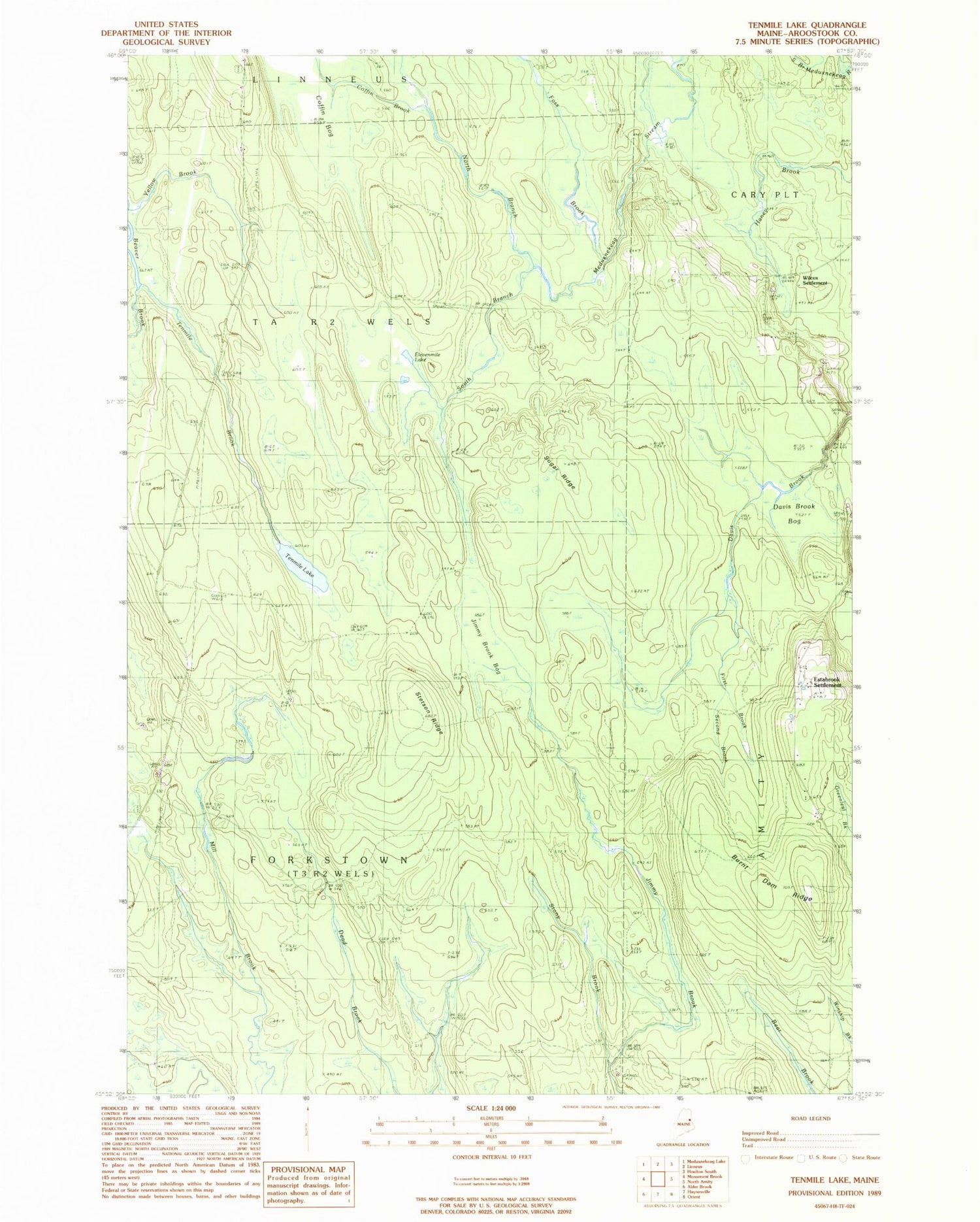
Classic USGS Ten Mile Lake Maine 7.5'x7.5' Topo Map
Couldn't load pickup availability
Historical USGS topographic quad map of Ten Mile Lake in the state of Maine. Map scale may vary for some years, but is generally around 1:24,000. Print size is approximately 24" x 27"
This quadrangle is in the following counties: Aroostook.
The map contains contour lines, roads, rivers, towns, and lakes. Printed on high-quality waterproof paper with UV fade-resistant inks, and shipped rolled.
Contains the following named places: Burnt Dam Ridge, Coffin Bog, Coffin Brook, Davis Brook Bog, Elevenmile Lake, Estabrook Cemetery, Estabrook Settlement, First Brook, Forkstown Township, Foss Brook, Haney Brook, Hiram T Smith Grave, Jimmy Brook Bog, North Branch Meduxnekeag Stream, Second Brook, South Branch Meduxnekeag Stream, Stetson Ridge, Stony Brook, Sugar Ridge, TA R2 WELS, Tenmile Brook, Tenmile Lake, Wilcox Cemetery, Wilcox Settlement, Yellow Brook