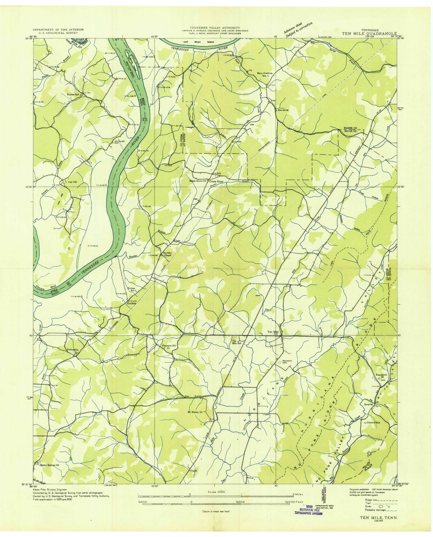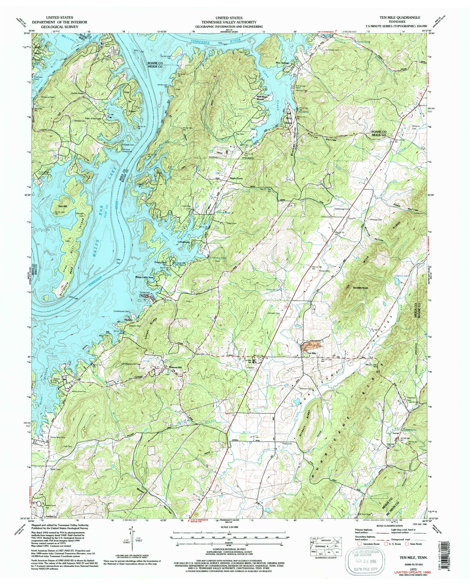
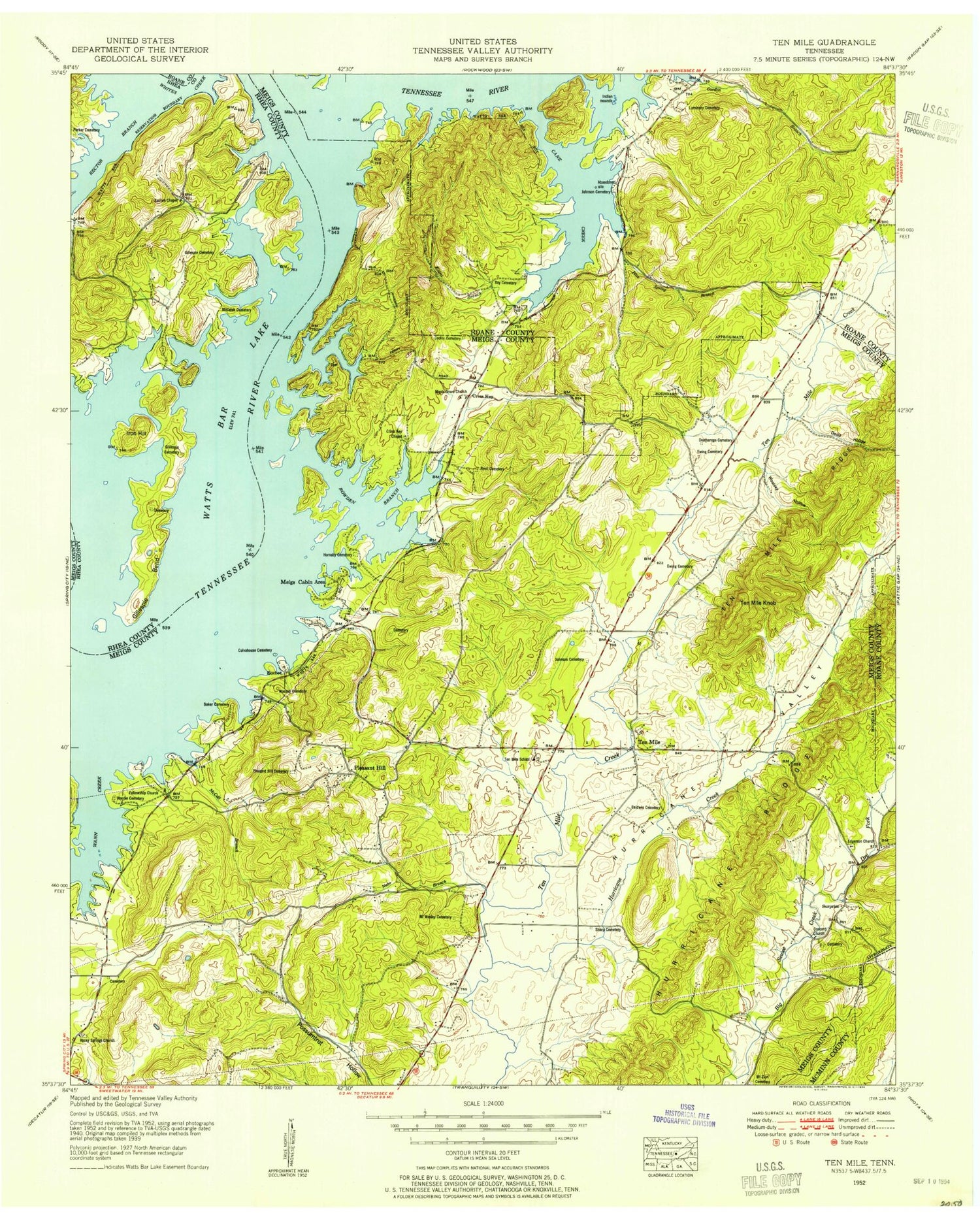
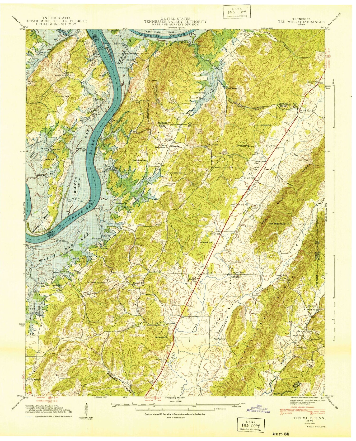

MyTopo
Classic USGS Ten Mile Tennessee 7.5'x7.5' Topo Map
Couldn't load pickup availability
Historical USGS topographic quad map of Ten Mile in the state of Tennessee. Map scale may vary for some years, but is generally around 1:24,000. Print size is approximately 24" x 27"
This quadrangle is in the following counties: McMinn, Meigs, Rhea, Roane.
The map contains contour lines, roads, rivers, towns, and lakes. Printed on high-quality waterproof paper with UV fade-resistant inks, and shipped rolled.
Contains the following named places: Apollo Shores, Arrowhead Dock, Baker Cemetery, Baldwin Cemetery, Bayside, Bayside Dock, Big Springs Access Area, Bills Pier, Blue Spring, Blue Spring Branch, Blue Springs, Blue Springs Dock, Blue Springs Resort, Bowdens Store, Branham Hollow, Camp Oo-tah-nee-noh-chee, Campground on the Lakeshore, Cane Creek, Cedine Bible Camp, Commissioner District 5, Concord Cemetery, Concord Church, Concord School, Cooley Cemetery, Crabtree Spring, Cross Key Cemetery, Cross Key Chapel, Culvahouse, Culvahouse Cemetery, Deatherage Cemetery, Dodd Hollow, Dry Fork, Dry Fork Valley, Eden of the Lake, Edgemon Cemetery, Edgemon Church, Edgemon Lake, Euchee, Euchee Chapel, Euchee Dock, Euchee Old Fields, Euchee School, Evans Branch, Ewing Cemetery, Ewings School, Fellowship Baptist Church, Gilbert Ridge, Gillaspies Ferry, Gillespie Bend, Gillespie Cemetery, Gordon Spring, Gravelly Hollow, Half Moon Shores, Holloway Spring, Hornsby Chapel Cemetery, Hornsby Hollow Recreation Area, Hornsbys Chapel Methodist Church, Huff Cemetery, Hurricane Creek, Hurricane Valley, Iron Hill, Iron Hill Island, Johnson Cemetery, Keylon Hollow, Keylon Springs, Looney Ridge, Luminary Cemetery, Maple Grove, Maple Grove Church, Marney Creek, Mary Crabtree School, McCaleb Cemetery, McCall Branch, McPherson Cemetery, Meigs Cabin Area, Meigs County Emergency Services Fire Rescue Station 5, Morris Island, Mount Wesley Cemetery, Mount Wesley Methodist Church, Mount Zion Cemetery, Nebo Branch, No Pone Ridge, Old Hope Cemetery, Old Pleasant Hill Cemetery, Old Ten Mile Cemetery, Parker Cemetery, Peakland Church, Pearl Harbor, Pleasant Hill, Pleasant Hill Baptist Church Cemetery, Pleasant Hill Methodist Church, Pleasant Hill School, Ponderosa Resort, Ray Cemetery, Rector Branch, Red Cloud Campground, Reed Cemetery, Rocky Springs Cemetery, Rocky Springs Church, Roork Cemetery, Rowden Branch, Sams Dock, Sand Island, Sensaboy Spring, Sharp Cemetery, South Roane County Volunteer Fire Department Station 5 Half Moon Shores Fire Station, Stump Hollow Campground, Surprise, Tabor, Ten Mile, Ten Mile Division, Ten Mile Elementary School, Ten Mile Knob, Ten Mile Methodist Church, Ten Mile Post Office, Ten Mile Ridge, Terrace View Resort, Wann Branch, Wasson Cemetery, Watts Bar Estates, White Creek Shoals, Williams Cemetery, Woodys Mill, Woolsey Cemetery, Woolsey Hollow, ZIP Code: 37880