MyTopo
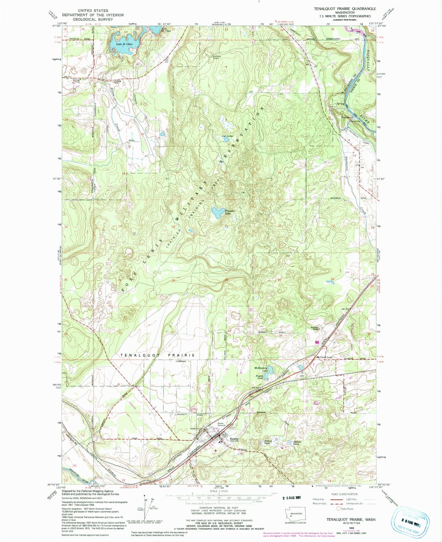
Classic USGS Tenalquot Prairie Washington 7.5'x7.5' Topo Map
Couldn't load pickup availability
Historical USGS topographic quad map of Tenalquot Prairie in the state of Washington. Typical map scale is 1:24,000, but may vary for certain years, if available. Print size: 24" x 27"
This quadrangle is in the following counties: Pierce, Thurston.
The map contains contour lines, roads, rivers, towns, and lakes. Printed on high-quality waterproof paper with UV fade-resistant inks, and shipped rolled.
Contains the following named places: Burnham Ranch, Cat Lakes, Collins School, Eaton Creek, Fagan Lake, Fiander Lake, Gehrke Lake, Inman Lake, McClure Lake, McEnniery Lake, Rainier, Tenalquot Prairie, Thompson Creek, Yelm Creek, Rainier Tower, Southworth Elementary School, Yelm High School, Rainier Primary School, Rainier Senior High School, Oxbow Lake Dam, Oxbow Lake, Olympia East Division, City of Yelm, City of Rainier, LZ Ranch Airport, Taylor Airport, Thurston County Fire Protection District 4, Lacey Fire District 3 Station 32, Southeast Thurston Fire Authority Station 24 Rainier, Rainier Police Department, Rainier Post Office, P-L Ranch Airport