MyTopo
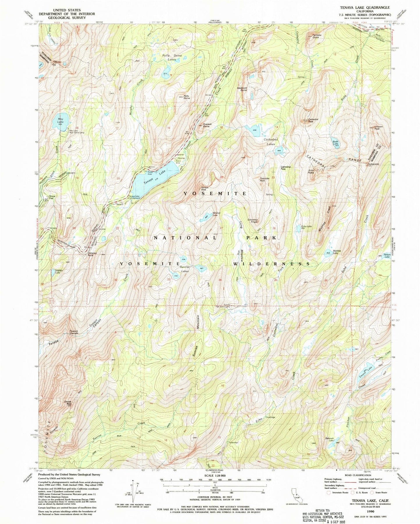
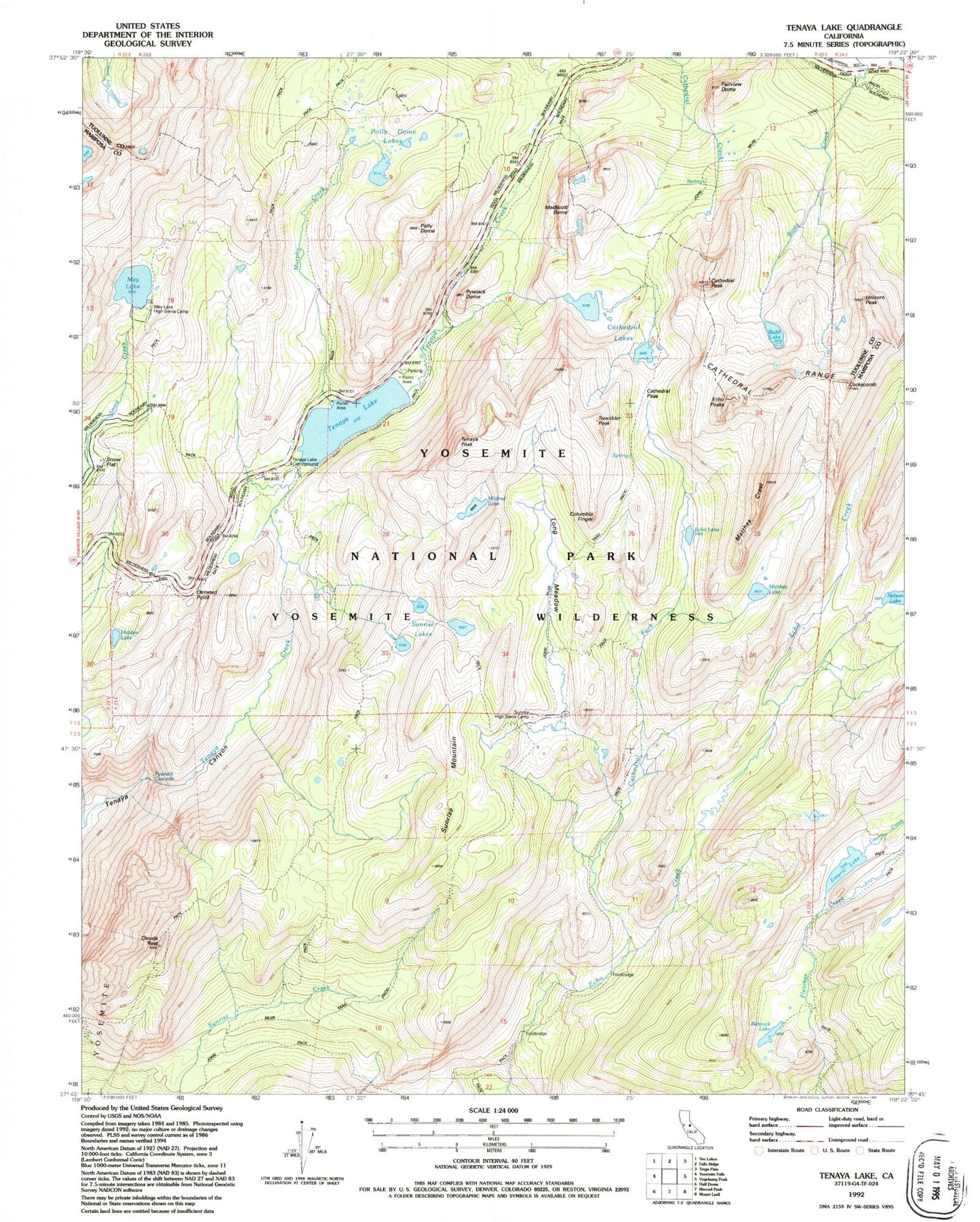
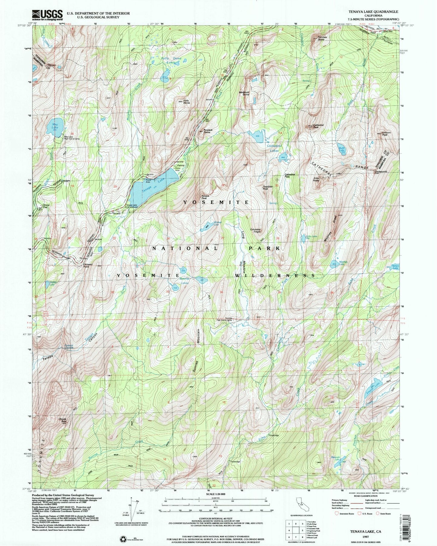
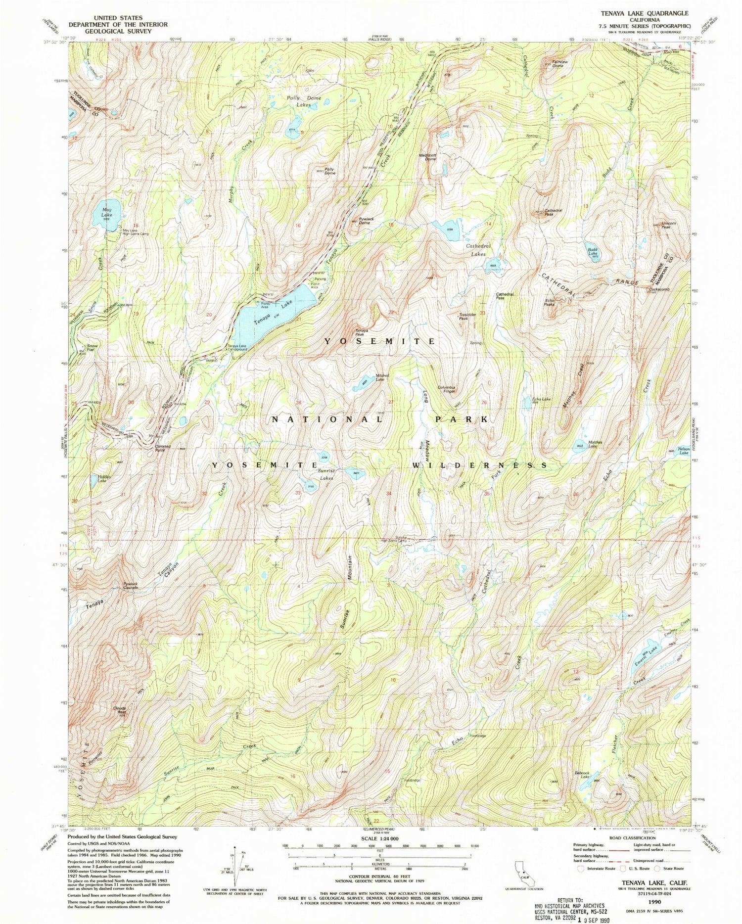
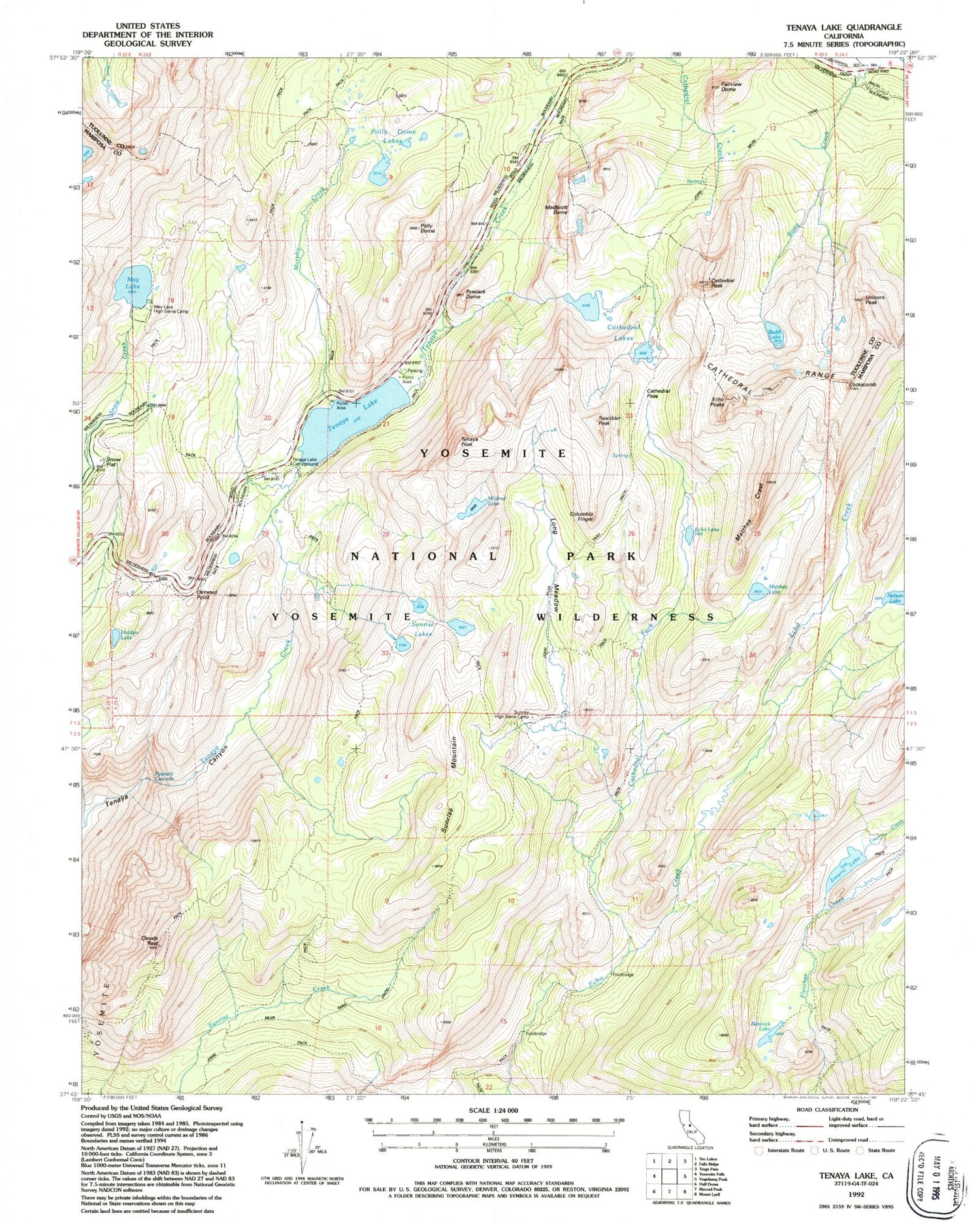
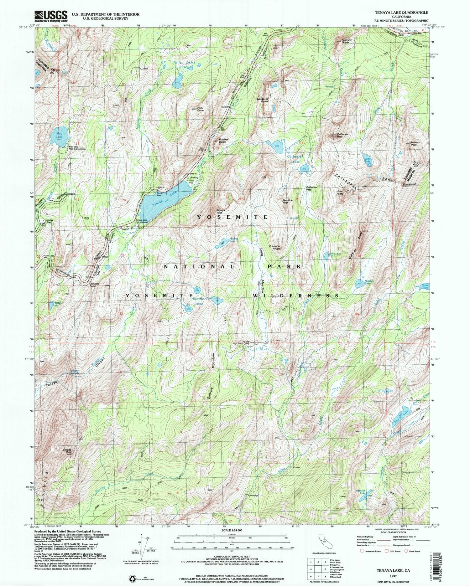
USGS Classic Tenaya Lake California 7.5'x7.5' Topo Map
Couldn't load pickup availability
Historical USGS topographic quad map of Tenaya Lake in the state of California. Scale: 1:24000. Print size: 24" x 27"
This quadrangle is in the following counties: Mariposa, Tuolumne.
The map contains contour lines, roads, rivers, towns, lakes, and grids including latitude / longitude and UTM / MGRS. Printed on high-quality waterproof paper with UV fade-resistant inks.
Contains the following named places: Matthes Lake, May Lake, May Lake High Sierra Camp, Mildred Lake, Polly Dome Lakes, Sunrise Lakes, Olmstead Point, Tenaya Lake Campground, Cathedral Fork, Echo Lake, Fairview Dome, Hidden Lake, Matthes Crest, Nelson Lake, Sunrise and Tuolumne Meadows Trail (historical), Emeric Creek, Emeric Lake, Polly Dome, Pywiack Cascade, Sunrise Mountain, Babcock Lake, Budd Lake, Cathedral Lakes, Cathedral Pass, Cathedral Peak, Clouds Rest, Cockscomb, Long Meadow, Murphy Creek, Tenaya Lake, Tenaya Peak, Columbia Finger, Echo Peaks, Pywiack Dome, Tresidder Peak, Unicorn Peak, Medlicott Dome, Sunrise High Sierra Camp, The Pinnacles