MyTopo
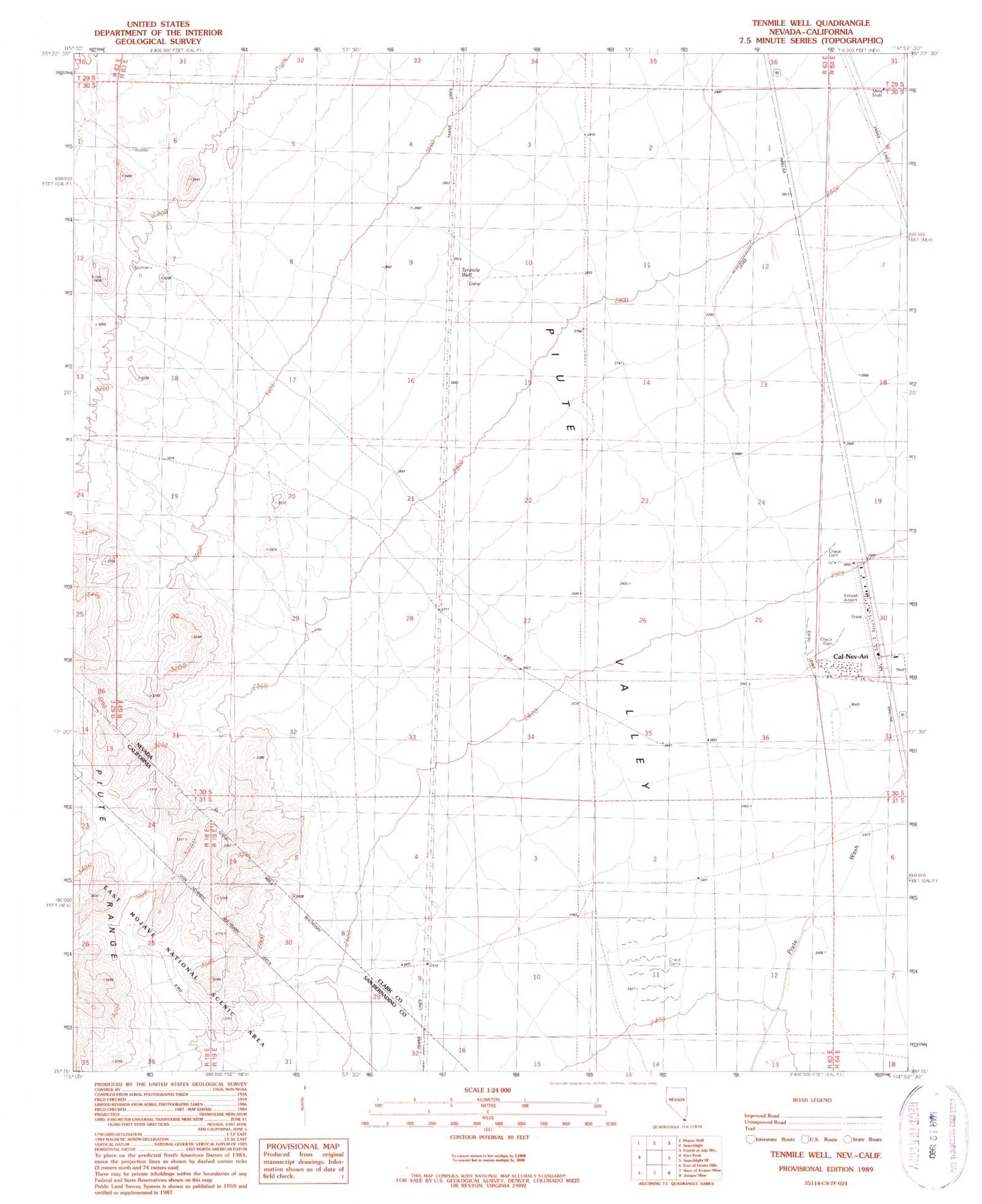
Classic USGS Tenmile Well Nevada 7.5'x7.5' Topo Map
Regular price
$16.95
Regular price
Sale price
$16.95
Unit price
per
Couldn't load pickup availability
Historical USGS topographic quad map of Tenmile Well in the state of Nevada. Map scale may vary for some years, but is generally around 1:24,000. Print size is approximately 24" x 27"
This quadrangle is in the following counties: Clark, San Bernardino.
The map contains contour lines, roads, rivers, towns, and lakes. Printed on high-quality waterproof paper with UV fade-resistant inks, and shipped rolled.
Contains the following named places: Cal Nev Ari Rural Branch Post Office, Cal-Nev-Ari, Cal-Nev-Ari Census Designated Place, Clark County Fire Department Station 84, Kidwell Airport, Lewis Spring, Tenmile Well, Weikel Reservoir, ZIP Code: 89039