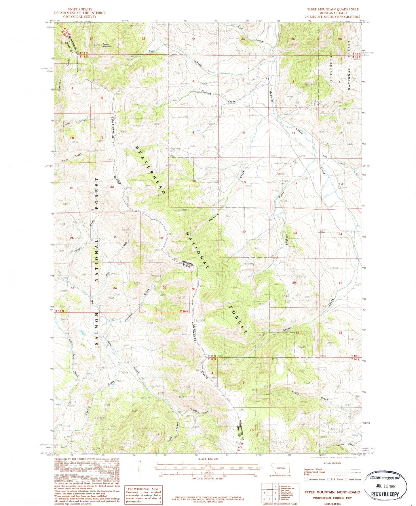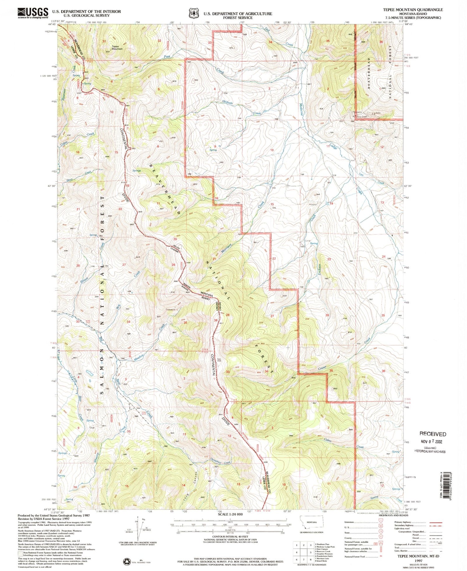
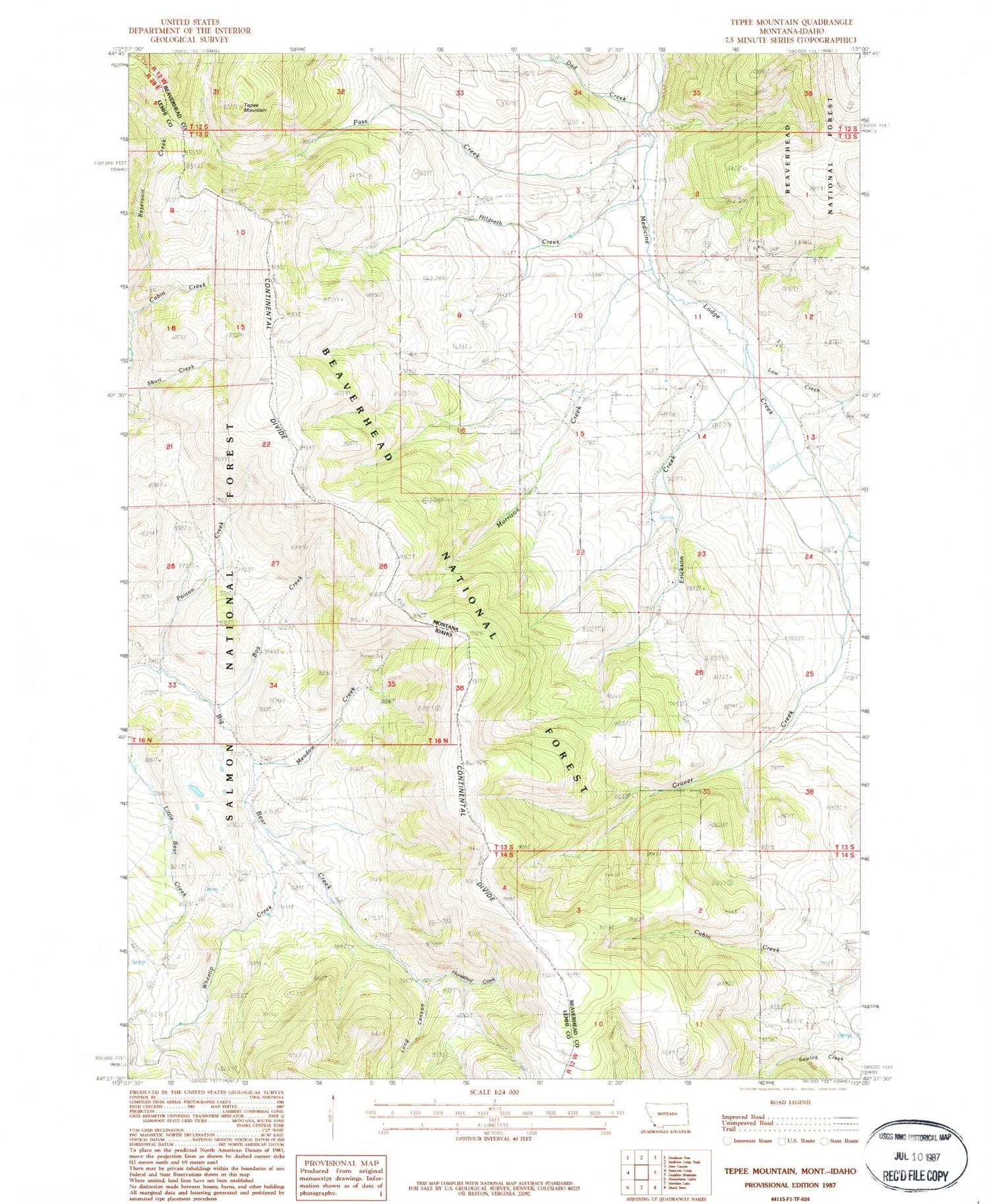
MyTopo
Classic USGS Tepee Mountain Montana 7.5'x7.5' Topo Map
Regular price
$16.95
Regular price
Sale price
$16.95
Unit price
per
Couldn't load pickup availability
Historical USGS topographic quad map of Tepee Mountain in the states of Montana, Idaho. Map scale may vary for some years, but is generally around 1:24,000. Print size is approximately 24" x 27"
This quadrangle is in the following counties: Beaverhead, Lemhi.
The map contains contour lines, roads, rivers, towns, and lakes. Printed on high-quality waterproof paper with UV fade-resistant inks, and shipped rolled.
Contains the following named places: Bog Creek, Craver Creek, Dad Creek, Erickson Creek, Hildreth, Hildreth Creek, Horsethief Creek, Law Creek, Long Canyon, Meadow Creek, Morrison Creek, Pass Creek, Poison Creek, Tepee Mountain, Wheetip Creek