MyTopo
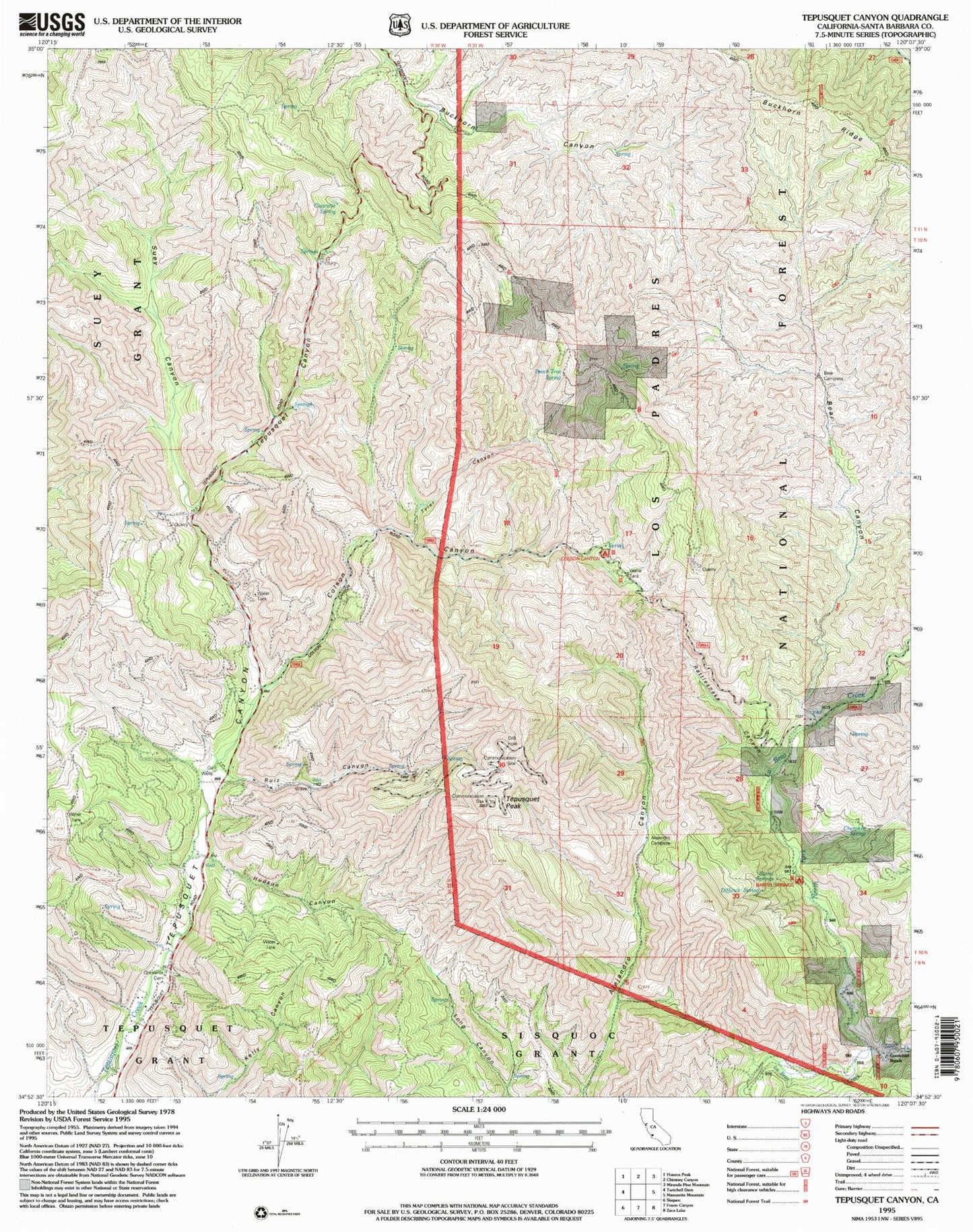
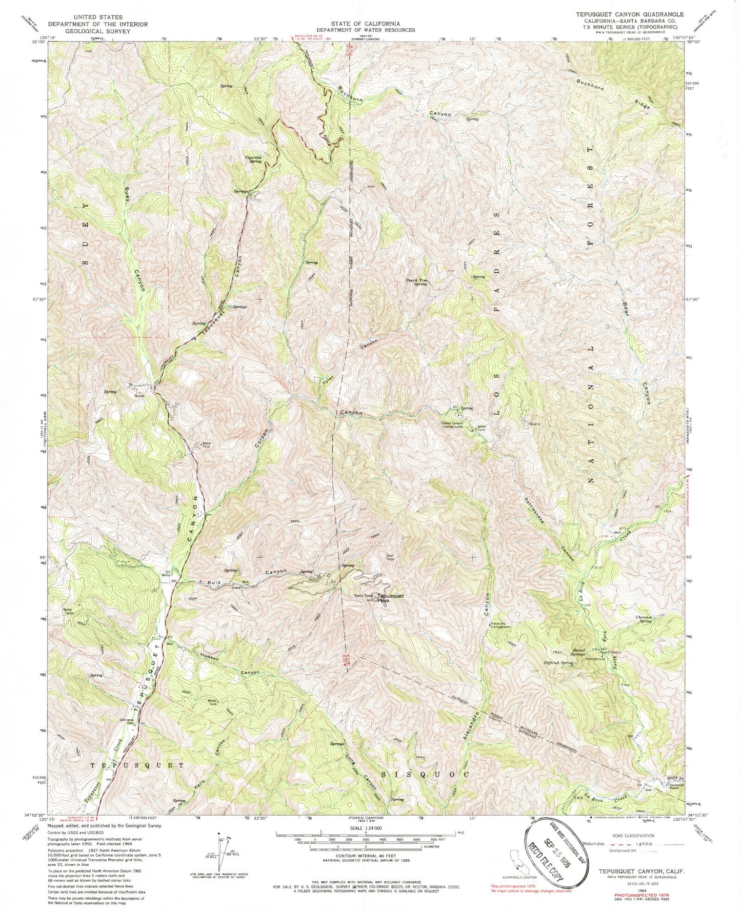
Classic USGS Tepusquet Canyon California 7.5'x7.5' Topo Map
Couldn't load pickup availability
Historical USGS topographic quad map of Tepusquet Canyon in the state of California. Map scale may vary for some years, but is generally around 1:24,000. Print size is approximately 24" x 27"
This quadrangle is in the following counties: Santa Barbara.
The map contains contour lines, roads, rivers, towns, and lakes. Printed on high-quality waterproof paper with UV fade-resistant inks, and shipped rolled.
Contains the following named places: Adams Ranch, Alejandro Campsite, Barrel Springs, Barrel Springs Recreation Site, Bear Campsite, Bear Canyon, Cherokee Spring, Cigarette Spring, Colson Canyon, Colson Canyon Campgrounds, Colson Summit Quarry, Difficult Spring, Goodchild Ranch, Horseshoe Springs Recreation, Hudson Canyon, KCOY-TV (Santa Maria), KXFM-FM (Santa Maria), North Fork La Brea Creek, Oak Valley Creek, Ontiveros Cemetery, Peach Tree Spring, Rattlesnake Canyon, Ruiz Canyon, South Fork La Brea Creek, Suey Canyon, Tepusquet Peak, Tyler Canyon, Webber Ranch