MyTopo
Classic USGS Termination Point Washington 7.5'x7.5' Topo Map
Couldn't load pickup availability
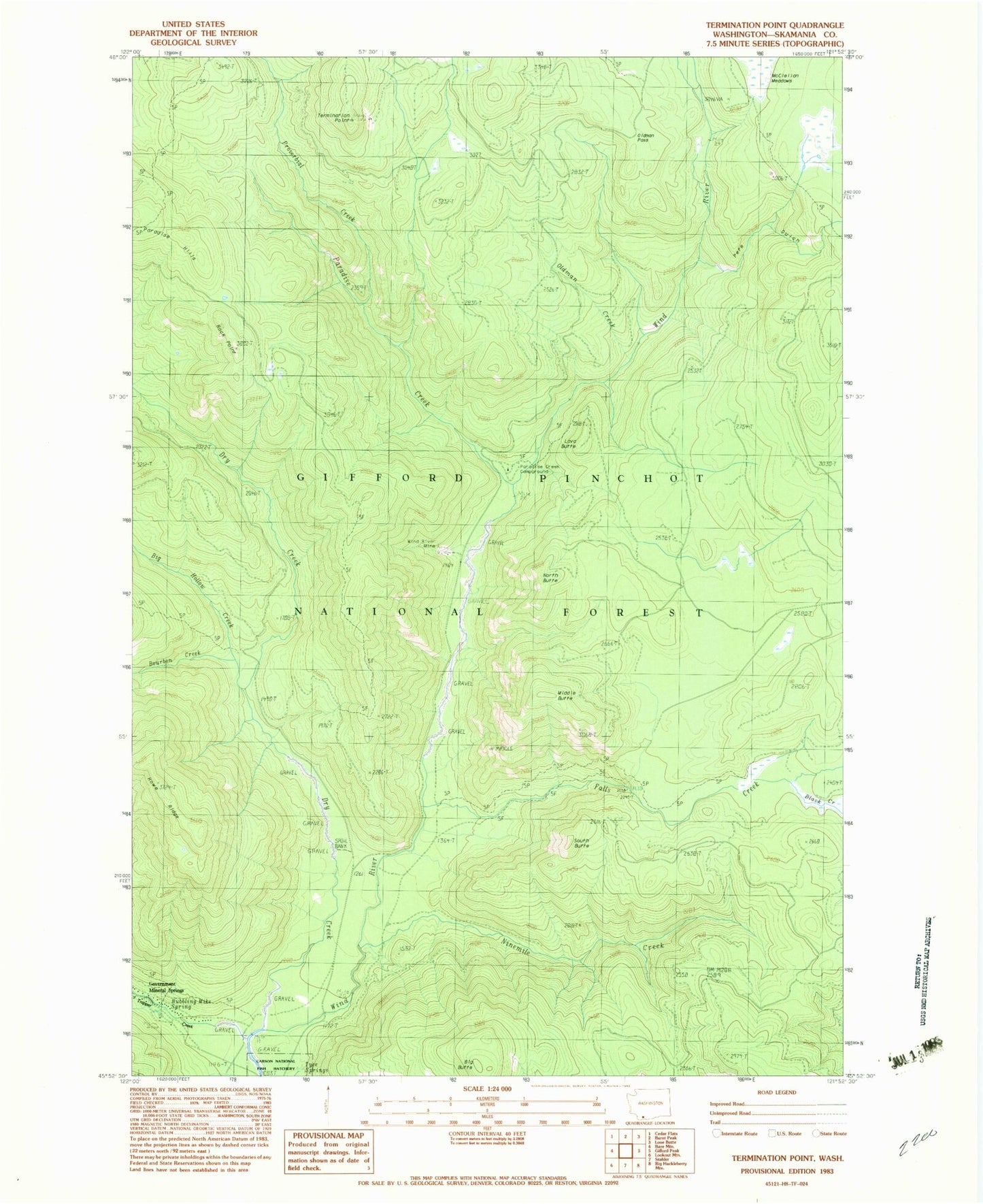
Historical USGS topographic quad map of Termination Point in the state of Washington. Typical map scale is 1:24,000, but may vary for certain years, if available. Print size: 24" x 27"
This quadrangle is in the following counties: Skamania.
The map contains contour lines, roads, rivers, towns, and lakes. Printed on high-quality waterproof paper with UV fade-resistant inks, and shipped rolled.
Contains the following named places: Big Butte, Big Hollow Creek, Black Creek, Bourbon Creek, Dry Creek, Falls Creek, Falls Creek Trail, Government Mineral Springs, Howe Ridge, Juice Creek, Lava Butte, Lava Butte Trail, McClellan Meadows, Middle Butte, Ninemile Creek, North Butte, Oldman Creek, Paradise Creek, Paradise Creek Campground, Paradise Trail, Pete Gulch, Proverbial Creek, Rock Point, South Butte, Termination Point, Trapper Creek, Tyee Springs, Wind River Mine, Oldman Pass, Upper Wind River Winter Sports Area, Falls Creek Falls, Ridge Trail, Bubbling Mike Spring, Home Guard Station, Government Spring Guard Station