MyTopo
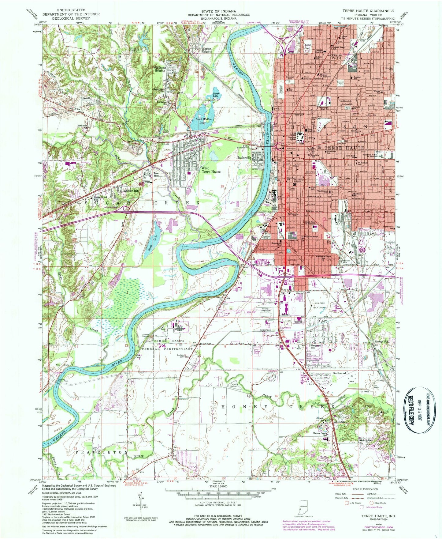
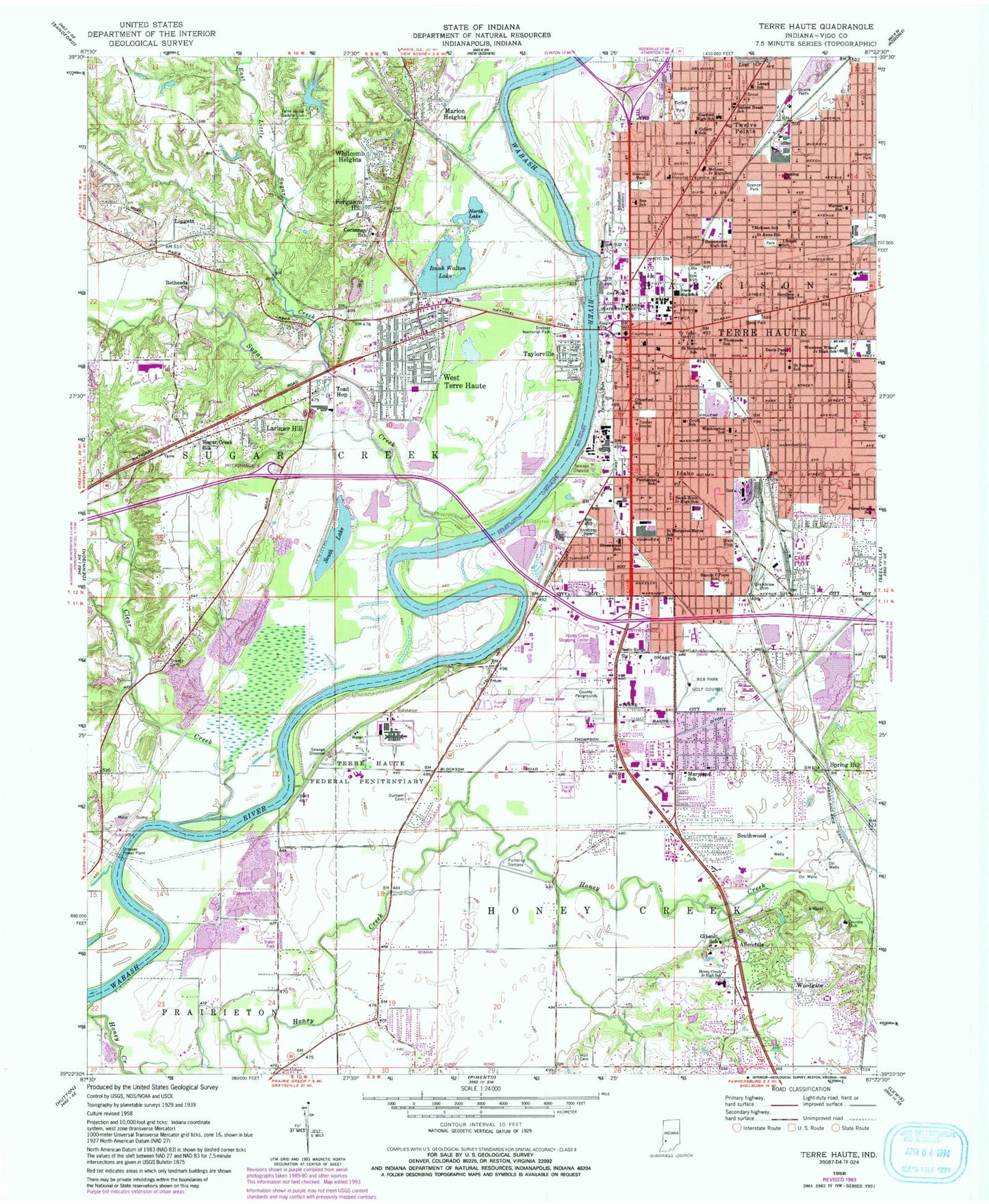
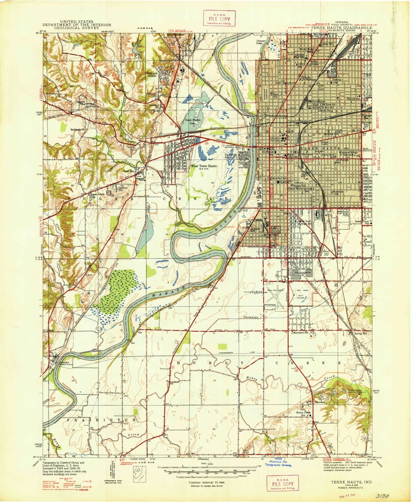
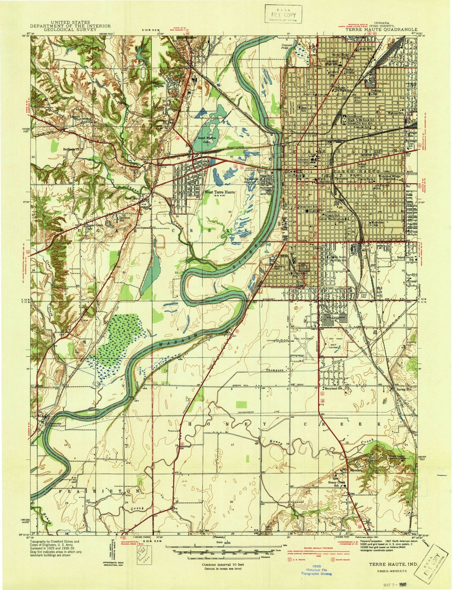
Classic USGS Terre Haute Indiana 7.5'x7.5' Topo Map
Couldn't load pickup availability
Historical USGS topographic quad map of Terre Haute in the state of Indiana. Map scale may vary for some years, but is generally around 1:24,000. Print size is approximately 24" x 27"
This quadrangle is in the following counties: Vigo.
The map contains contour lines, roads, rivers, towns, and lakes. Printed on high-quality waterproof paper with UV fade-resistant inks, and shipped rolled.
Contains the following named places: Allendale, Bethesda Church, Blanche E Fuqua Elementary School, City of Terre Haute, Clear Creek, Cocannon School, Collett Park, Collett School, Crawford School, Cruft School, Davis Park Elementary School, Deming Elementary School, Dresser Census Designated Place, Dresser Memorial Park, Dresser Power Plant, Duane Yards, Durham Cemetery, East Little Sugar Creek, Fairbanks Elementary School, Fairbanks Park, Federal Correctional Institution Terre Haute, Ferguson Hill, Garfield High School, Gerstmeyer High School, Gilbault School, Grandview Cemetery, Greenwood Elementary School, Hamilton Center, Honey Creek, Honey Creek Fire Department Station 91, Honey Creek Fire Department Station 92, Honey Creek Junior High School, Honey Creek Square Shopping Center, Hull Cemetery, Indiana State University, Izaak Walton Lake, Lange School, Larimer Hill, Liggett, Lincoln School, Little Sugar Creek, Lost Creek, Marion Heights, Maryland School, McKeen School, McLean Junior High School, Memorial Park, Montrose School, New Hope Cemetery, North Lake, Rea Park Golf Course, Rea School, Rose Post Office, Sacred Heart School, Saint Anns School, Saint Benedicts School, Saint Joseph Cemetery, Saint Margaret Marys School, Saint Patrick School, Sandison School, Sarah Scott Junior High School, Sheridan Park, South Lake, Southwood, Spencer Park, Spring Hill, State High School, Sugar Creek, Sugar Creek Fire Department, Sugar Creek School, Sugar Grove Elementary School, Taylorville, Terre Haute, Terre Haute Federal Penitentiary, Terre Haute Fire Department Station 11, Terre Haute Fire Department Station 2, Terre Haute Fire Department Station 3, Terre Haute Fire Department Station 5, Terre Haute Fire Department Station 6, Terre Haute Fire Department Station 9, Terre Haute Post Office, Terre Haute Regional Hospital, Terre Haute Saddle Club, Thompson Ditch, Thompson School, Toad Hop, Toad Hop Census Designated Place, Torner House, Town of West Terre Haute, Township of Harrison, Township of Honey Creek, Township of Sugar Creek, Trans Care Ambulance Service, Tri-Land Estates Lake, Tri-Land Estates Lake Dam, Twelve Points, Union Hospital, United States Penitentiary Terre Haute, Vigo County, Vigo County Sheriff's Office, Vorrhees Park, Warren Elementary School, Washington School, WBOW-AM (Terre Haute), West Terre Haute, West Terre Haute Police Department, West Terre Haute Post Office, Whitcomb Heights, Wiley High School, WISU-FM (Terre Haute), WISU-TV (Terre Haute), Woodgate, Woodlawn Cemetery, Woodrow Wilson Junior High School, WTHI-FM (Terre Haute), WVTS-FM (Terre Haute), WWVR-FM (West Terre Haute), ZIP Codes: 47804, 47807, 47809