MyTopo
Classic USGS Tescott SE Kansas 7.5'x7.5' Topo Map
Regular price
$16.95
Regular price
Sale price
$16.95
Unit price
per
Couldn't load pickup availability
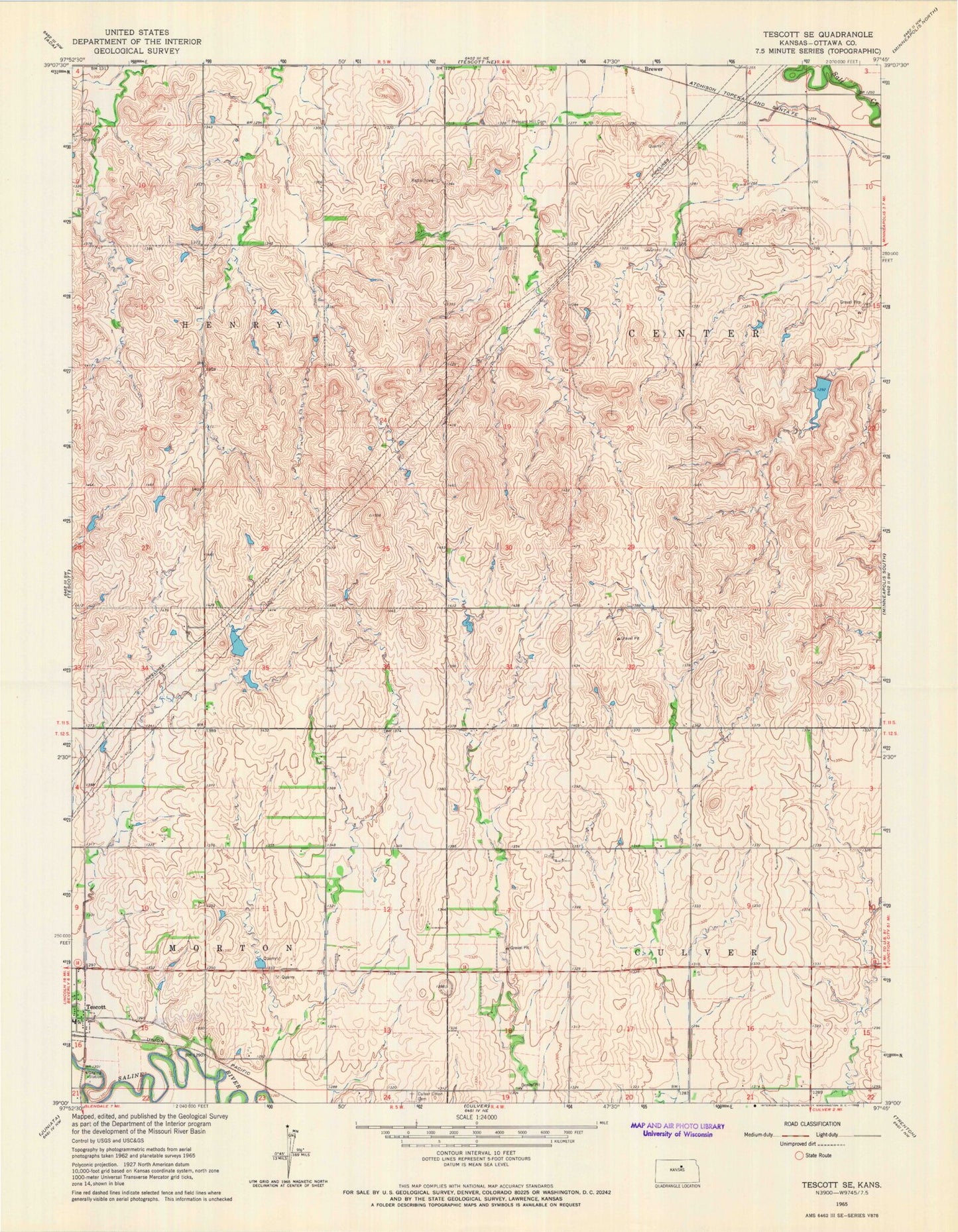
Historical USGS topographic quad map of Tescott SE in the state of Kansas. Map scale may vary for some years, but is generally around 1:24,000. Print size is approximately 24" x 27"
This quadrangle is in the following counties: Ottawa.
The map contains contour lines, roads, rivers, towns, and lakes. Printed on high-quality waterproof paper with UV fade-resistant inks, and shipped rolled.
Contains the following named places: Brandy Lake, Brewer, Culver Union Cemetery, KHCC-FM (Hutchinson), Lost Creek, Ottawa County Solid Waste Landfill, Phillips Seed Farms Grain Elevator Number 1, Pleasant Hill Cemetery, Township of Center, Township of Culver, Township of Henry, Township of Morton