MyTopo
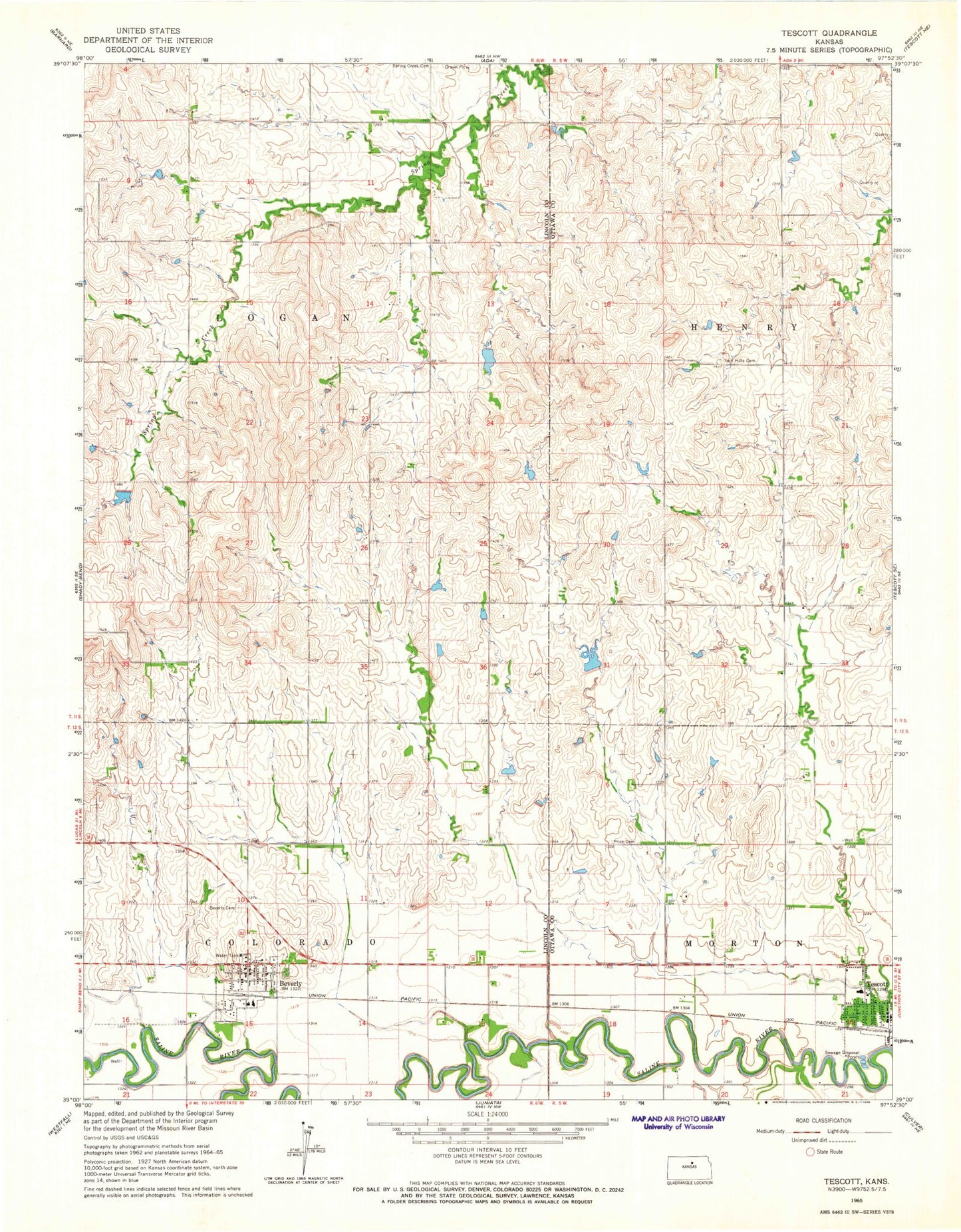
Classic USGS Tescott Kansas 7.5'x7.5' Topo Map
Couldn't load pickup availability
Historical USGS topographic quad map of Tescott in the state of Kansas. Map scale may vary for some years, but is generally around 1:24,000. Print size is approximately 24" x 27"
This quadrangle is in the following counties: Lincoln, Ottawa.
The map contains contour lines, roads, rivers, towns, and lakes. Printed on high-quality waterproof paper with UV fade-resistant inks, and shipped rolled.
Contains the following named places: Berkley Brothers Airport, Beverly, Beverly Cemetery, Beverly Community Church, Beverly Junior High School, Beverly Municipal Waste Treatment Plant, Beverly Post Office, Beverly Rural Fire Department, Beverly United Methodist Church, City of Beverly, City of Tescott, Hillbillies Airport, Ottawa County Rural Fire District 6 Tescott Station, Price Cemetery, Saint Paul Lutheran Church, Tescott, Tescott Elementary School, Tescott Junior / Senior High School, Tescott Municipal Wastewater Treatment Facility, Tescott Post Office, Tescott United Methodist Church, Township of Colorado, Township of Logan, Twin Hills Cemetery