
MyTopo
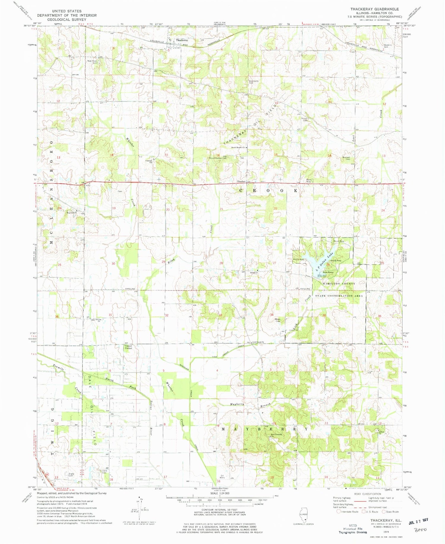
Classic USGS Thackeray Illinois 7.5'x7.5' Topo Map
Couldn't load pickup availability
Historical USGS topographic quad map of Thackeray in the state of Illinois. Map scale may vary for some years, but is generally around 1:24,000. Print size is approximately 24" x 27"
This quadrangle is in the following counties: Hamilton.
The map contains contour lines, roads, rivers, towns, and lakes. Printed on high-quality waterproof paper with UV fade-resistant inks, and shipped rolled.
Contains the following named places: Albion Church, Arterberry Cemetery, Ash Grove Picnic Area, Brush Harbor Church, Catfish Corner Picnic Area, Clark Cemetery, Concord Church, Concord School, Digby Cemetery, Dolan Lake Dam, Farris School, Four Corners, Green Acre Picnic Area, Hamilton County State Conservation Area, Hickory Hill Picnic Area, Hopewell Church, Hopson Cemetery, Jackies Giant Oak Picnic Area, Kiwanis Point Picnic Area, L P Dolan Lake, Lakeside View Picnic Area, Lick Creek, Lick Creek Church, Lick Creek Drain, Logansport, Logansport School, Main Lake, Main Lake Dam, Malone Cemetery, Martins Store, Mayberry Branch, Mayberry School, Metcalf School, Munsell Cemetery, New Hope Cemetery, New Prospect Church, Nipper Corner, Old Brush Harbor Cemetery, Oliver Church, Oliver School, Persimmon Ridge Picnic Area, Pig Ridge School, Piney Wood Camping Area, Riley Creek, Rocky Point Picnic Area, Runoff Collection Dam, Runoff Collection Pond, Shady Rest Picnic Area, Sneed Church, Sneed School, Sunrise Point Picnic Area, Tenmile Creek, Thackeray, Thackeray Church, Thackeray Oil Field, Thurber, Township of Crook, Twin Oaks Picnic Area, Walters School, Webb Cemetery, Wheeler Creek Drain, Williams School, Zinnia Knoll Picnic Area


