MyTopo
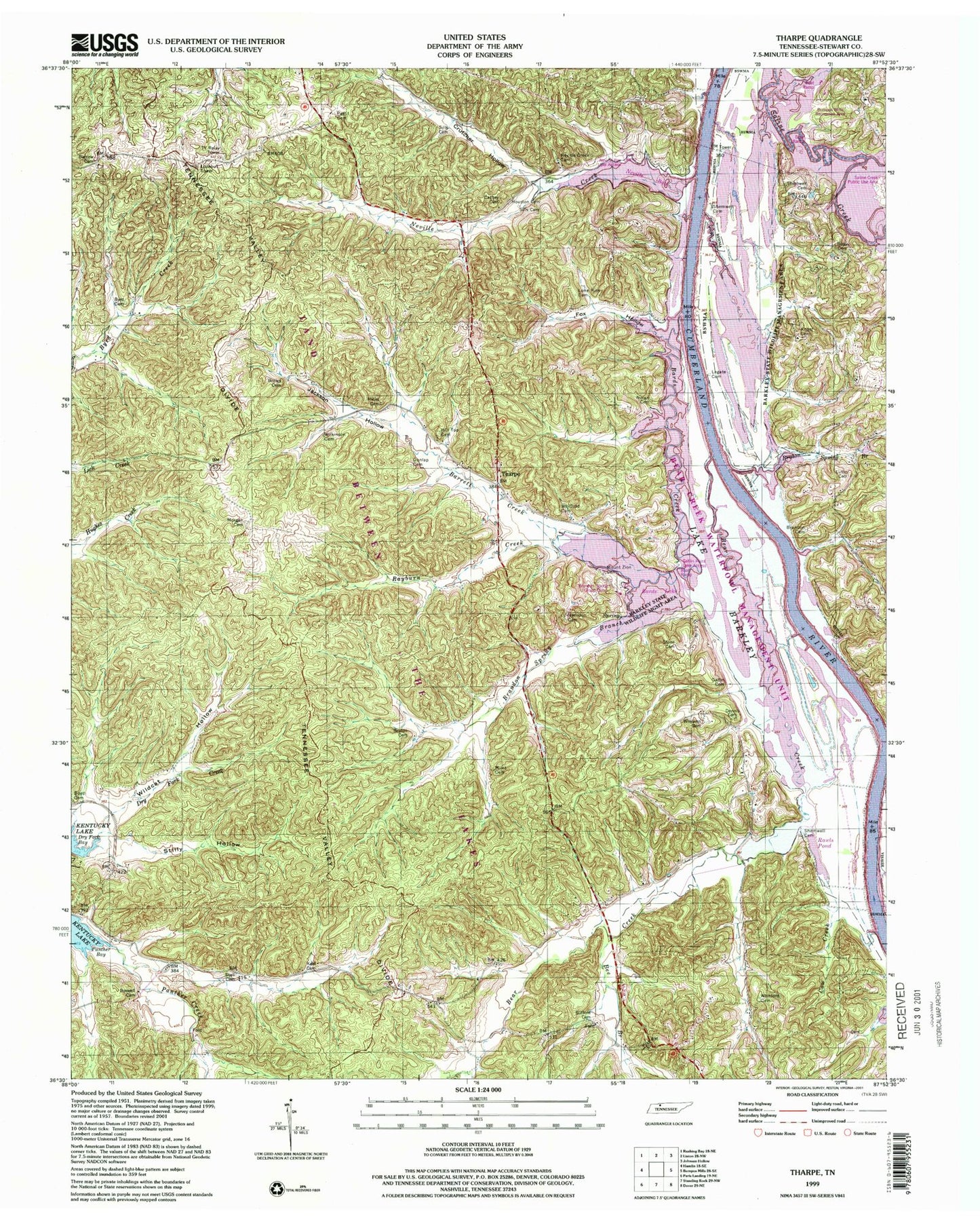
USGS Classic Tharpe Tennessee 7.5'x7.5' Topo Map
Couldn't load pickup availability
Historical USGS topographic quad map of Tharpein the states of Tennessee, Kentucky. Scale: 1:24000. Print size: 24" x 27"
This quadrangle is in the following counties: Stewart.
The map contains contour lines, roads, rivers, towns, lakes, and grids including latitude / longitude and UTM / MGRS. Printed on high-quality waterproof paper with UV fade-resistant inks.
Contains the following named places: Shemwell Cemetery, Shemwell Cemetery, Shemwell Cemetery, Sills Cemetery, Sills Cemetery, South Fork Panther Creek, Stalls Cemetery, Stilly Hollow, Stone Cemetery, Tharpe, Tharpe Church, Whitford Cemetery, Wildcat Hollow, Wilkinson Cemetery, Williams Cemetery, Barrow Cemetery, Bear Creek, Bee Branch, Beech Fork Creek, Blue Creek, Boswell Cemetery, Boyd Cemetery, Brandon Cemetery, Brown Cemetery, Bruton Cemetery, Bruton Spring Branch, Buckingham Hollow, Bufford Cemetery, Byrd Cemetery, Cathey Cemetery, Cow Creek, Crutcher Hollow, Dennis Cemetery, Dry Branch, Dunlap Cemetery, Fox Hollow, Gatlin Cemetery, Herndon Cemetery, Hickory Grove Church, Hicks Cemetery, Hill Top Cemetery, Hopewell Church, Houston Cemetery, Jackson Hollow, Keel Cemetery, Knott Cemetery, Legate Cemetery, Lone Pine Cemetery, Luton Cemetery, Miles Cemetery, Morgan Cemetery, Mount Zion Cemetery, Neville Creek Cemetery, Nolan Cemetery, Oak Grove Church, Pettit Cemetery, Ross Cemetery, Bards Lake, Bards Dam, Tiptop Church, Whitford Cemetery, Bards Creek, Barrett Creek, Brandon Spring Branch, Neville Creek, Neville Bay, Bear Creek Waterfowl Management Unit, Brandon Spring, Brandon Spring Group Camp, Bumpus Mills Recreation Area, Burgess Hollow, Elliots Landing (historical), Gatlin Point Lake Access, Happy Hollow, Happy Hollow Branch, Harris Branch, Hickory Hollow, Horton Chapel (historical), Neville Bay, Neville Bay Lake Access, Neville Creek Church, New Ground Hollow, Pea Ridge School (historical), Popular Springs School (historical), Rawls Pond, Rayburn Creek, Round Top, Saline Creek Public Use Area, Scarborough Cemetery, Snider, Tharpe School (historical), Tip Top, Walker Branch, Andersons Landing (historical), Brandons Landing (historical), Hicks Landing (historical), Jackson Landing, Mannings Landing, Nolins Landing (historical), Rawles Landing (historical), Saline Creek Access Point, Shammels Mound Landing (historical), Stewarts Landing (historical), Walkers Landing (historical), Williams Landing (historical), Nolin Ridge, Model Division (historical), Commissioner District 4, Beech Fork Creek