MyTopo
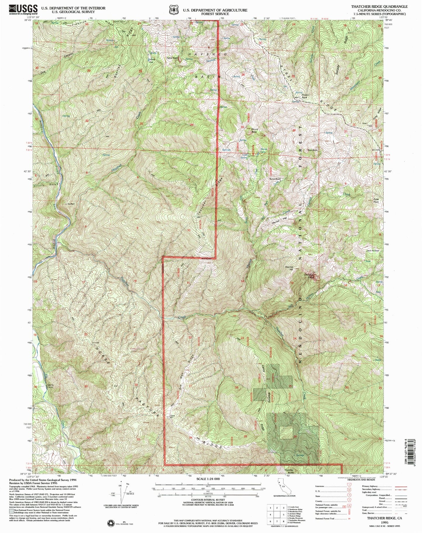
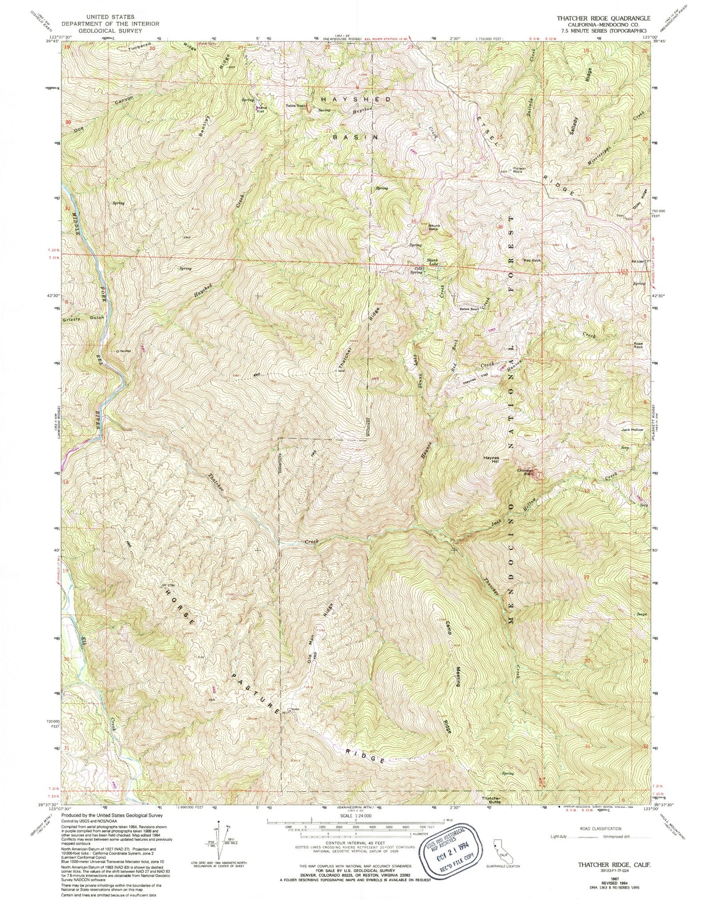
Classic USGS Thatcher Ridge California 7.5'x7.5' Topo Map
Couldn't load pickup availability
Historical USGS topographic quad map of Thatcher Ridge in the state of California. Map scale may vary for some years, but is generally around 1:24,000. Print size is approximately 24" x 27"
This quadrangle is in the following counties: Mendocino.
The map contains contour lines, roads, rivers, towns, and lakes. Printed on high-quality waterproof paper with UV fade-resistant inks, and shipped rolled.
Contains the following named places: Barnes Ranch, Camp Meeting Ridge, Chimney Rock, Cold Spring, Doan Ridge, Grizzly Gulch, Hand Flat, Haynes Creek, Haynes Flat, Haynes Hill, Hayshed Basin, Hayshed Creek, Holzhauser Ranch, Horse Pasture Ridge, Jack Hollow, Jack Hollow Creek, Old Man Ridge, Perata Ranch, Poison Rock, Red Rock, Red Rock Creek, Rose Rock, Sallady Ridge, Skunk Lake, Skunk Lake Creek, Skunk Rock, Table Rock, Thatcher Butte, Thatcher Creek, Thatcher Ridge, Thurman Rock, Timbered Ridge