
MyTopo
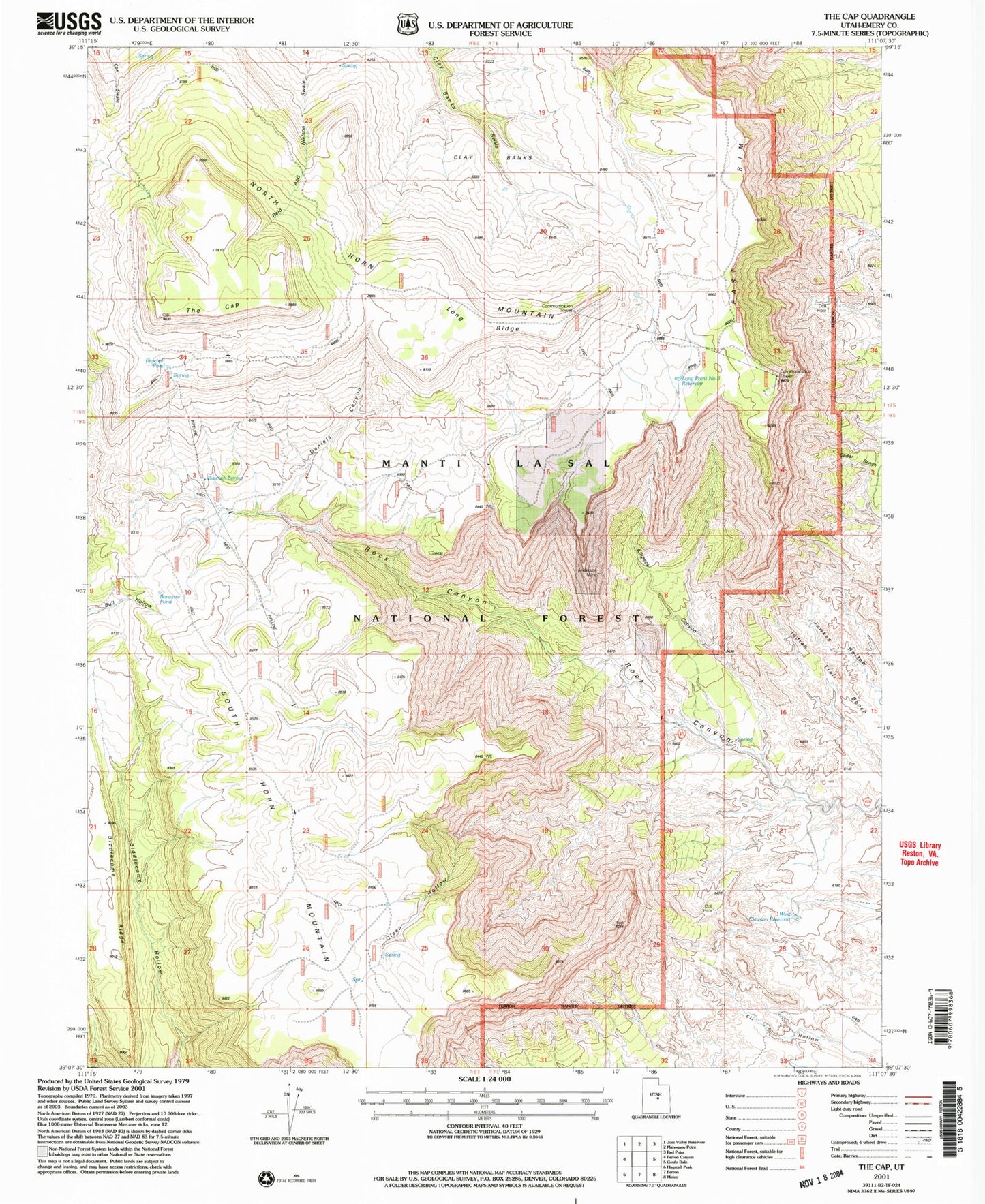
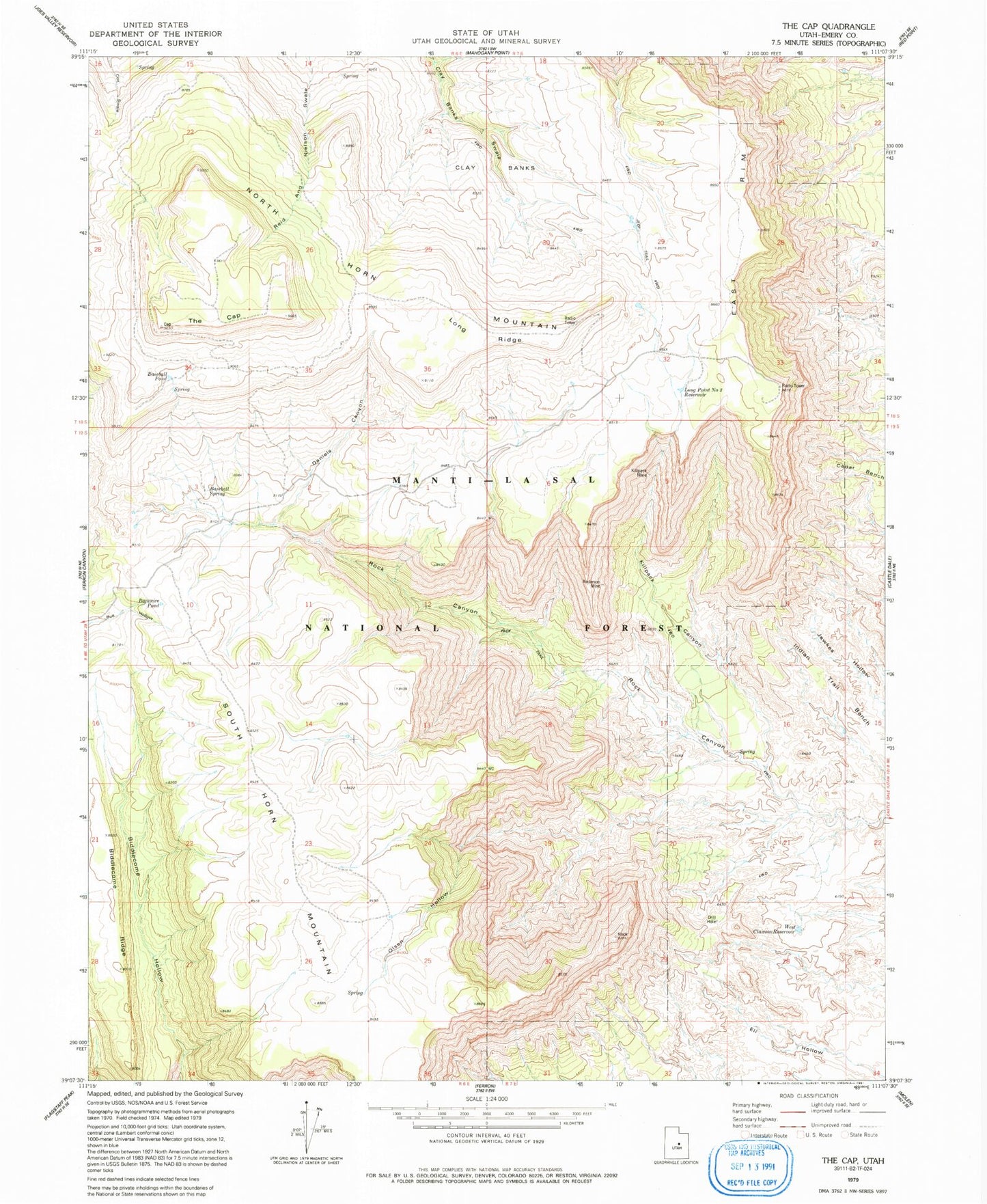
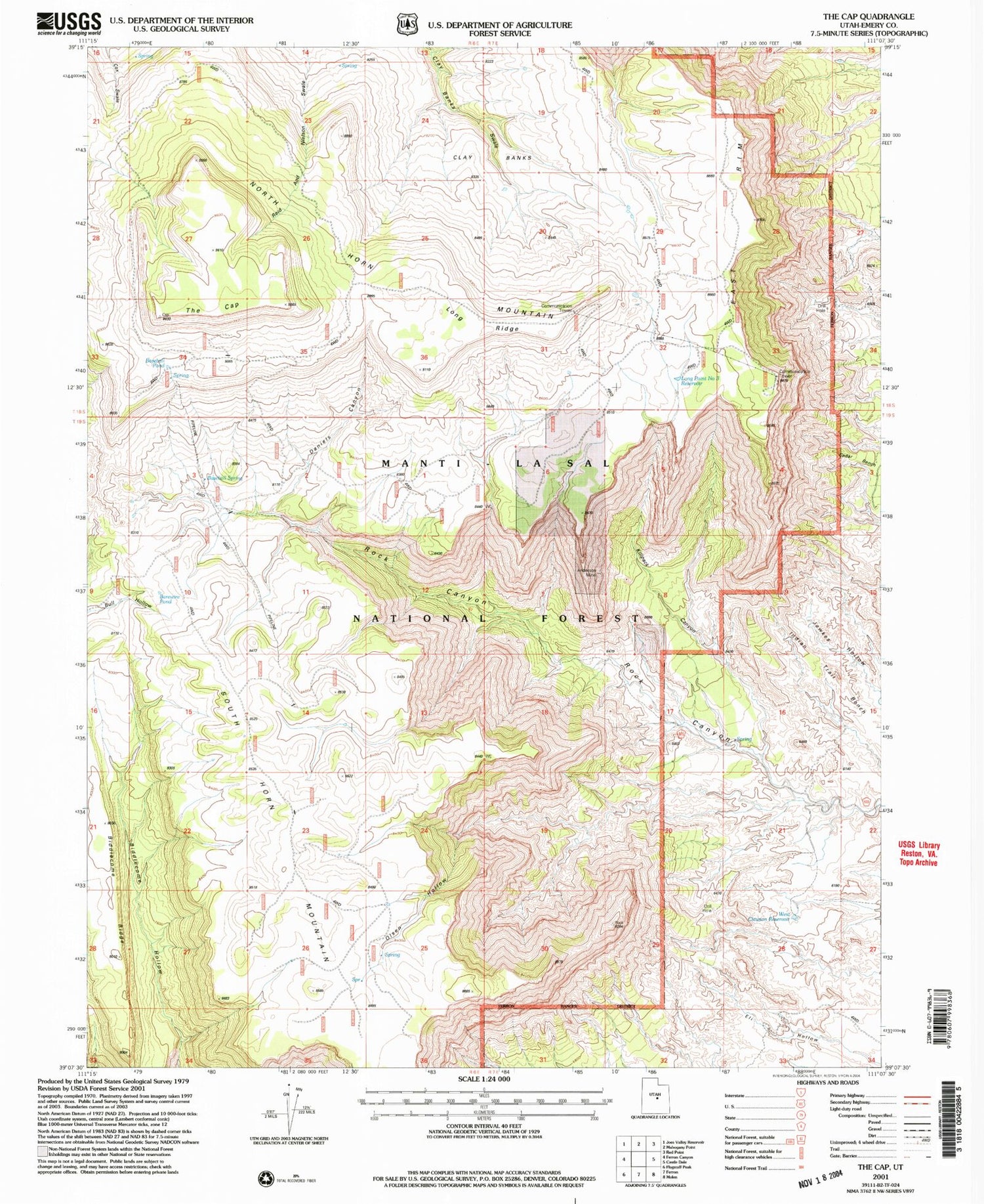
Classic USGS The Cap Utah 7.5'x7.5' Topo Map
Regular price
$16.95
Regular price
Sale price
$16.95
Unit price
per
Couldn't load pickup availability
Historical USGS topographic quad map of The Cap in the state of Utah. Map scale may vary for some years, but is generally around 1:24,000. Print size is approximately 24" x 27"
This quadrangle is in the following counties: Emery.
The map contains contour lines, roads, rivers, towns, and lakes. Printed on high-quality waterproof paper with UV fade-resistant inks, and shipped rolled.
Contains the following named places: Anderson Mine, Barewire Pond, Baseball Pond, Baseball Spring, Clay Banks, Daniels Canyon, East Rim, Eil Hollow, Killpack Canyon, Killpack Mine, Long Point Number 3 Reservoir, Long Ridge, North Horn Mountain, Olsen Hollow, South Horn Mountain, The Cap, West Clawson Reservoir