MyTopo
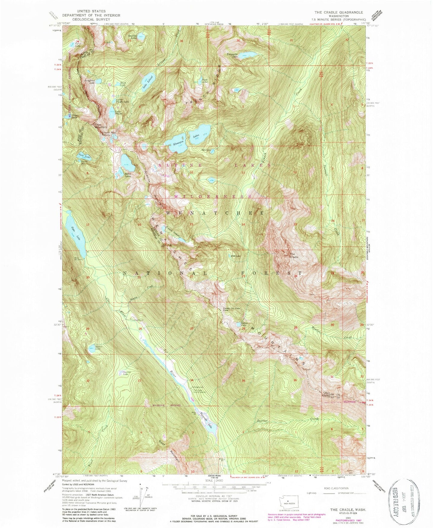
Classic USGS The Cradle Washington 7.5'x7.5' Topo Map
Couldn't load pickup availability
Historical USGS topographic quad map of The Cradle in the state of Washington. Typical map scale is 1:24,000, but may vary for certain years, if available. Print size: 24" x 27"
This quadrangle is in the following counties: Chelan, King, Kittitas.
The map contains contour lines, roads, rivers, towns, and lakes. Printed on high-quality waterproof paper with UV fade-resistant inks, and shipped rolled.
Contains the following named places: Bobs Lake, Carrie Lake, Fish Lake Guard Station, French Potholes, French Ridge, Granite Mountain, Granite Mountain Potholes, Hyas Lake, Jungfrau Lake, Klonaqua Lakes, Lake Leland, Lower Phoebe Lake, M M Lake, Paddy-Go-Easy Pass, Lake Phoebe, Robin Lakes, Scatter Creek, Scatter Creek Campground, Shoal Lake, Skeeter Creek, Snowall Creek, Sprite Lake, Squaw Lake, Squitch Lake, Talus Lake, The Cradle, Todd Lake, Trico Mountain, Tuck Lake, Tucks Pot, Tucquala Lake, Turquoise Lake, Fish Lake Campground, Tucquala Meadow Trailhead, Tucquala Meadow Campground, Cle Elum Ranger District, Trico Lake, Klonaqua Lake Dam, Welcome Lake