MyTopo
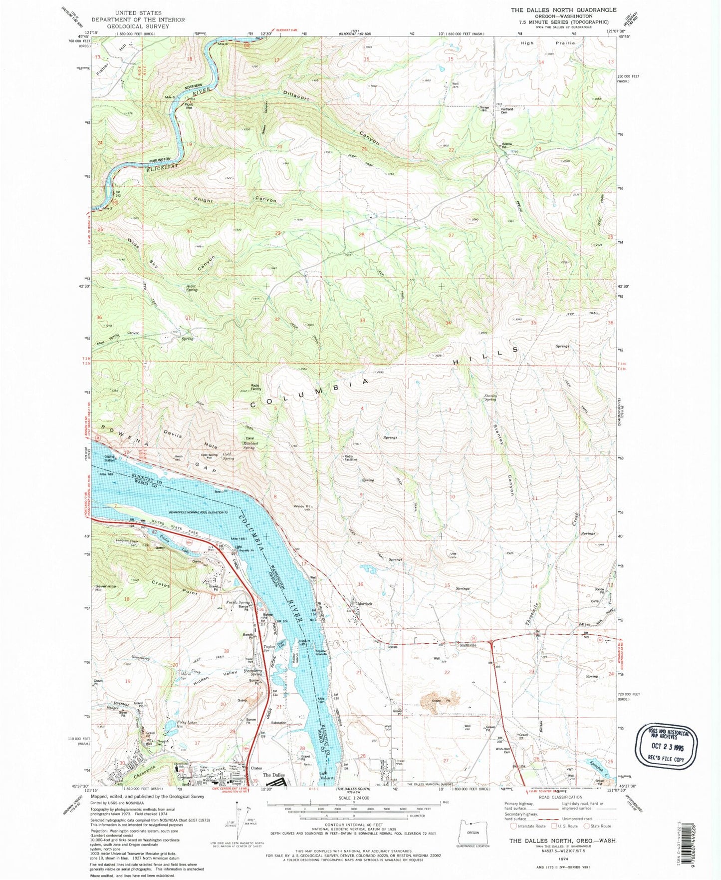
Classic USGS The Dalles North Oregon 7.5'x7.5' Topo Map
Couldn't load pickup availability
Historical USGS topographic quad map of The Dalles North in the states of Oregon, Washington. Map scale may vary for some years, but is generally around 1:24,000. Print size is approximately 24" x 27"
This quadrangle is in the following counties: Klickitat, Wasco.
The map contains contour lines, roads, rivers, towns, and lakes. Printed on high-quality waterproof paper with UV fade-resistant inks, and shipped rolled.
Contains the following named places: Alder Spring, Badger Creek, Chenoweth, Chenoweth Creek, Chenoweth Flat, Chenoweth Middle School, Chenoweth Substation, Chenowith Elementary School, Cold Spring, Cold Spring Flat, Columbia Gorge Discovery Center, Crates, Crates Point, Crates Point Light, Dallesdam, Dallesport Census Designated Place, Devils Hole, Dillacort Canyon, Foley Lakes Reservoir, Frantz Spring, Gooseberry Creek, Gooseberry Spring, Green Canyon, Hartland, Hidden Valley, High Bridge, Klickitat County Fire District 14 High Prairie, Klickitat Wild and Scenic River, Klindt Point, Knight Canyon, Little Spearfish Lake, Lone Pine Cemetery, Marsh Spring, Murdock, Rocky Island, Rowena Gap, Rowland Spring, Smithville, Spearfish, Spearfish Lake, Squally Point, Squaw Islands, Stanley Canyon, Stanley Spring, Taylor Lake, Taylor Spring, The Dalles Columbia Gorge Water System, The Dalles Country Club, The Dalles-Wahtonka High School, Thornton Spring, Threemile Creek, Tooley Lake, Windy Point, Wish - Ulm Cemetery, ZIP Code: 98617