MyTopo
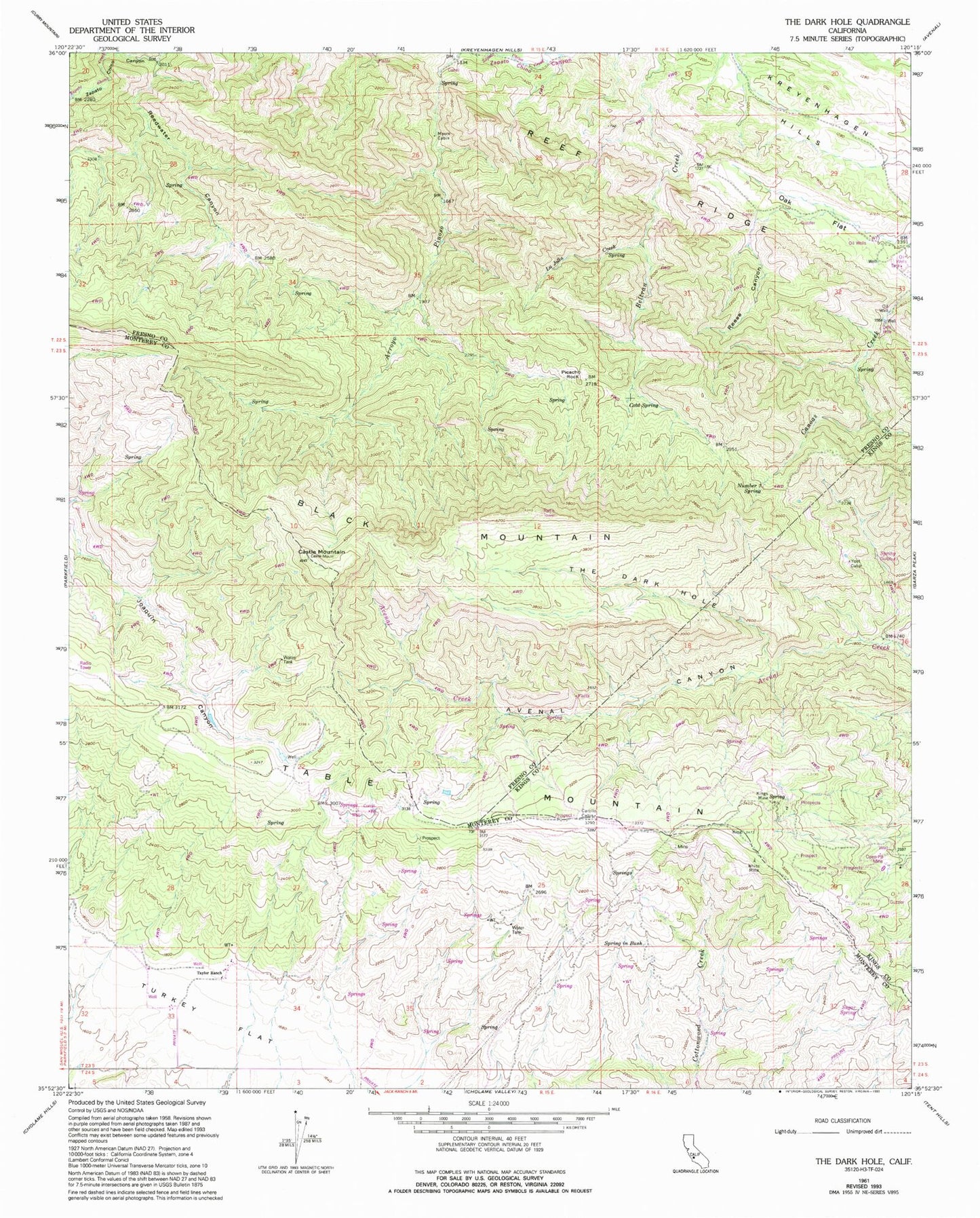
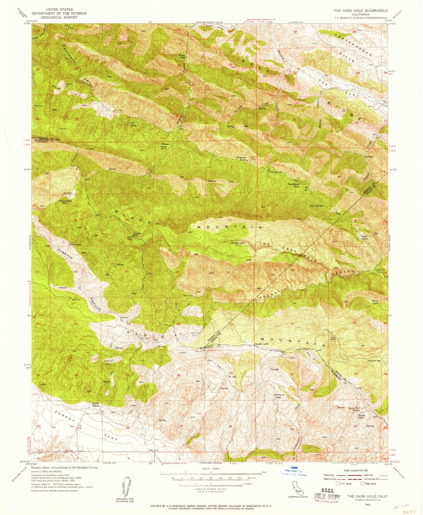
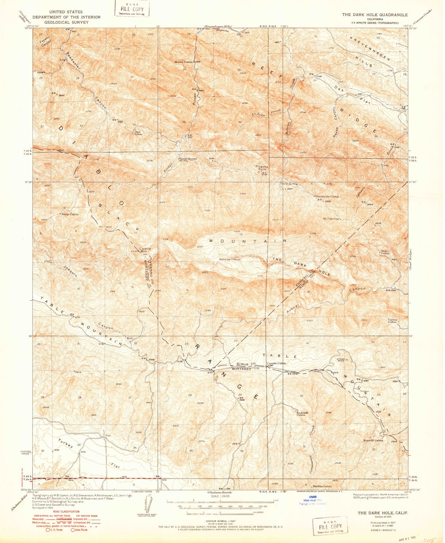
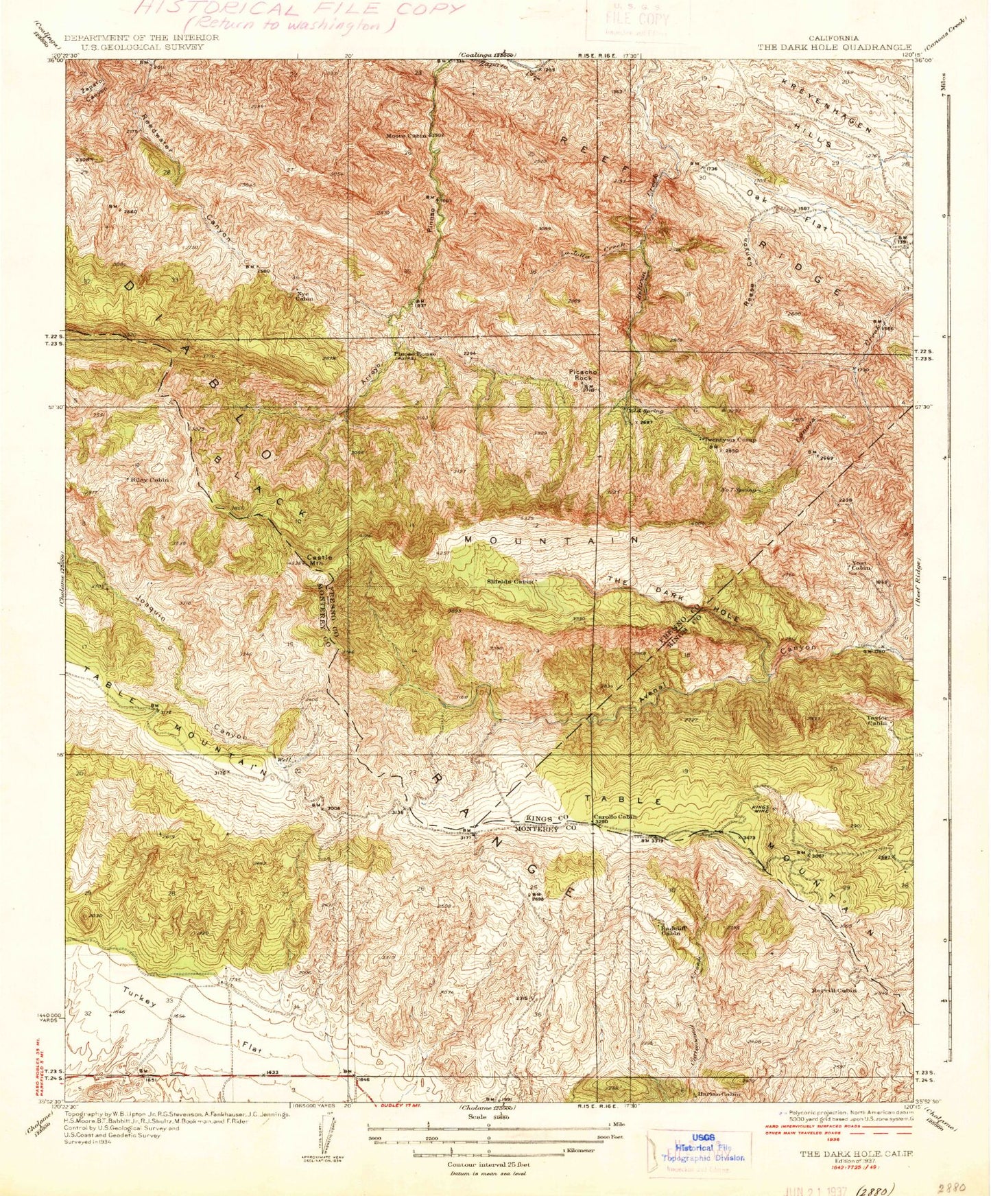
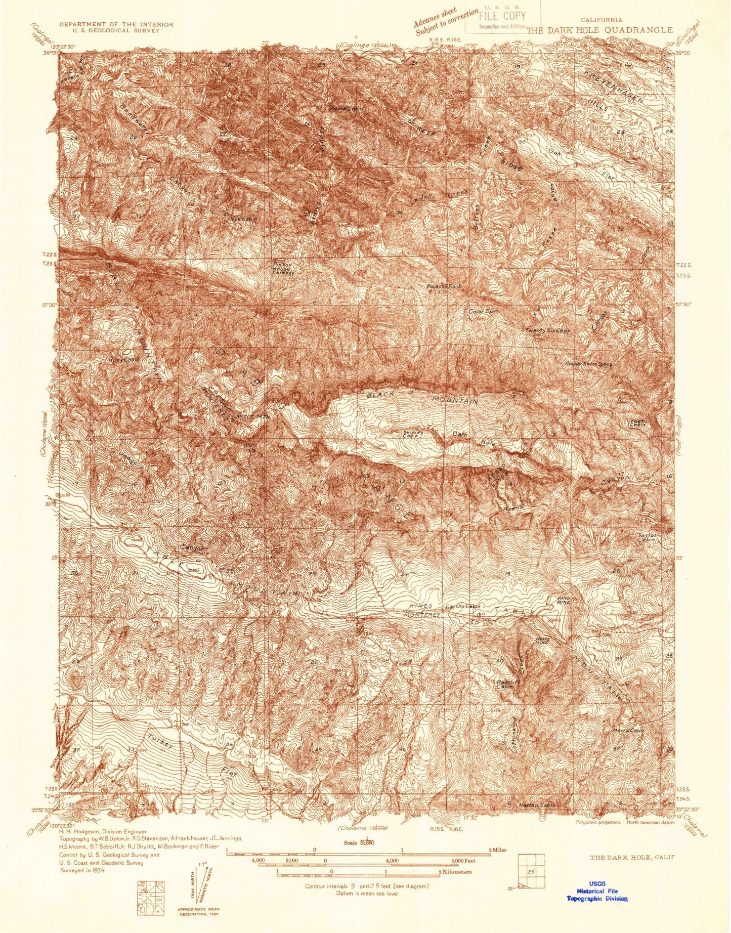
Classic USGS The Dark Hole California 7.5'x7.5' Topo Map
Couldn't load pickup availability
Historical USGS topographic quad map of The Dark Hole in the state of California. Map scale may vary for some years, but is generally around 1:24,000. Print size is approximately 24" x 27"
This quadrangle is in the following counties: Fresno, Kings, Monterey.
The map contains contour lines, roads, rivers, towns, and lakes. Printed on high-quality waterproof paper with UV fade-resistant inks, and shipped rolled.
Contains the following named places: Black Mountain, Castle Mountain, Cold Spring, Harlan Cabin, Kings Mine, La Jolla Creek, Merrill Cabin, Moore Cabin, Number Seven Spring, Nye Cabin, Oak Flat, Picacho Rock, Pinoso House, Radcliff Cabin, Reedwater Canyon, Reef Ridge, Reese Canyon, Riley Cabin, Shields Cabin, Spring in Bush, Sugar Tail Spring, Table Mountain, Taylor Cabin, Taylor Ranch, The Dark Hole, Turkey Flat, Twentysix Camp, Vaquero Spring, White Mine, Yost Cabin