MyTopo
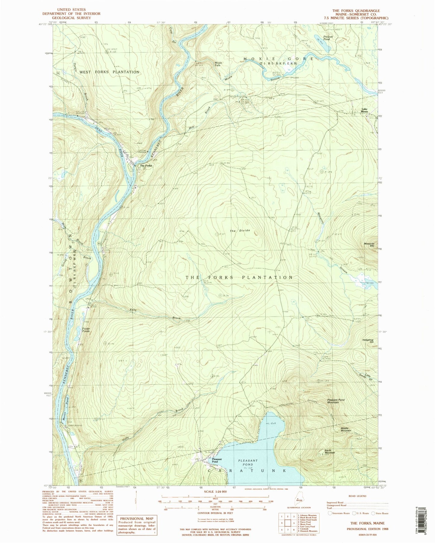
Classic USGS The Forks Maine 7.5'x7.5' Topo Map
Couldn't load pickup availability
Historical USGS topographic quad map of The Forks in the state of Maine. Typical map scale is 1:24,000, but may vary for certain years, if available. Print size: 24" x 27"
This quadrangle is in the following counties: Somerset.
The map contains contour lines, roads, rivers, towns, and lakes. Printed on high-quality waterproof paper with UV fade-resistant inks, and shipped rolled.
Contains the following named places: Ball School, Cold Stream, Dead River, Durgin Brook, Franklin School, Gilroy Brook, Holly Brook, Kelly Brook, Lake Moxie, Martin Pond, Middle Mountain, Mile Brook, Mink Brook, Moxie Falls, Moxie Stream, Pleasant Pond, Pleasant Pond, Pleasant Pond Mountain, Pooler Ponds, Prescott Pond, South Mountain, The Divide, The Forks, Plantation of The Forks, Northern Outdoors Campground, West Fork Fire Department, West Forks Post Office