MyTopo
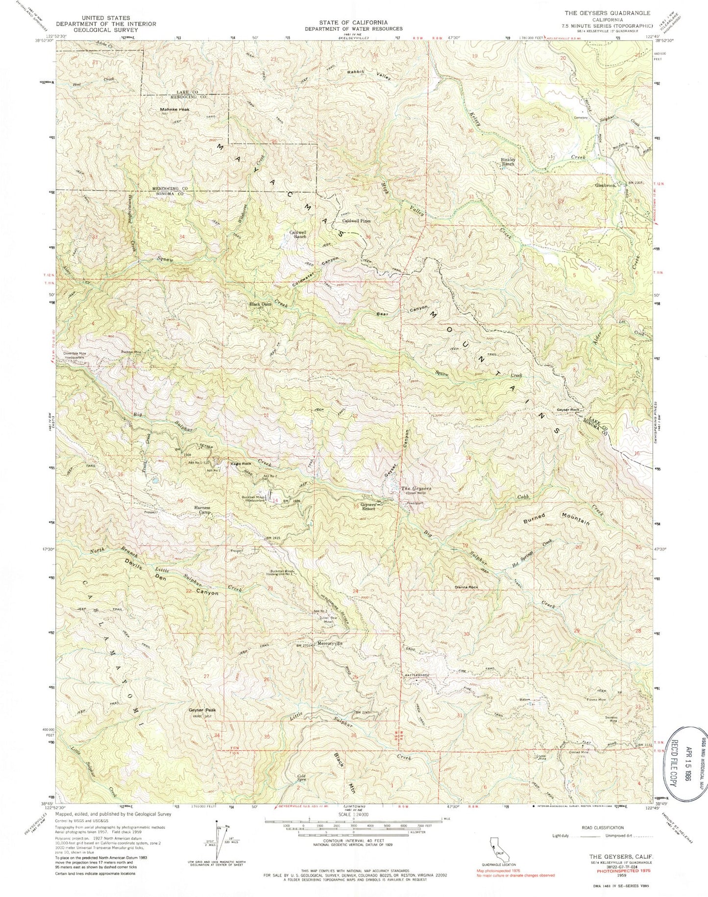
Classic USGS The Geysers California 7.5'x7.5' Topo Map
Couldn't load pickup availability
Historical USGS topographic quad map of The Geysers in the state of California. Map scale may vary for some years, but is generally around 1:24,000. Print size is approximately 24" x 27"
This quadrangle is in the following counties: Lake, Mendocino, Sonoma.
The map contains contour lines, roads, rivers, towns, and lakes. Printed on high-quality waterproof paper with UV fade-resistant inks, and shipped rolled.
Contains the following named places: Adit Number One, Adit Number One-One Hundred Twenty, Adit Number Three, Adit Number Two, Alder Creek, Bear Canyon, Binkley Ranch, Black Oaks, Buckeye Mine, Buckman Mines Headquarters, Buckman Mines Housing Unit Number Two, Burned Mountain, Cadd Fire Trail, Caldwell Pines, Caldwell Ranch, Cloverdale Mine Headquarters, Cobb Creek, Cobb Division, Cold Springs, Coldwater Canyon, Contact Mine, Crystal Mine, Culver-Bear Mine, Dianna Rock, Eagle Rock, Eureka Mine, Farleys Ranch, Geyser Canyon, Geyser Peak, Geyser Rock, Geysers Resort, Glenbrook, Glenbrook Cobb Cemetery, Glenbrook Resort, Harness Camp, High Valley Creek, Hot Springs Creek, Hummingbird Creek, KHTT-FM (Healdsburg), KLVR-FM (Santa Rosa), Lee Creek, Mahnke Peak, Mercuryville, Rabbit Valley, Rattlesnake Fire Trail, Smudgeo Number 1 Heliport, Socrates Mine, Sulphur Creek, The Geysers, Truitt Creek, Truitt Ranch, Wildhorse Creek