
MyTopo
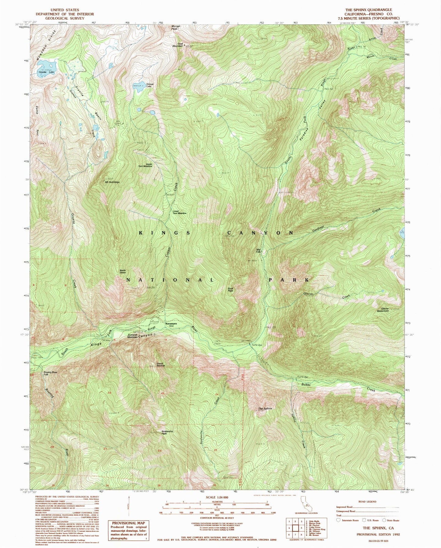
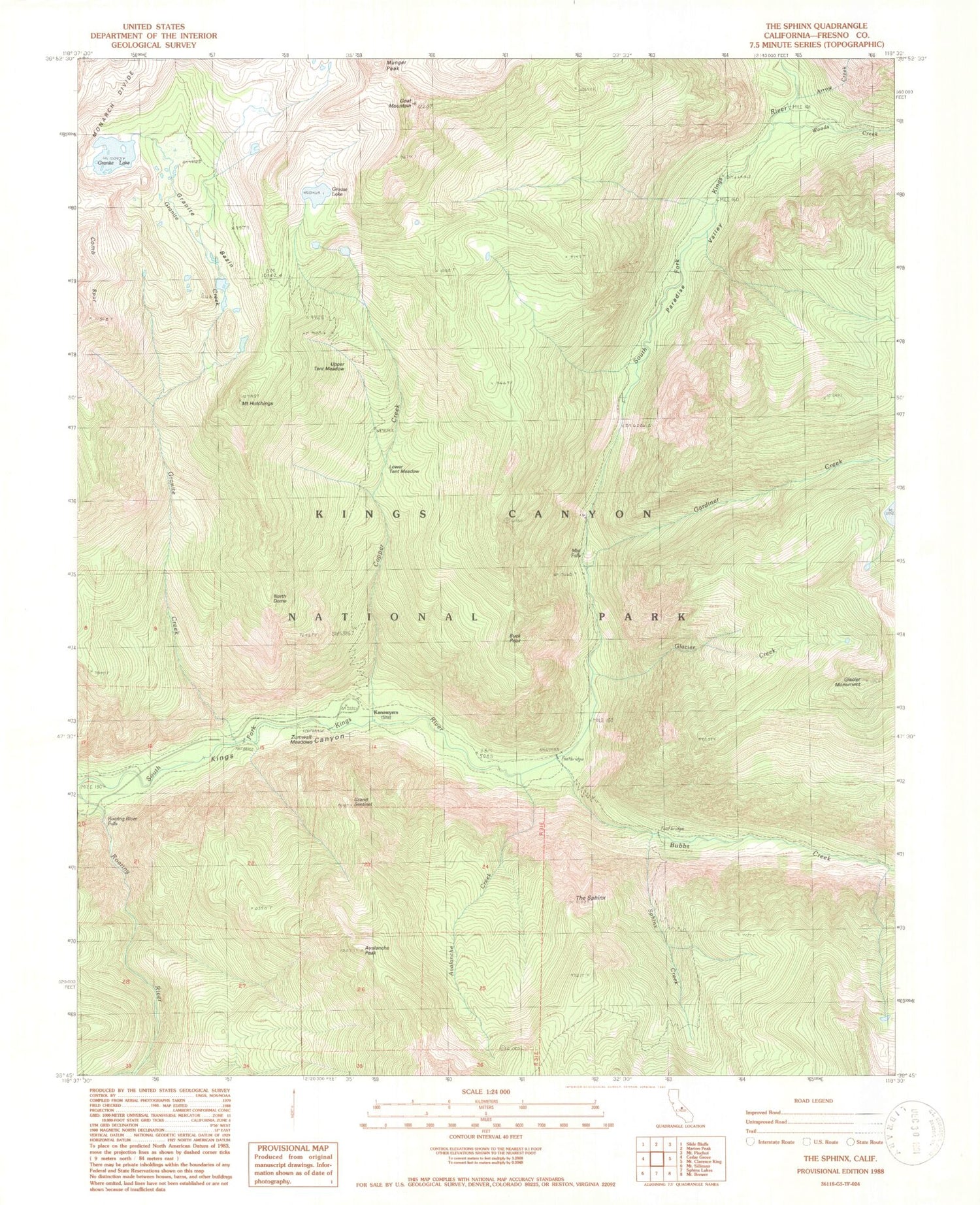
USGS Classic The Sphinx California 7.5'x7.5' Topo Map
Couldn't load pickup availability
Historical USGS topographic quad map of The Sphinx in the state of California. Scale: 1:24000. Print size: 24" x 27"
This quadrangle is in the following counties: Fresno.
The map contains contour lines, roads, rivers, towns, lakes, and grids including latitude / longitude and UTM / MGRS. Printed on high-quality waterproof paper with UV fade-resistant inks.
Contains the following named places: Arrow Creek, Bubbs Creek, Buck Peak, Copper Creek, Gardiner Creek, Glacier Creek, Glacier Monument, Goat Mountain, Grand Sentinel, Granite Basin, Granite Creek, Granite Lake, Grouse Lake, Mount Hutchings, Lower Tent Meadow, Mist Falls, North Dome, Paradise Valley, Roaring River Falls, Avalanche Creek, Sphinx Creek, Sugarloaf Creek, The Sphinx, Upper Tent Meadow, Woods Creek, Zumwalt Meadows, Munger Peak, Kanawyers, Avalanche Peak, Goat Crest, Avalanche Canyon, Kings Wild and Scenic River