MyTopo
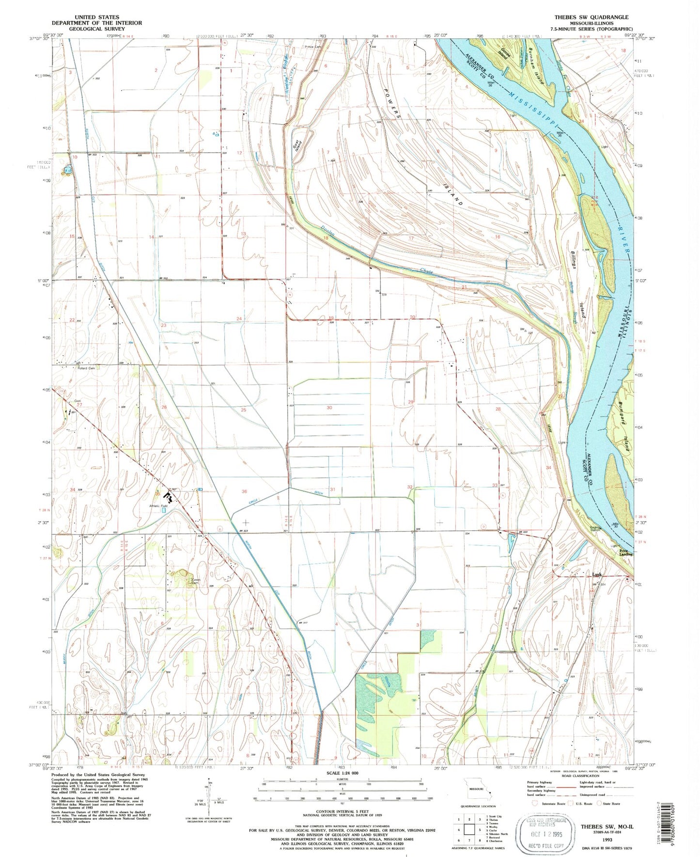
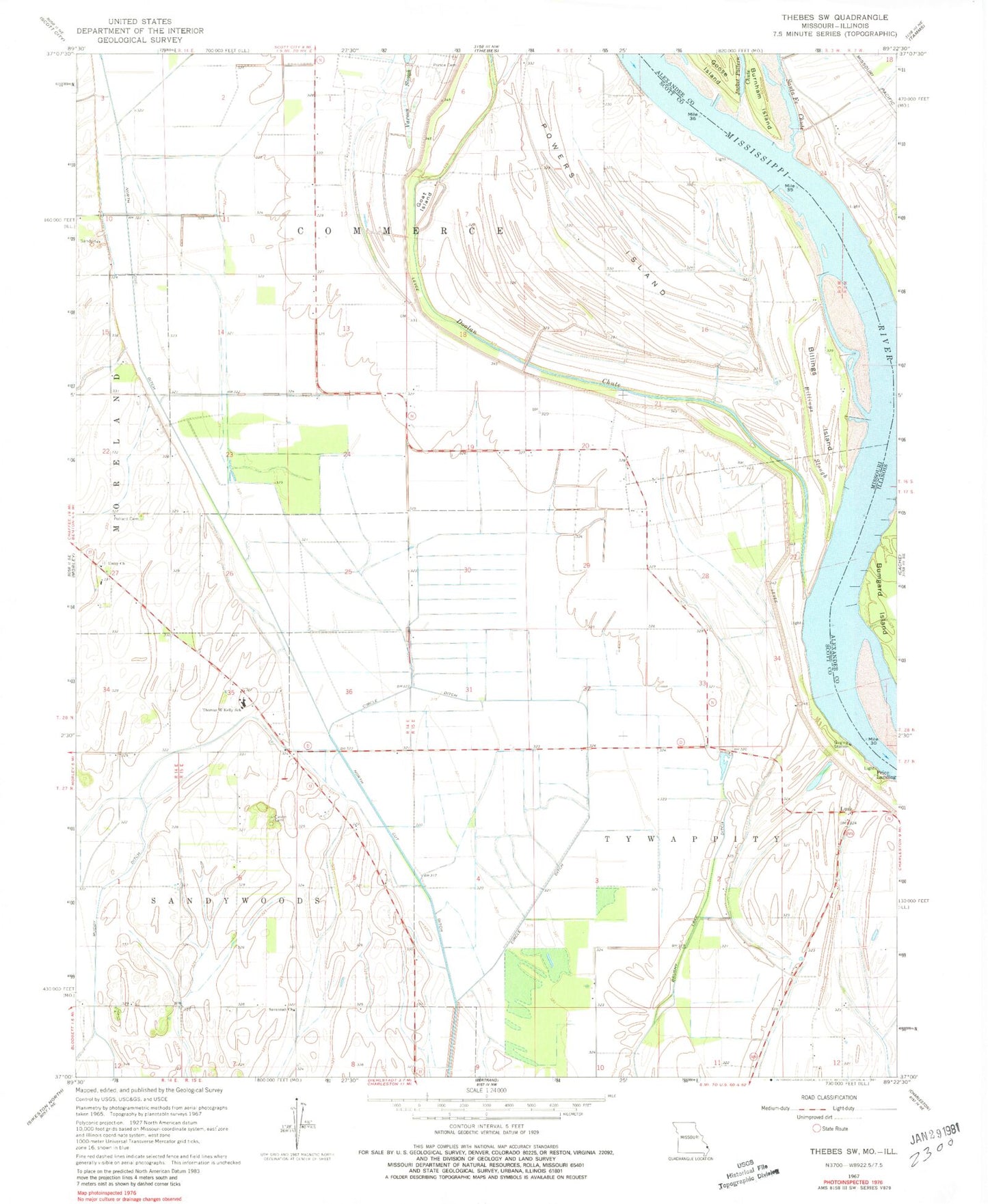
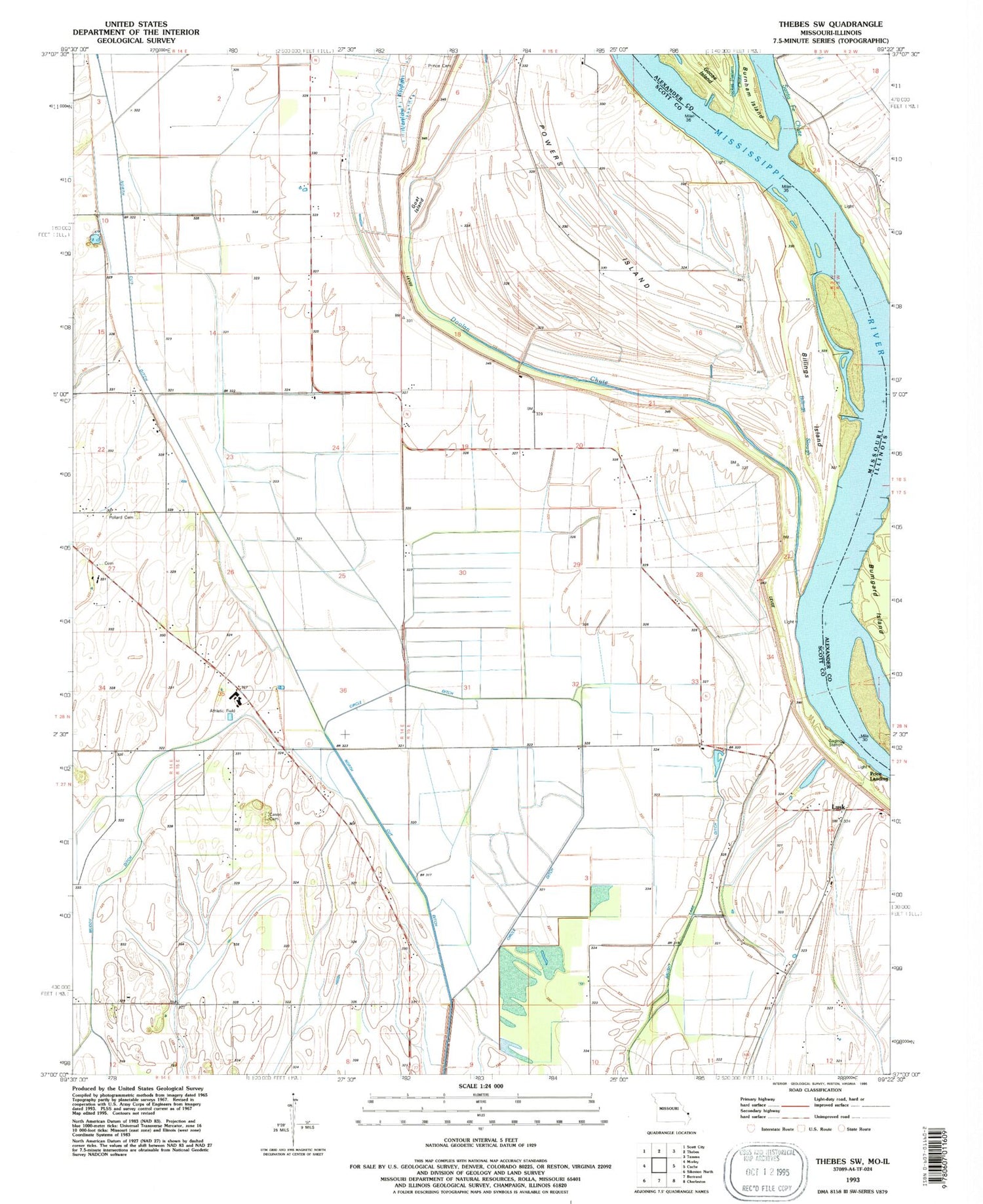
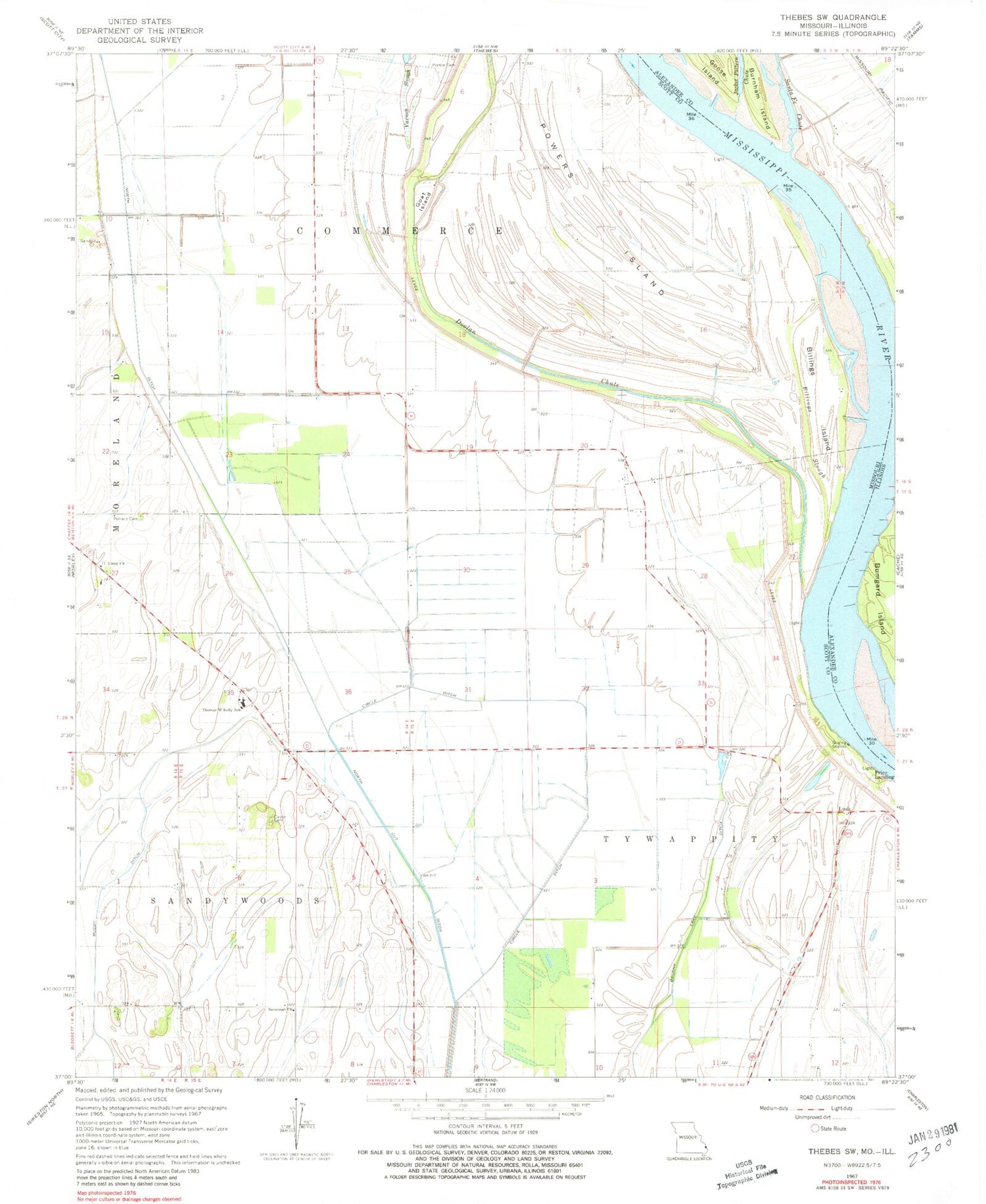
Classic USGS Thebes SW Missouri 7.5'x7.5' Topo Map
Couldn't load pickup availability
Historical USGS topographic quad map of Thebes SW in the states of Missouri, Illinois. Map scale may vary for some years, but is generally around 1:24,000. Print size is approximately 24" x 27"
This quadrangle is in the following counties: Alexander, Scott.
The map contains contour lines, roads, rivers, towns, and lakes. Printed on high-quality waterproof paper with UV fade-resistant inks, and shipped rolled.
Contains the following named places: Anita Towhead, Billings Bar, Billings Island, Billings Slough, Brushy Lake Ditch, Campbell School, Cason Cemetery, Circle Ditch, Doolan Chute, Goat Island, Jacket Pattern Chute, Jones Spur, Lemon School, Lusk, Lusk Chapel, Lusk School, Moore Landing, Owensby School, Pollard Cemetery, Powers Island, Powers Island School, Price Landing, Prince Cemetery, Santa Fe Chute, Savannah Church, Thomas W Kelly School, Township of Commerce, Township of Tywappity, Unity Cemetery, Unity Church, Varnon Slough, Woods Island