MyTopo
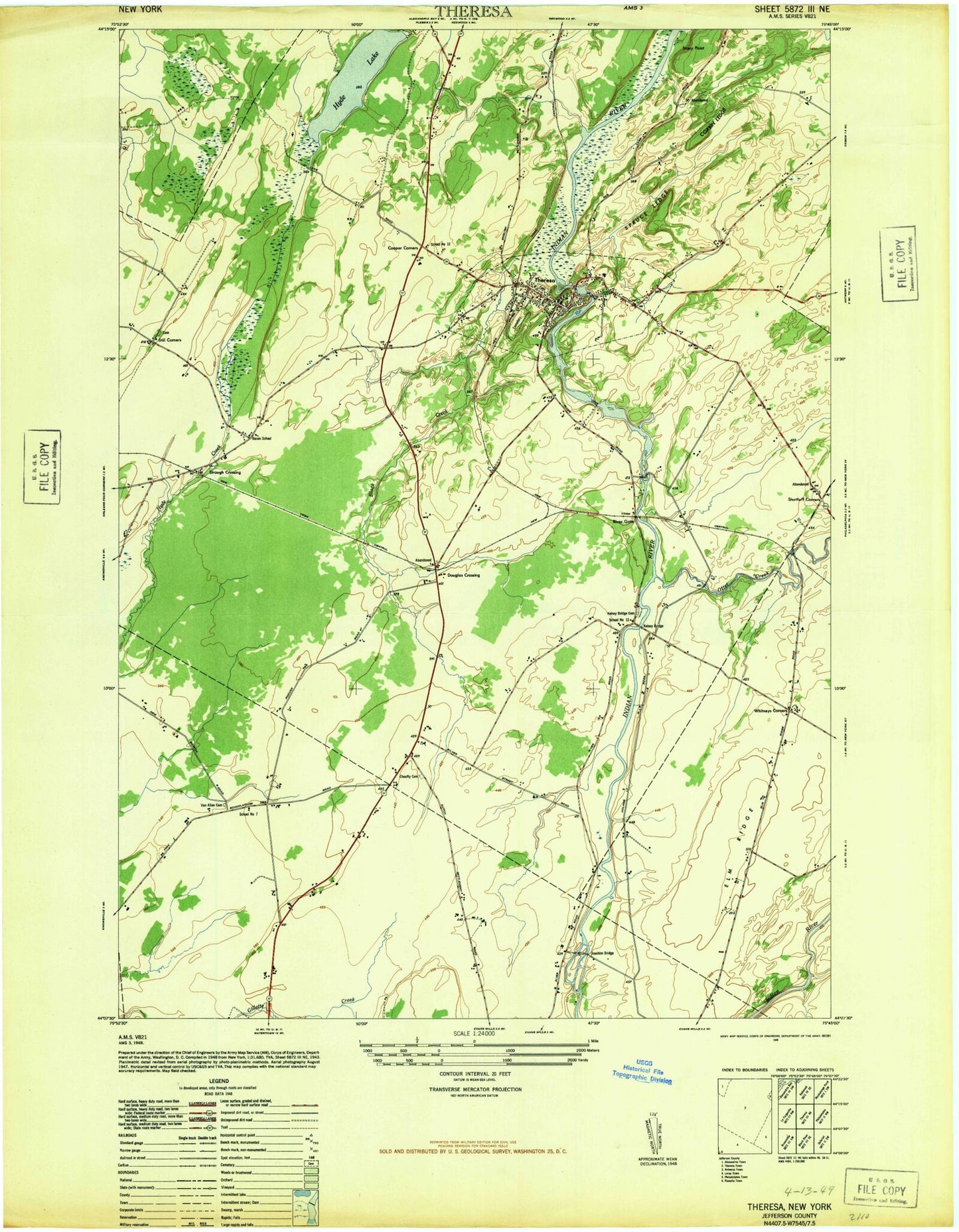
Classic USGS Theresa New York 7.5'x7.5' Topo Map
Couldn't load pickup availability
Historical USGS topographic quad map of Theresa in the state of New York. Map scale may vary for some years, but is generally around 1:24,000. Print size is approximately 24" x 27"
This quadrangle is in the following counties: Jefferson.
The map contains contour lines, roads, rivers, towns, and lakes. Printed on high-quality waterproof paper with UV fade-resistant inks, and shipped rolled.
Contains the following named places: Bacon School, Black Creek, Casey Creek, Chaufty Cemetery, Coon Bridge, Cooper Corners, Corbin Ledge, Douglas Crossing, Elm Ridge, Gospel Mission Fellowship, Home Again Farm, Hyde Lake, Indian River Estates Mobile Home Park, Joachim Bridge, Kelsey Bridge, Kelsey Bridge Cemetery, Martin's Organic Farm, North Jefferson Christian Fellowship, Otter Creek, Rivergate, Saint Theresa of Avila Church, Santway Park, School Number 12, School Number 13, School Number 7, Shurtleff Corners, Soapstone Creek, Still Corners, Stony Point, Stroughs Crossing, Theresa, Theresa Emergency Corps, Theresa Fire Department, Theresa Free Library, Theresa Post Office, Theresa Presbyterian Church, Theresa Primary School, Town of Theresa, Van Allen Cemetery, Village of Theresa, Whitneys Corners, ZIP Code: 13691