MyTopo
Classic USGS Thermal Canyon California 7.5'x7.5' Topo Map
Regular price
$16.95
Regular price
Sale price
$16.95
Unit price
per
Couldn't load pickup availability
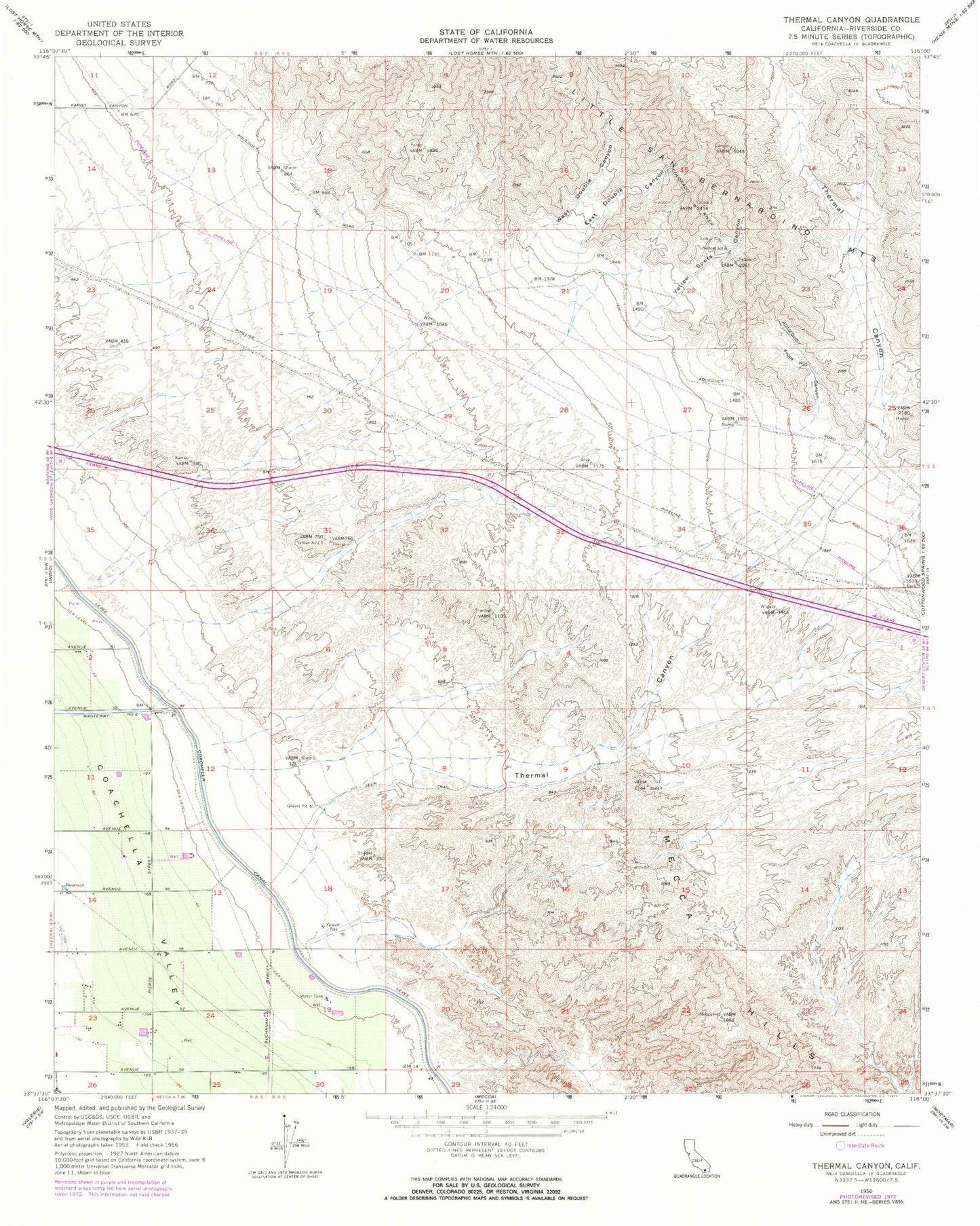
Historical USGS topographic quad map of Thermal Canyon in the state of California. Map scale may vary for some years, but is generally around 1:24,000. Print size is approximately 24" x 27"
This quadrangle is in the following counties: Riverside.
The map contains contour lines, roads, rivers, towns, and lakes. Printed on high-quality waterproof paper with UV fade-resistant inks, and shipped rolled.
Contains the following named places: Aqueduct Jeep Trail, East Double Canyon, East Side Detention Dike Number 1 Dam, Front Hill Canyon, Thermal Canyon, West Double Canyon, Yellow Spots Canyon