MyTopo
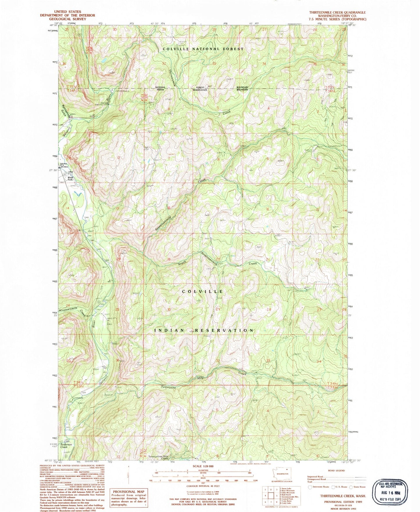
Classic USGS Thirteenmile Creek Washington 7.5'x7.5' Topo Map
Couldn't load pickup availability
Historical USGS topographic quad map of Thirteenmile Creek in the state of Washington. Map scale may vary for some years, but is generally around 1:24,000. Print size is approximately 24" x 27"
This quadrangle is in the following counties: Ferry.
The map contains contour lines, roads, rivers, towns, and lakes. Printed on high-quality waterproof paper with UV fade-resistant inks, and shipped rolled.
Contains the following named places: Anderson Creek, Nineteenmile Creek, Rattlesnake Gulch, Seventeenmile Creek, Seventeenmile Trail, South Seventeenmile Creek, Thirteenmile Campground, Thirteenmile Creek, Thirteenmile Hiking Trail, Thirteenmile Road, Twentyone Mile Campground, Twentyone Mile Creek, West Fork Sanpoil River